Pirep is a free, collaborative database of all public and private airports. All pilots are welcome to contribute their local knowledge to any airport, no registration required.
Public
Undocumented
Edit Tags
No upcoming events. Is anything happening here soon?
Airport Statistics
- Webcam links
- General description
- Airport photos
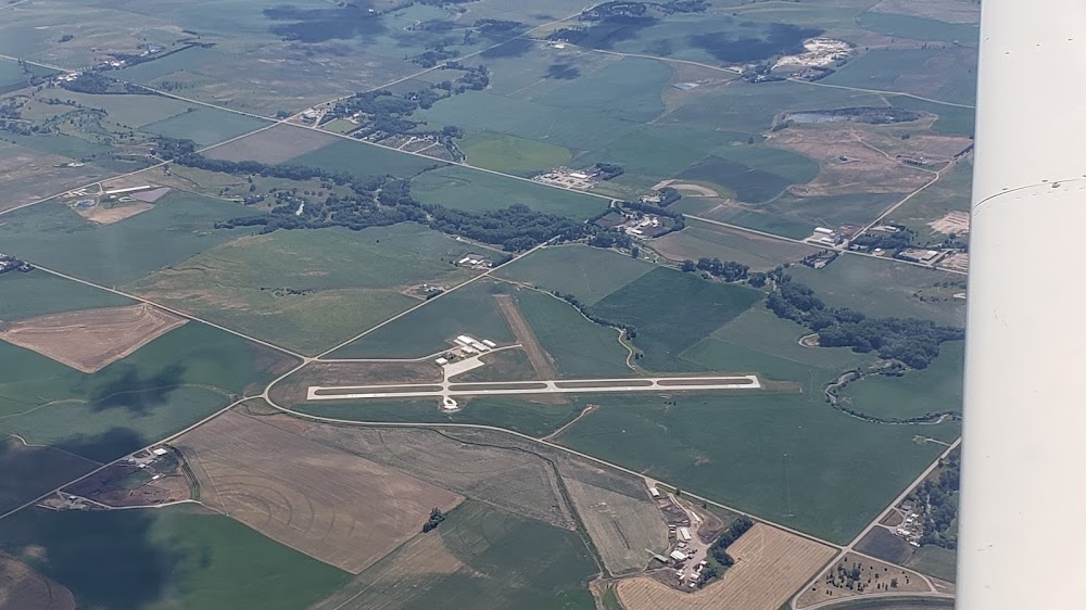
Location:
Hartington, NE
Elevation:
1,388ft
Sectional:
Omaha
Activation date:
Feb 1949
Fuel:
100LL (prices)
Runway 13/31:
3,950ft
Runway 03/21:
2,150ft
Access: Open to the public
Click/tap to add an annotation marker to the map
No webcams added yet.
Remarks
- Existed prior to 1959.
- For cd ctc minneapolis artcc at 651-463-5588.
- Actvt papi rwy 13 & 31; mirl rwy 13/31 - ctaf.
- Airport authority chairman is karma schulte
- Mobile phone 402-841-0486 (manager)
- For fuel call 402-254-7316 or 402-841-0486.
- Not plowed during winter months.
- Rwy 31 apch ratio 21:1 to dsplcd thr due to road 31 ft abv 675 ft fm dsplcd thr, 351 ft l.
Comments