Pirep is a free, collaborative database of all public and private airports. All pilots are welcome to contribute their local knowledge to any airport, no registration required.


Public
Undocumented
METAR / TAF
Edit Tags
No upcoming events. Is anything happening here soon?
Airport Statistics
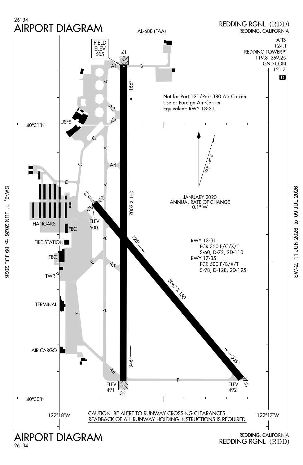
- Airport map annotations
- General description
- Transient parking location
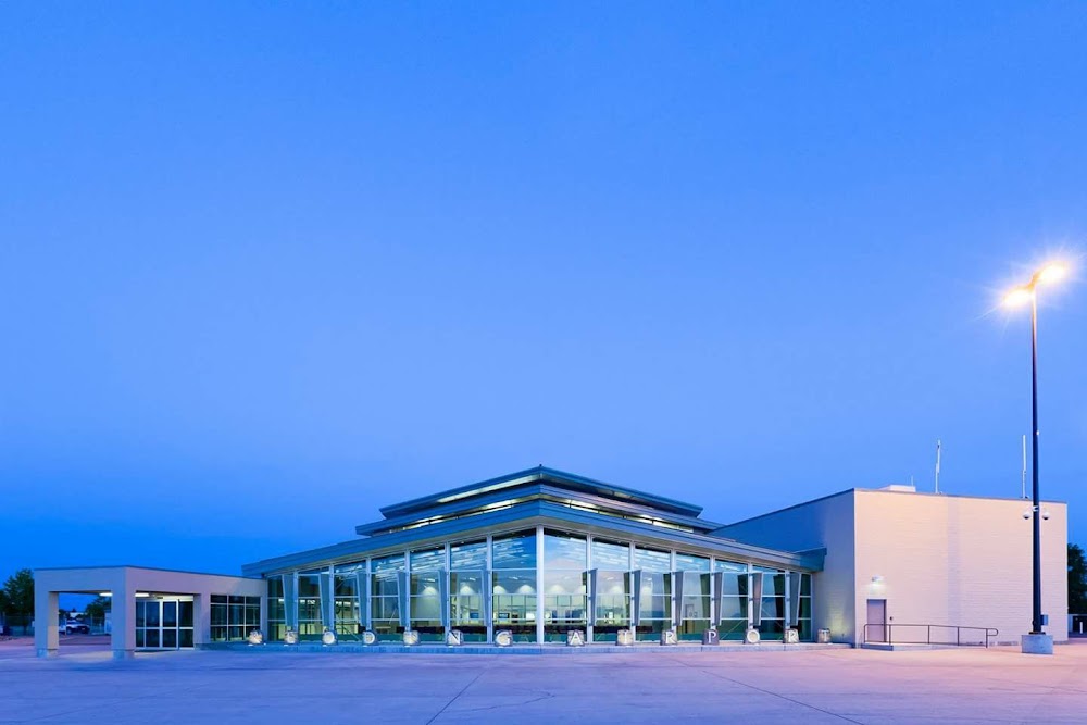
Location:
Redding, CA
Elevation:
505ft
Sectional:
Klamath Falls
Activation date:
Jul 1944
Fuel:
100LL, A (prices)
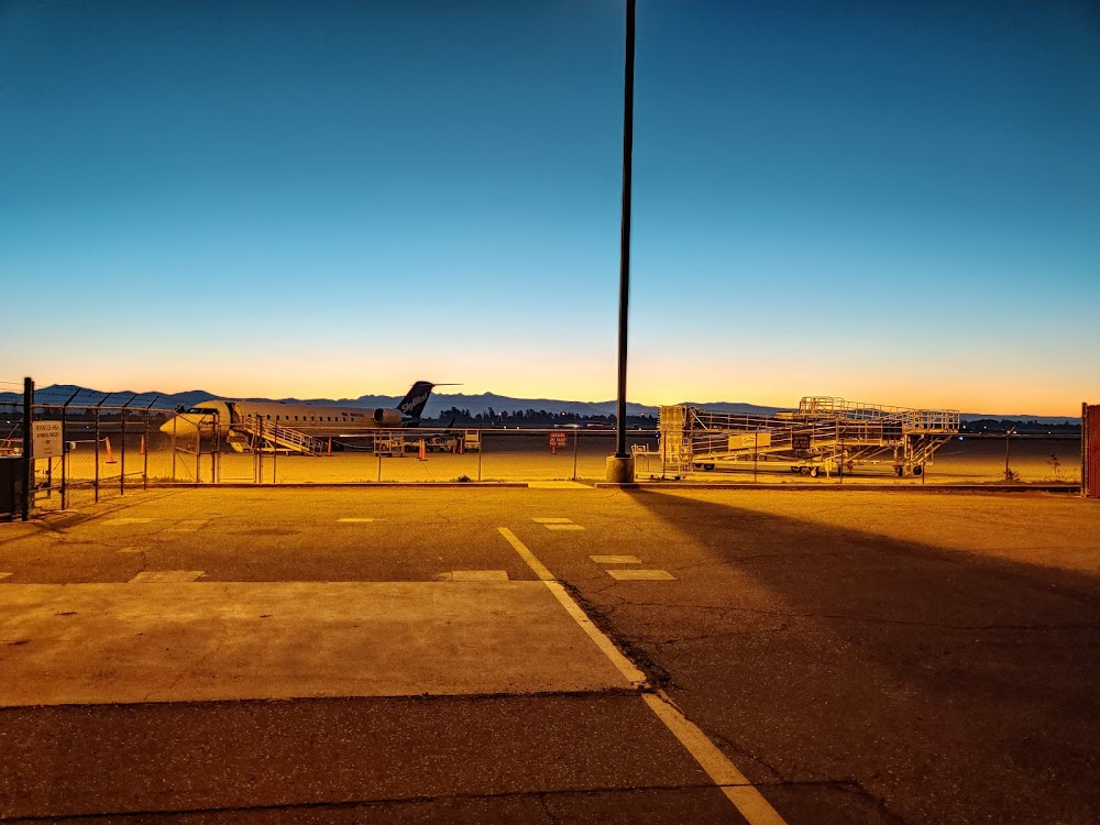
Runway 16/34:
7,003ft
Runway 17/35:
7,003ft
Runway 12/30:
5,067ft
Runway 13/31:
5,067ft
Access: Open to the public
Current Weather — VFR
-
Weather data is strictly informational and not for flight planning purposes.
-
METAR2026-07-21 05:53:00 PDT
Ceiling: Sky clear Wind: 330° @ 3kt Temperature: 75°F Dewpoint: 55°F Weather: N/A Visbility: 10SM Raw:METAR KRDD 211253Z AUTO 33003KT 10SM CLR 24/13 A2987 RMK AO2 SLP106 T02440128 -
TAF2026-07-21 05:00:00 PDT – 2026-07-21 14:00:00 PDT
Ceiling: 25,000ft Wind: 310° @ 5kt Weather: N/A Visbility: 6SM Clouds: Overcast @ 25,000ft Raw:TAF KRDD 211123Z 2112/2212 31005KT P6SM OVC250 FM212100 18007KT P6SM OVC250 FM220400 VRB04KT P6SM BKN250 -
TAF2026-07-21 14:00:00 PDT – 2026-07-21 21:00:00 PDT
Ceiling: 25,000ft Wind: 180° @ 7kt Weather: N/A Visbility: 6SM Clouds: Overcast @ 25,000ft Raw:TAF KRDD 211123Z 2112/2212 31005KT P6SM OVC250 FM212100 18007KT P6SM OVC250 FM220400 VRB04KT P6SM BKN250 -
TAF2026-07-21 21:00:00 PDT – 2026-07-22 05:00:00 PDT
Ceiling: 25,000ft Wind: Variable Weather: N/A Visbility: 6SM Clouds: Broken @ 25,000ft Raw:TAF KRDD 211123Z 2112/2212 31005KT P6SM OVC250 FM212100 18007KT P6SM OVC250 FM220400 VRB04KT P6SM BKN250
Click/tap to add an annotation marker to the map
No webcams added yet.
Remarks
- Ppr for unsked acr opns with more than 30 psgr seats 2130-0630 call amgr (530) 224-4321.
- U.s. forest service on fld, expect heavy air tanker activity during fire season.
- Field conditions rwy; apns & twys good to fair.
- For noise abatement avoid overflights of residential housing when possible.
- Use ctn birds invof arpt.
Comments