Pirep is a free, collaborative database of all public and private airports. All pilots are welcome to contribute their local knowledge to any airport, no registration required.
Undocumented
METAR / TAF
Edit Tags
No upcoming events. Is anything happening here soon?
Airport Statistics
- Transient parking location
- WiFi availability
- Local flying clubs
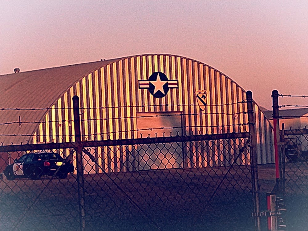
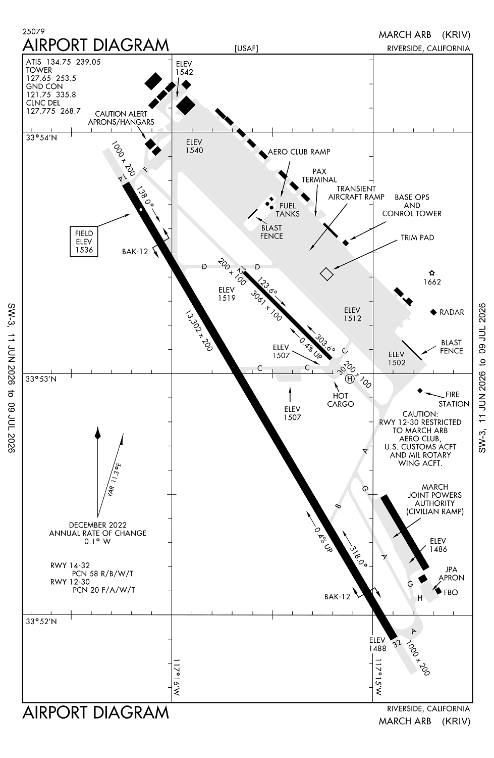
Location:
Riverside, CA
Elevation:
1,536ft
Sectional:
Los Angeles
Activation date:
May 1941
Fuel:
100LL, A, A++ (prices)
Runway 14/32:
13,302ft
Runway 12/30:
3,061ft
Access: Open to the public
Current Weather — IFR
-
Weather data is strictly informational and not for flight planning purposes.
-
METAR2026-06-26 05:08:00 PDT
Ceiling: 500ft Wind: 250° @ 3kt Temperature: 59°F Dewpoint: 57°F Weather: Mist Visbility: 5SM Clouds: Scattered @ 200ft, Broken @ 500ft Raw:SPECI KRIV 261208Z 25003KT 5SM BR SCT002 BKN005 15/14 A2989 RMK AO2A SLP109 -
TAF2026-06-26 05:00:00 PDT – 2026-06-26 08:00:00 PDT
Ceiling: 300ft Wind: 300° @ 4kt Weather: Mist Visbility: 1SM Clouds: Overcast @ 300ft Raw:TAF KRIV 261200Z 2612/2718 30004KT 3200 BR OVC003 QNH2988INS BECMG 2615/2616 VRB04KT 8000 HZ BKN007 QNH2992INS BECMG 2616/2617 VRB04KT 9999 NSW FEW015 QNH2994INS BECMG 2620/2621 32009KT 9999 SKC 510009 QNH2987INS TEMPO 2621/2702 31012G18KT BECMG 2703/2704 VRB06KT 9999 SKC QNH2991INS BECMG 2709/2710 VRB04KT 9999 BKN007 QNH2993INS BECMG 2715/2716 VRB04KT 9999 SCT010 QNH2995INS TX28/2622Z TN12/2613Z -
TAF2026-06-26 08:00:00 PDT – 2026-06-26 09:00:00 PDT
Ceiling: 700ft Wind: Variable Weather: Haze Visbility: 4SM Clouds: Broken @ 700ft Raw:TAF KRIV 261200Z 2612/2718 30004KT 3200 BR OVC003 QNH2988INS BECMG 2615/2616 VRB04KT 8000 HZ BKN007 QNH2992INS BECMG 2616/2617 VRB04KT 9999 NSW FEW015 QNH2994INS BECMG 2620/2621 32009KT 9999 SKC 510009 QNH2987INS TEMPO 2621/2702 31012G18KT BECMG 2703/2704 VRB06KT 9999 SKC QNH2991INS BECMG 2709/2710 VRB04KT 9999 BKN007 QNH2993INS BECMG 2715/2716 VRB04KT 9999 SCT010 QNH2995INS TX28/2622Z TN12/2613Z -
TAF2026-06-26 09:00:00 PDT – 2026-06-26 13:00:00 PDT
Ceiling: Sky clear Wind: Variable Weather: N/A Visbility: 6SM Clouds: Few @ 1,500ft Raw:TAF KRIV 261200Z 2612/2718 30004KT 3200 BR OVC003 QNH2988INS BECMG 2615/2616 VRB04KT 8000 HZ BKN007 QNH2992INS BECMG 2616/2617 VRB04KT 9999 NSW FEW015 QNH2994INS BECMG 2620/2621 32009KT 9999 SKC 510009 QNH2987INS TEMPO 2621/2702 31012G18KT BECMG 2703/2704 VRB06KT 9999 SKC QNH2991INS BECMG 2709/2710 VRB04KT 9999 BKN007 QNH2993INS BECMG 2715/2716 VRB04KT 9999 SCT010 QNH2995INS TX28/2622Z TN12/2613Z -
TAF2026-06-26 13:00:00 PDT – 2026-06-26 20:00:00 PDT
Ceiling: Sky clear Wind: 320° @ 9kt Weather: N/A Visbility: 6SM Clouds: @ ft Raw:TAF KRIV 261200Z 2612/2718 30004KT 3200 BR OVC003 QNH2988INS BECMG 2615/2616 VRB04KT 8000 HZ BKN007 QNH2992INS BECMG 2616/2617 VRB04KT 9999 NSW FEW015 QNH2994INS BECMG 2620/2621 32009KT 9999 SKC 510009 QNH2987INS TEMPO 2621/2702 31012G18KT BECMG 2703/2704 VRB06KT 9999 SKC QNH2991INS BECMG 2709/2710 VRB04KT 9999 BKN007 QNH2993INS BECMG 2715/2716 VRB04KT 9999 SCT010 QNH2995INS TX28/2622Z TN12/2613Z -
TAF2026-06-26 14:00:00 PDT – 2026-06-26 19:00:00 PDT
Ceiling: Sky clear Wind: 310° @ 12kt, gusts 18kt Weather: N/A Visbility: SM Raw:TAF KRIV 261200Z 2612/2718 30004KT 3200 BR OVC003 QNH2988INS BECMG 2615/2616 VRB04KT 8000 HZ BKN007 QNH2992INS BECMG 2616/2617 VRB04KT 9999 NSW FEW015 QNH2994INS BECMG 2620/2621 32009KT 9999 SKC 510009 QNH2987INS TEMPO 2621/2702 31012G18KT BECMG 2703/2704 VRB06KT 9999 SKC QNH2991INS BECMG 2709/2710 VRB04KT 9999 BKN007 QNH2993INS BECMG 2715/2716 VRB04KT 9999 SCT010 QNH2995INS TX28/2622Z TN12/2613Z -
TAF2026-06-26 20:00:00 PDT – 2026-06-27 02:00:00 PDT
Ceiling: Sky clear Wind: Variable Weather: N/A Visbility: 6SM Clouds: @ ft Raw:TAF KRIV 261200Z 2612/2718 30004KT 3200 BR OVC003 QNH2988INS BECMG 2615/2616 VRB04KT 8000 HZ BKN007 QNH2992INS BECMG 2616/2617 VRB04KT 9999 NSW FEW015 QNH2994INS BECMG 2620/2621 32009KT 9999 SKC 510009 QNH2987INS TEMPO 2621/2702 31012G18KT BECMG 2703/2704 VRB06KT 9999 SKC QNH2991INS BECMG 2709/2710 VRB04KT 9999 BKN007 QNH2993INS BECMG 2715/2716 VRB04KT 9999 SCT010 QNH2995INS TX28/2622Z TN12/2613Z -
TAF2026-06-27 02:00:00 PDT – 2026-06-27 08:00:00 PDT
Ceiling: 700ft Wind: Variable Weather: N/A Visbility: 6SM Clouds: Broken @ 700ft Raw:TAF KRIV 261200Z 2612/2718 30004KT 3200 BR OVC003 QNH2988INS BECMG 2615/2616 VRB04KT 8000 HZ BKN007 QNH2992INS BECMG 2616/2617 VRB04KT 9999 NSW FEW015 QNH2994INS BECMG 2620/2621 32009KT 9999 SKC 510009 QNH2987INS TEMPO 2621/2702 31012G18KT BECMG 2703/2704 VRB06KT 9999 SKC QNH2991INS BECMG 2709/2710 VRB04KT 9999 BKN007 QNH2993INS BECMG 2715/2716 VRB04KT 9999 SCT010 QNH2995INS TX28/2622Z TN12/2613Z -
TAF2026-06-27 08:00:00 PDT – 2026-06-27 11:00:00 PDT
Ceiling: Sky clear Wind: Variable Weather: N/A Visbility: 6SM Clouds: Scattered @ 1,000ft Raw:TAF KRIV 261200Z 2612/2718 30004KT 3200 BR OVC003 QNH2988INS BECMG 2615/2616 VRB04KT 8000 HZ BKN007 QNH2992INS BECMG 2616/2617 VRB04KT 9999 NSW FEW015 QNH2994INS BECMG 2620/2621 32009KT 9999 SKC 510009 QNH2987INS TEMPO 2621/2702 31012G18KT BECMG 2703/2704 VRB06KT 9999 SKC QNH2991INS BECMG 2709/2710 VRB04KT 9999 BKN007 QNH2993INS BECMG 2715/2716 VRB04KT 9999 SCT010 QNH2995INS TX28/2622Z TN12/2613Z
Click/tap to add an annotation marker to the map
No webcams added yet.
Remarks
- Caution: nstd rwy mrk-landing zone (lz) mark (3500x90 painted on rwy 32 for base asgn c17 acft only).
- Caution: extv glider, skydiving, balloonist and ultralight act at perris arpt, 7 nm s of march.
- Caution: heavy military flight training.
- Joint use airport - owned and operated by us air force/ no civil touch and go ops or maneuvers.
- Airfield use agreement with civil arpt auth (march inland port arpt auth) military, civil commercial and general aviation(ga) uses.
Comments