Pirep is a free, collaborative database of all public and private airports. All pilots are welcome to contribute their local knowledge to any airport, no registration required.
Public
Undocumented
Edit Tags
No upcoming events. Is anything happening here soon?
Airport Statistics
- Transient parking location
- Local flying clubs
- WiFi availability
Location:
Thayer, MO
Elevation:
808ft
Sectional:
Kansas City
Activation date:
Apr 1965
Fuel:
None
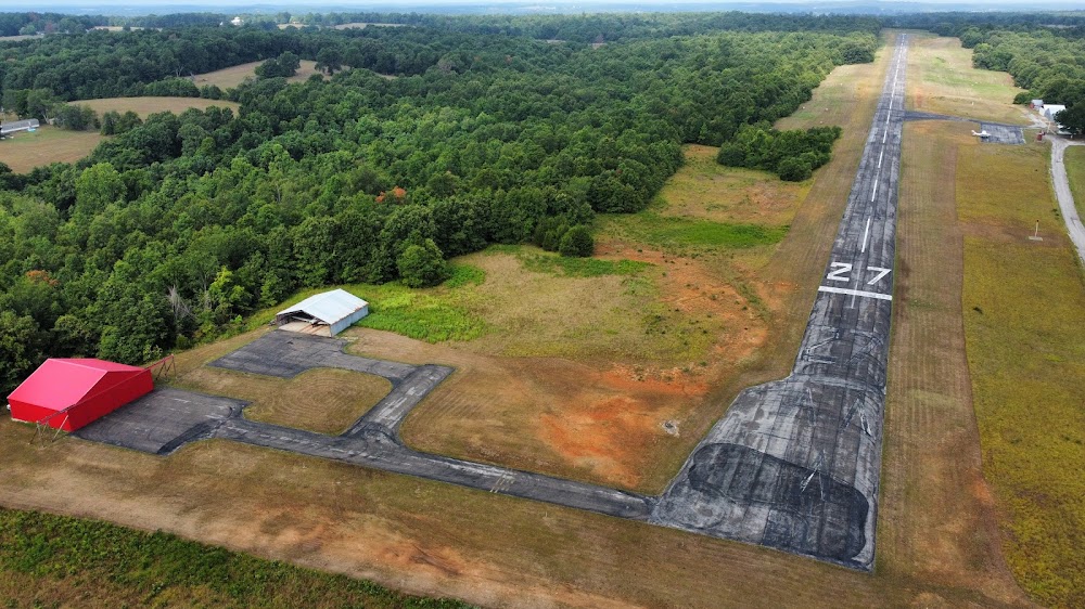
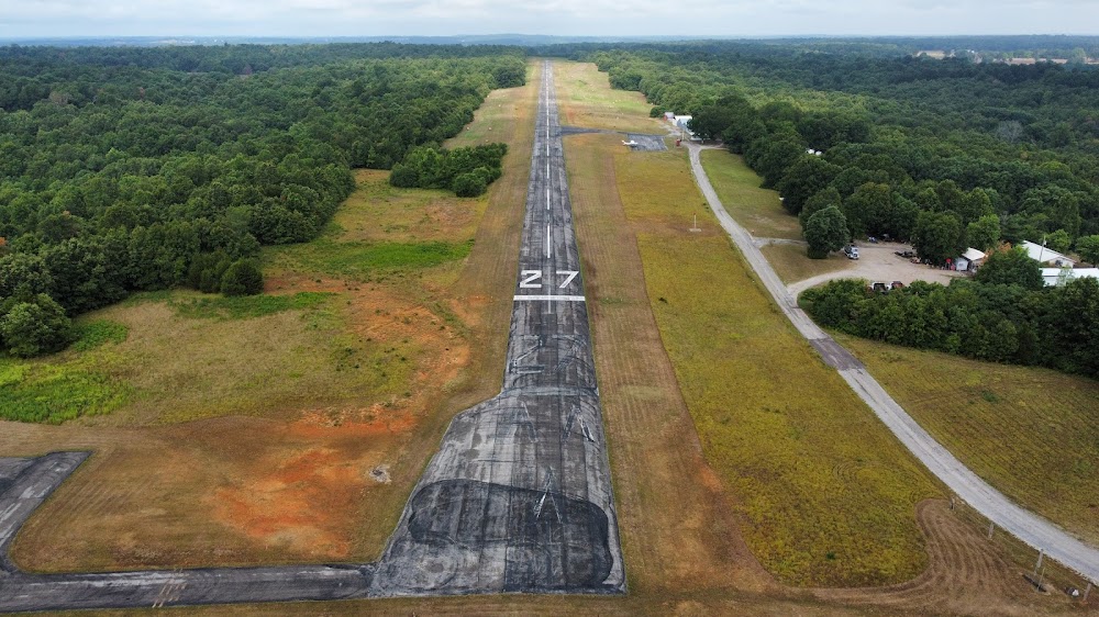
Runway 09/27:
4,200ft
Access: Open to the public
Click/tap to add an annotation marker to the map
No webcams added yet.
Remarks
- Rotg bcn ots indefly.
- Wild animals on ry at early & late hrs.
- Ntsd ry safety areas byd each ry end & along ry edges; ry 09 end incorrect terrain gradients & brush; ry 27 end brush, trees, fence & posts. tall brush along pavement edges.
- For cd ctc memphis artcc at 901-368-8453/8449.
- To actvt lirl rwy 09/27 key 122.9 5 times.
- Ry 09/27 nstd lirl; ry edge & thld lgts placed 15 ft off edges of pavement.
- +1-15 ft brush 0-10 ft fm ry end 75 ft l, +1-3 ft gnd 50-95 ft fm ry end 40-125 ft r.
- Rwy 27 +1 ft fence 20 ft fm ry end l/r; 1-21 ft fence & brush 65-80 ft fm ry end l/r.
Comments