Pirep is a free, collaborative database of all public and private airports. All pilots are welcome to contribute their local knowledge to any airport, no registration required.


Public
Undocumented
METAR / TAF
Edit Tags
No upcoming events. Is anything happening here soon?
Airport Statistics
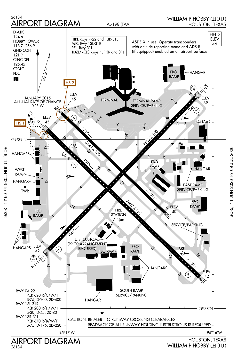
- Airport map annotations
- General description
- Tags
Location:
Houston, TX
Elevation:
46ft
Sectional:
Houston
Activation date:
Jan 1939
Fuel:
100LL, A, A1 (prices)
Runway 04/22:
7,602ft
Runway 13R/31L:
7,602ft
Runway 13L/31R:
5,148ft
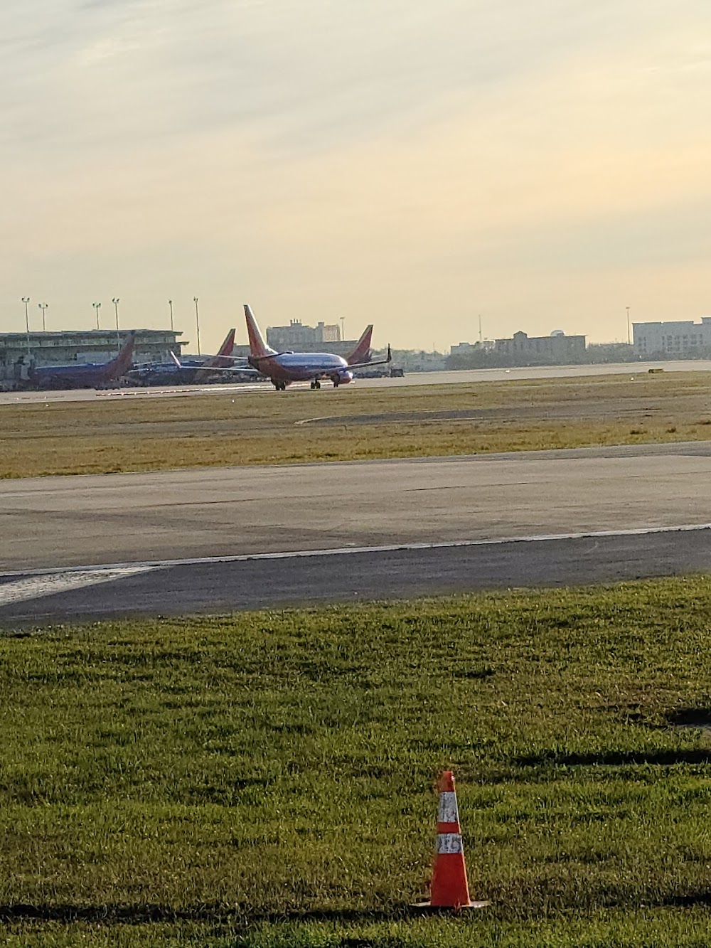
Access: Open to the public
Current Weather — VFR
-
Weather data is strictly informational and not for flight planning purposes.
-
METAR2026-07-01 04:53:00 CDT
Ceiling: Sky clear Wind: 190° @ 5kt Temperature: 78°F Dewpoint: 75°F Weather: N/A Visbility: 9SM Clouds: Few @ 3,000ft Raw:METAR KHOU 010953Z 19005KT 9SM FEW030 26/24 A2999 RMK AO2 SLP158 T02610244 -
TAF2026-07-01 04:00:00 CDT – 2026-07-01 09:00:00 CDT
Ceiling: Sky clear Wind: Variable Weather: N/A Visbility: 6SM Clouds: Scattered @ 2,000ft Raw:TAF KHOU 010844Z 0109/0206 VRB04KT P6SM SCT020 FM011400 16007KT P6SM SCT025 SCT035 FM011800 15009KT P6SM SCT040 BKN060 FM020000 15008KT P6SM FEW035 SCT120 -
TAF2026-07-01 09:00:00 CDT – 2026-07-01 13:00:00 CDT
Ceiling: Sky clear Wind: 160° @ 7kt Weather: N/A Visbility: 6SM Clouds: Scattered @ 2,500ft, Scattered @ 3,500ft Raw:TAF KHOU 010844Z 0109/0206 VRB04KT P6SM SCT020 FM011400 16007KT P6SM SCT025 SCT035 FM011800 15009KT P6SM SCT040 BKN060 FM020000 15008KT P6SM FEW035 SCT120 -
TAF2026-07-01 13:00:00 CDT – 2026-07-01 19:00:00 CDT
Ceiling: 6,000ft Wind: 150° @ 9kt Weather: N/A Visbility: 6SM Clouds: Scattered @ 4,000ft, Broken @ 6,000ft Raw:TAF KHOU 010844Z 0109/0206 VRB04KT P6SM SCT020 FM011400 16007KT P6SM SCT025 SCT035 FM011800 15009KT P6SM SCT040 BKN060 FM020000 15008KT P6SM FEW035 SCT120 -
TAF2026-07-01 19:00:00 CDT – 2026-07-02 01:00:00 CDT
Ceiling: Sky clear Wind: 150° @ 8kt Weather: N/A Visbility: 6SM Clouds: Few @ 3,500ft, Scattered @ 12,000ft Raw:TAF KHOU 010844Z 0109/0206 VRB04KT P6SM SCT020 FM011400 16007KT P6SM SCT025 SCT035 FM011800 15009KT P6SM SCT040 BKN060 FM020000 15008KT P6SM FEW035 SCT120
Click/tap to add an annotation marker to the map
No webcams added yet.
Remarks
- Nmrs birds on and in vcnty of arpt.
- Twy g cntrln to parked acft on west side only 68 ft. twy g cntrln to edge of adj svc vehicle road on west side only 48 ft.
- Due to complex rwy confign; when tax to thrs 13l & 13r check compass hdg bfr departing.
- Acft southbound on twy c to rwy 31l thr use extreme care; twy c makes a 45 deg dogleg to the left xng twy k.
- Acft in tkof ptn on rwy 22 be alert for poss radio intfc or null on freq 118.7. use upper ant if so equipped.
Comments