Pirep is a free, collaborative database of all public and private airports. All pilots are welcome to contribute their local knowledge to any airport, no registration required.
Undocumented
METAR / TAF
Edit Tags
No upcoming events. Is anything happening here soon?
Airport Statistics
- Airport photos
- Transient parking location
- Airport map annotations
Location:
Fallon, NV
Elevation:
3,934ft
Sectional:
San Francisco
Activation date:
Dec 1942
Fuel:
None
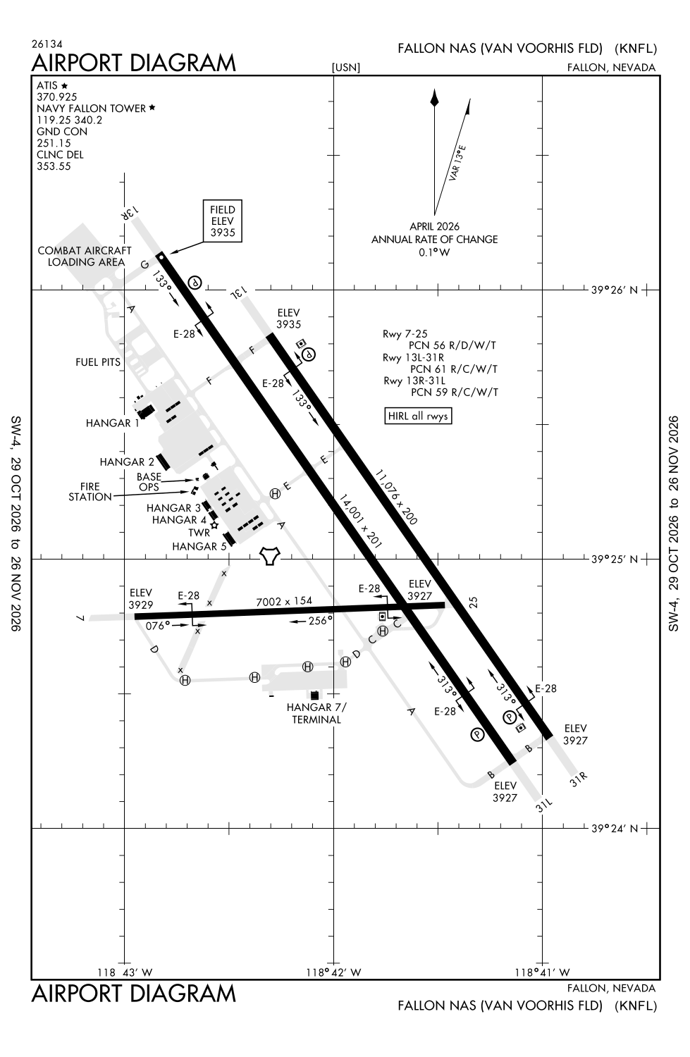
Runway 13R/31L:
14,001ft
Runway 13L/31R:
11,076ft
Runway 07/25:
7,003ft
Access: Private to everyone
This is a military facility.
Click/tap to add an annotation marker to the map
No webcams added yet.
Remarks
- A-gear: e-28(b) apch end on parallel rwys nml derigged.
- Jasu: 1(gtc-85) 1(ncpp-105) 2(nc-8a).
- Fluid: sp lox.
- Tran alert: no tsnt maint/hgr space or de-ice avbl.
- See flip ap/1 supplementary arpt rmk.
Comments