Pirep is a free, collaborative database of all public and private airports. All pilots are welcome to contribute their local knowledge to any airport, no registration required.
Public
Undocumented
METAR / TAF
Edit Tags
No upcoming events. Is anything happening here soon?
Airport Statistics
- Webcam links
- Crew car availability
- Tags
Location:
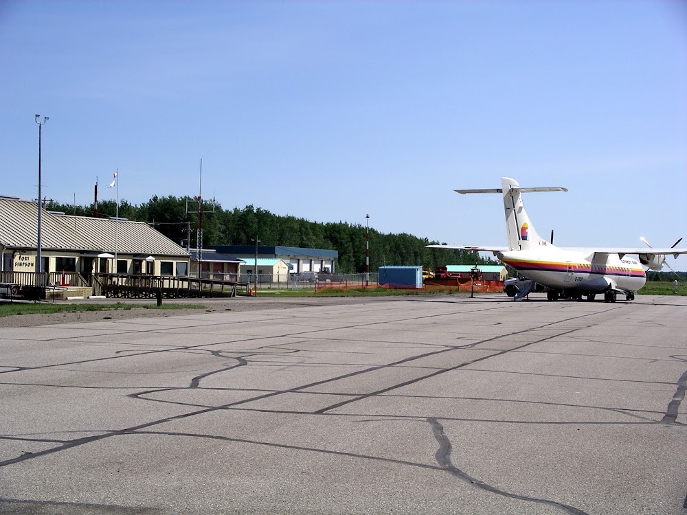
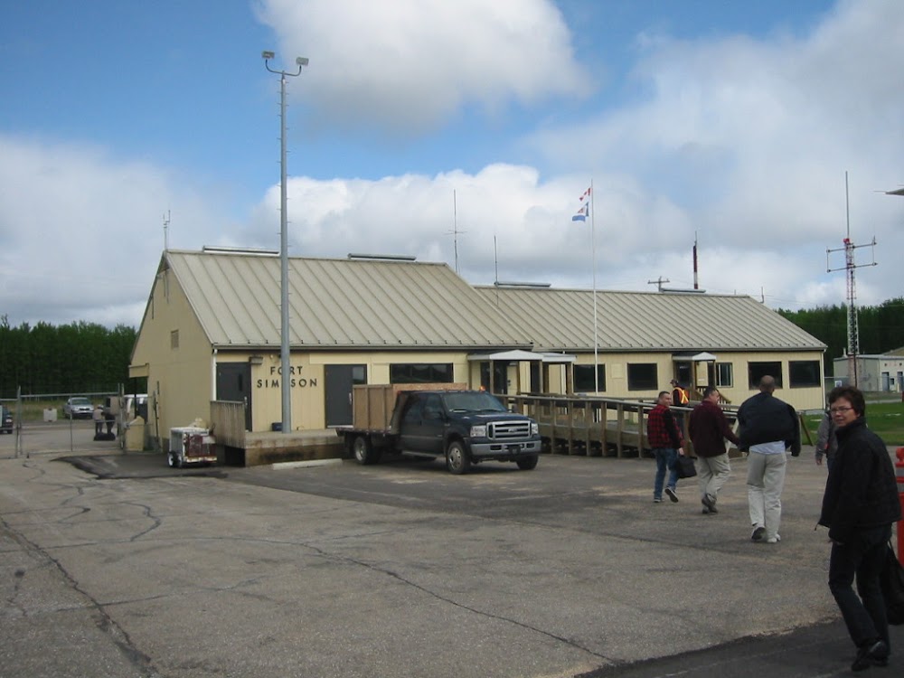
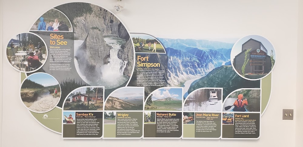
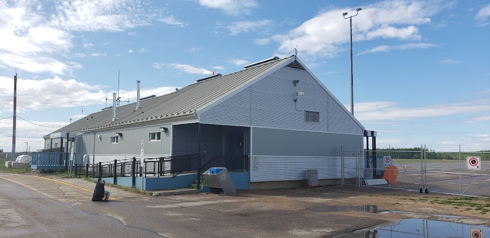
Fort Simpson, Northwest Territories
Elevation:
555ft
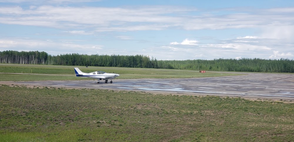
Runway 14/32:
6,000ft
Warning: This airport was imported from a non-authoritative source. Its public/private status may not be accurate.
Access: Open to the public
Current Weather — VFR
-
Weather data is strictly informational and not for flight planning purposes.
-
METAR2026-06-25 20:00:00 MDT
Ceiling: 14,000ft Wind: 130° @ 2kt Temperature: 69°F Dewpoint: 57°F Weather: N/A Visbility: 15SM Clouds: Few @ 7,200ft, Scattered @ 10,000ft, Broken @ 14,000ft, Broken @ 25,000ft Raw:METAR CYFS 260200Z 13002KT 15SM FEW072 SCT100 BKN140 BKN250 21/14 A2960 RMK CU1AC3AC4CI1 CU TR CI TR VIRGA SLP030 DENSITY ALT 1800FT -
TAF2026-06-25 19:00:00 MDT – 2026-06-26 01:00:00 MDT
Ceiling: 11,000ft Wind: 110° @ 5kt Weather: N/A Visbility: 6SM Clouds: Scattered @ 5,000ft, Broken @ 11,000ft Raw:TAF AMD CYFS 260106Z 2601/2612 11005KT P6SM SCT050CB BKN110 TEMPO 2601/2607 VRB25G35KT 5SM -TSRA BKN080CB FM260700 11004KT P6SM FEW080 SCT100 TEMPO 2607/2612 P6SM -SHRA VCTS SCT080CB BKN100 RMK NXT FCST BY 260600Z -
TAF2026-06-25 19:00:00 MDT – 2026-06-26 01:00:00 MDT
Ceiling: 8,000ft Wind: Variable, gusts 35kt Weather: Light thunderstorm rain Visbility: 5SM Clouds: Broken @ 8,000ft Raw:TAF AMD CYFS 260106Z 2601/2612 11005KT P6SM SCT050CB BKN110 TEMPO 2601/2607 VRB25G35KT 5SM -TSRA BKN080CB FM260700 11004KT P6SM FEW080 SCT100 TEMPO 2607/2612 P6SM -SHRA VCTS SCT080CB BKN100 RMK NXT FCST BY 260600Z -
TAF2026-06-26 01:00:00 MDT – 2026-06-26 06:00:00 MDT
Ceiling: Sky clear Wind: 110° @ 4kt Weather: N/A Visbility: 6SM Clouds: Few @ 8,000ft, Scattered @ 10,000ft Raw:TAF AMD CYFS 260106Z 2601/2612 11005KT P6SM SCT050CB BKN110 TEMPO 2601/2607 VRB25G35KT 5SM -TSRA BKN080CB FM260700 11004KT P6SM FEW080 SCT100 TEMPO 2607/2612 P6SM -SHRA VCTS SCT080CB BKN100 RMK NXT FCST BY 260600Z -
TAF2026-06-26 01:00:00 MDT – 2026-06-26 06:00:00 MDT
Ceiling: 10,000ft Wind: 000° @ kt Weather: Light rain showers, thunderstorm in vicinity Visbility: 6SM Clouds: Scattered @ 8,000ft, Broken @ 10,000ft Raw:TAF AMD CYFS 260106Z 2601/2612 11005KT P6SM SCT050CB BKN110 TEMPO 2601/2607 VRB25G35KT 5SM -TSRA BKN080CB FM260700 11004KT P6SM FEW080 SCT100 TEMPO 2607/2612 P6SM -SHRA VCTS SCT080CB BKN100 RMK NXT FCST BY 260600Z
Click/tap to add an annotation marker to the map
No webcams added yet.
Comments