Pirep is a free, collaborative database of all public and private airports. All pilots are welcome to contribute their local knowledge to any airport, no registration required.


Public
METAR / TAF
Webcam
Edit Tags
No upcoming events. Is anything happening here soon?
Last updated: 2024-06-26 13:34:55 EDT
Last updated: 2025-02-26 22:35:09 EST
Airport Statistics
- Local flying clubs
- Tags
- Landing & tie-down fees
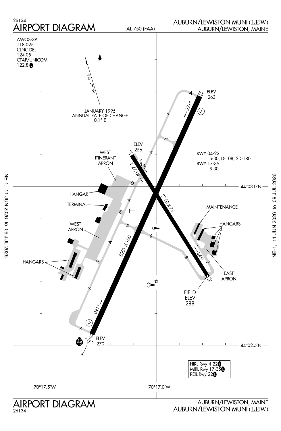
Location:
Auburn/Lewiston, ME
Elevation:
287ft
Sectional:
Montreal
Activation date:
Apr 1940
Fuel:
100LL, A1+ (prices)
Runway 04/22:
5,001ft
Runway 17/35:
2,750ft
Access: Open to the public
Current Weather — VFR
-
Weather data is strictly informational and not for flight planning purposes.
-
METAR2026-07-15 19:56:00 EDT
Ceiling: Sky clear Wind: 340° @ 6kt Temperature: 77°F Dewpoint: 57°F Weather: N/A Visbility: 10SM Clouds: Few @ 7,000ft Raw:METAR KLEW 152356Z AUTO 34006KT 10SM FEW070 25/14 A2972 RMK AO2 SLP067 6//// T02500139 10306 20250 53013
Click/tap to add an annotation marker to the map
Remarks
- This airport has been surveyed by the national geodetic survey.
- Existed prior to 1959.
- Birds on & invof arpt.
- Rwy 04 dsgnd calm wind rwy.
- Ocnl blasting in prog mon-sat aprxly 4800-5000 ft sw of rwy 04 thr 1100-1500 durg vfr conds only.
According to Google maps the Cheesy Skillet is permanently closed.