Pirep is a free, collaborative database of all public and private airports. All pilots are welcome to contribute their local knowledge to any airport, no registration required.

Public
Undocumented
METAR / TAF
Edit Tags
No upcoming events. Is anything happening here soon?
Airport Statistics
- Transient parking location
- Airport map annotations
- Local flying clubs
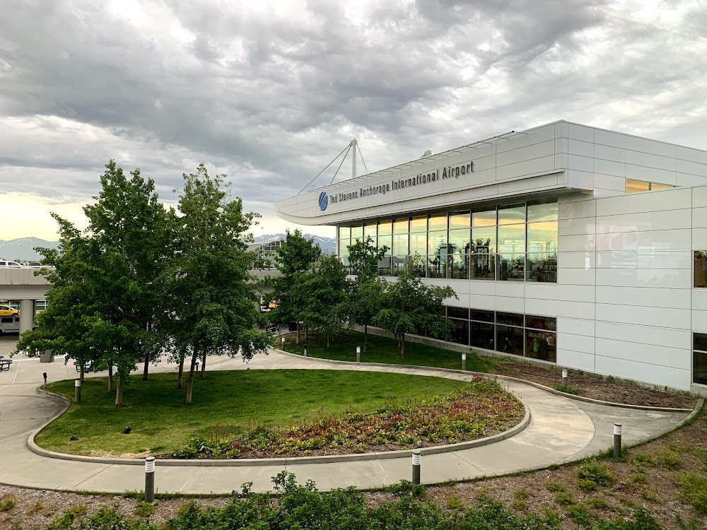
Location:
Anchorage, AK
Elevation:
151ft
Sectional:
Anchorage
Activation date:
Nov 1951
Fuel:
100, 100LL, A, A1 (prices)
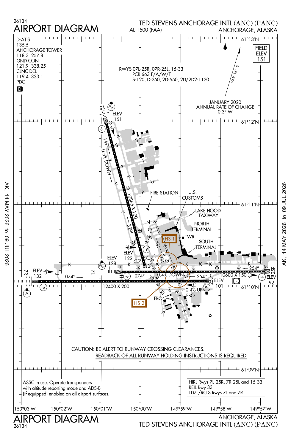
Runway 07R/25L:
12,400ft
Runway 15/33:
10,865ft
Runway 07L/25R:
10,600ft
Access: Open to the public
Current Weather — VFR
-
Weather data is strictly informational and not for flight planning purposes.
-
METAR2026-06-25 19:53:00 AKDT
Ceiling: Sky clear Wind: 300° @ 6kt Temperature: 60°F Dewpoint: 46°F Weather: N/A Visbility: 10SM Clouds: Few @ 5,000ft, Few @ 9,000ft, Scattered @ 20,000ft Raw:METAR PANC 260353Z 30006KT 10SM FEW050 FEW090 SCT200 16/08 A2971 RMK AO2 SLP061 T01610083 -
TAF2026-06-25 16:00:00 AKDT – 2026-06-25 22:00:00 AKDT
Ceiling: Sky clear Wind: 300° @ 7kt Weather: N/A Visbility: 6SM Clouds: Few @ 3,500ft, Scattered @ 10,000ft Raw:TAF PANC 252327Z 2600/2706 30007KT P6SM FEW035 SCT100 FM260600 18006KT P6SM BKN100 FM262000 26008KT P6SM SCT100 FM270000 17009KT P6SM -SHRA SCT040 BKN070 -
TAF2026-06-25 22:00:00 AKDT – 2026-06-26 12:00:00 AKDT
Ceiling: 10,000ft Wind: 180° @ 6kt Weather: N/A Visbility: 6SM Clouds: Broken @ 10,000ft Raw:TAF PANC 252327Z 2600/2706 30007KT P6SM FEW035 SCT100 FM260600 18006KT P6SM BKN100 FM262000 26008KT P6SM SCT100 FM270000 17009KT P6SM -SHRA SCT040 BKN070 -
TAF2026-06-26 12:00:00 AKDT – 2026-06-26 16:00:00 AKDT
Ceiling: Sky clear Wind: 260° @ 8kt Weather: N/A Visbility: 6SM Clouds: Scattered @ 10,000ft Raw:TAF PANC 252327Z 2600/2706 30007KT P6SM FEW035 SCT100 FM260600 18006KT P6SM BKN100 FM262000 26008KT P6SM SCT100 FM270000 17009KT P6SM -SHRA SCT040 BKN070 -
TAF2026-06-26 16:00:00 AKDT – 2026-06-26 22:00:00 AKDT
Ceiling: 7,000ft Wind: 170° @ 9kt Weather: Light rain showers Visbility: 6SM Clouds: Scattered @ 4,000ft, Broken @ 7,000ft Raw:TAF PANC 252327Z 2600/2706 30007KT P6SM FEW035 SCT100 FM260600 18006KT P6SM BKN100 FM262000 26008KT P6SM SCT100 FM270000 17009KT P6SM -SHRA SCT040 BKN070
Click/tap to add an annotation marker to the map
No webcams added yet.
Remarks
- Birds invof arpt spring - fall.
- Non-radio night ops na; non-parrot ops 1 hr ppr; non-radio ops ppr; must prvd eta & remain wi 15 min - atct 907-271-2700 wkdays 0730-1600; aft hr & hol - faa 907-271-5936.
- Wso - 907-266-5105.
- Noise sensitive area in efct; for info - amgr
- 489 ft unlgtd twr 2.5 mi ne.
Comments