Pirep is a free, collaborative database of all public and private airports. All pilots are welcome to contribute their local knowledge to any airport, no registration required.

Public
Undocumented
METAR / TAF
Edit Tags
No upcoming events. Is anything happening here soon?
Airport Statistics
- Webcam links
- General description
- Tags
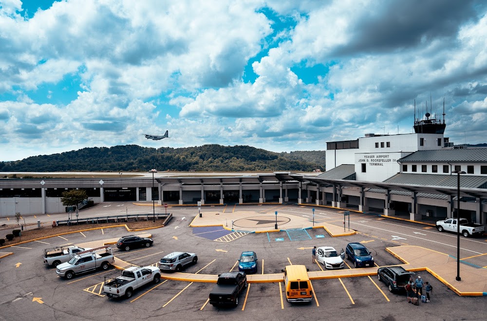
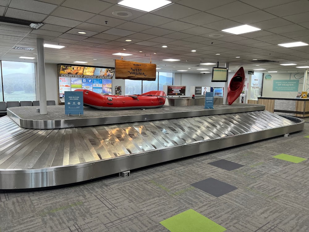
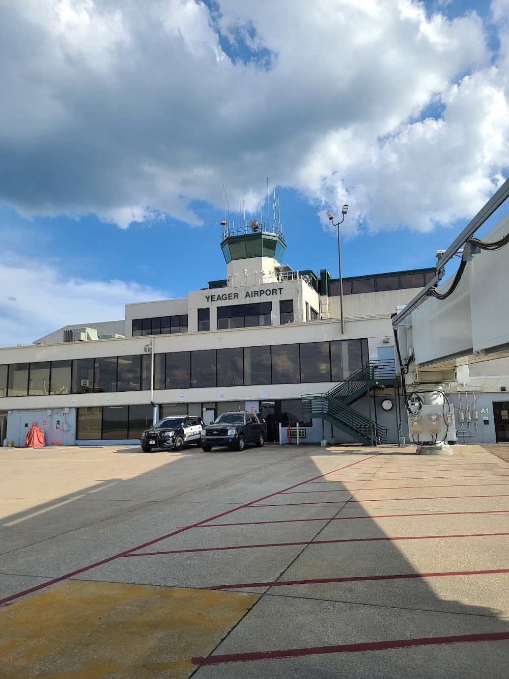
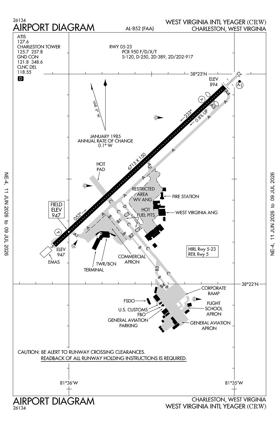
Location:
Charleston, WV
Elevation:
947ft
Sectional:
Cincinnati
Activation date:
Aug 1947
Fuel:
100LL, A (prices)
Runway 05/23:
6,715ft
Access: Open to the public
Current Weather — VFR
-
Weather data is strictly informational and not for flight planning purposes.
-
METAR2026-07-21 12:54:00 EDT
Ceiling: 3,200ft Wind: 250° @ 10kt Temperature: 84°F Dewpoint: 73°F Weather: N/A Visbility: 10SM Clouds: Broken @ 3,200ft, Broken @ 18,000ft Raw:METAR KCRW 211654Z 25010KT 10SM BKN032 BKN180 29/23 A2982 RMK AO2 SLP088 T02940233 $ -
TAF2026-07-21 14:00:00 EDT – 2026-07-21 19:00:00 EDT
Ceiling: 3,500ft Wind: 250° @ 11kt, gusts 21kt Weather: Thunderstorm in vicinity Visbility: 6SM Clouds: Broken @ 3,500ft Raw:TAF KCRW 211726Z 2118/2218 25011G21KT P6SM VCTS BKN035CB PROB30 2119/2123 27025G40KT 1SM +TSRA BR OVC025CB FM212300 24009G21KT 6SM -SHRA VCTS OVC021CB FM220200 22007KT 6SM -SHRA VCTS OVC040CB FM220600 25004KT 5SM BR BKN012 FM220800 00000KT 2SM BR BKN002 FM221300 VRB03KT 5SM BR BKN007 FM221500 31004KT P6SM BKN021 -
TAF2026-07-21 15:00:00 EDT – 2026-07-21 19:00:00 EDT
Ceiling: 2,500ft Wind: 270° @ 25kt, gusts 40kt Weather: Heavy thunderstorm rain, mist Visbility: 1SM Clouds: Overcast @ 2,500ft Raw:TAF KCRW 211726Z 2118/2218 25011G21KT P6SM VCTS BKN035CB PROB30 2119/2123 27025G40KT 1SM +TSRA BR OVC025CB FM212300 24009G21KT 6SM -SHRA VCTS OVC021CB FM220200 22007KT 6SM -SHRA VCTS OVC040CB FM220600 25004KT 5SM BR BKN012 FM220800 00000KT 2SM BR BKN002 FM221300 VRB03KT 5SM BR BKN007 FM221500 31004KT P6SM BKN021 -
TAF2026-07-21 19:00:00 EDT – 2026-07-21 22:00:00 EDT
Ceiling: 2,100ft Wind: 240° @ 9kt, gusts 21kt Weather: Light rain showers, thunderstorm in vicinity Visbility: 6SM Clouds: Overcast @ 2,100ft Raw:TAF KCRW 211726Z 2118/2218 25011G21KT P6SM VCTS BKN035CB PROB30 2119/2123 27025G40KT 1SM +TSRA BR OVC025CB FM212300 24009G21KT 6SM -SHRA VCTS OVC021CB FM220200 22007KT 6SM -SHRA VCTS OVC040CB FM220600 25004KT 5SM BR BKN012 FM220800 00000KT 2SM BR BKN002 FM221300 VRB03KT 5SM BR BKN007 FM221500 31004KT P6SM BKN021 -
TAF2026-07-21 22:00:00 EDT – 2026-07-22 02:00:00 EDT
Ceiling: 4,000ft Wind: 220° @ 7kt Weather: Light rain showers, thunderstorm in vicinity Visbility: 6SM Clouds: Overcast @ 4,000ft Raw:TAF KCRW 211726Z 2118/2218 25011G21KT P6SM VCTS BKN035CB PROB30 2119/2123 27025G40KT 1SM +TSRA BR OVC025CB FM212300 24009G21KT 6SM -SHRA VCTS OVC021CB FM220200 22007KT 6SM -SHRA VCTS OVC040CB FM220600 25004KT 5SM BR BKN012 FM220800 00000KT 2SM BR BKN002 FM221300 VRB03KT 5SM BR BKN007 FM221500 31004KT P6SM BKN021 -
TAF2026-07-22 02:00:00 EDT – 2026-07-22 04:00:00 EDT
Ceiling: 1,200ft Wind: 250° @ 4kt Weather: Mist Visbility: 5SM Clouds: Broken @ 1,200ft Raw:TAF KCRW 211726Z 2118/2218 25011G21KT P6SM VCTS BKN035CB PROB30 2119/2123 27025G40KT 1SM +TSRA BR OVC025CB FM212300 24009G21KT 6SM -SHRA VCTS OVC021CB FM220200 22007KT 6SM -SHRA VCTS OVC040CB FM220600 25004KT 5SM BR BKN012 FM220800 00000KT 2SM BR BKN002 FM221300 VRB03KT 5SM BR BKN007 FM221500 31004KT P6SM BKN021 -
TAF2026-07-22 04:00:00 EDT – 2026-07-22 09:00:00 EDT
Ceiling: 200ft Wind: Calm Weather: Mist Visbility: 2SM Clouds: Broken @ 200ft Raw:TAF KCRW 211726Z 2118/2218 25011G21KT P6SM VCTS BKN035CB PROB30 2119/2123 27025G40KT 1SM +TSRA BR OVC025CB FM212300 24009G21KT 6SM -SHRA VCTS OVC021CB FM220200 22007KT 6SM -SHRA VCTS OVC040CB FM220600 25004KT 5SM BR BKN012 FM220800 00000KT 2SM BR BKN002 FM221300 VRB03KT 5SM BR BKN007 FM221500 31004KT P6SM BKN021 -
TAF2026-07-22 09:00:00 EDT – 2026-07-22 11:00:00 EDT
Ceiling: 700ft Wind: Variable Weather: Mist Visbility: 5SM Clouds: Broken @ 700ft Raw:TAF KCRW 211726Z 2118/2218 25011G21KT P6SM VCTS BKN035CB PROB30 2119/2123 27025G40KT 1SM +TSRA BR OVC025CB FM212300 24009G21KT 6SM -SHRA VCTS OVC021CB FM220200 22007KT 6SM -SHRA VCTS OVC040CB FM220600 25004KT 5SM BR BKN012 FM220800 00000KT 2SM BR BKN002 FM221300 VRB03KT 5SM BR BKN007 FM221500 31004KT P6SM BKN021 -
TAF2026-07-22 11:00:00 EDT – 2026-07-22 14:00:00 EDT
Ceiling: 2,100ft Wind: 310° @ 4kt Weather: N/A Visbility: 6SM Clouds: Broken @ 2,100ft Raw:TAF KCRW 211726Z 2118/2218 25011G21KT P6SM VCTS BKN035CB PROB30 2119/2123 27025G40KT 1SM +TSRA BR OVC025CB FM212300 24009G21KT 6SM -SHRA VCTS OVC021CB FM220200 22007KT 6SM -SHRA VCTS OVC040CB FM220600 25004KT 5SM BR BKN012 FM220800 00000KT 2SM BR BKN002 FM221300 VRB03KT 5SM BR BKN007 FM221500 31004KT P6SM BKN021
Click/tap to add an annotation marker to the map
No webcams added yet.
Remarks
- Prior to 1959.
- Deer & birds on & invof arpt.
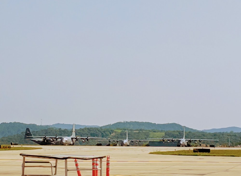
- Military: ang: afld mgmt ops opr 1200-2100z++ mon-fri, and unit trng assembly (uta) wknd. ppr req for all acft 48 hr prior for svcg and use of park ramps. file ppr nr in rmk sec on flt plan. clsd sat-sun and hol. avbl wknd for obo, ctc afld mgmt ops dsn 366-6240/6200, c304-341-6240/6200. acft must meet ppr time +/- 1 hr or will be consdr cnxed, update chng after hr call dsn 366-6301 or c304-341-6301. nstd pavement mrk on ang ramp. comd post dsn 366-6250/6256, c304-341-6250/6256. explosives proh. bash phase ii bird in eff 1 mar-31 may and 1 aug-31 oct annually. ctc afld mgmt for current bird watch cond.
- Fuel service-capital jet center ctc 304-346--9977.
- Service-fuel: a++(mil).
Comments