Pirep is a free, collaborative database of all public and private airports. All pilots are welcome to contribute their local knowledge to any airport, no registration required.


Undocumented
METAR / TAF
Edit Tags
No upcoming events. Is anything happening here soon?
Airport Statistics
- Landing & tie-down fees
- Tags
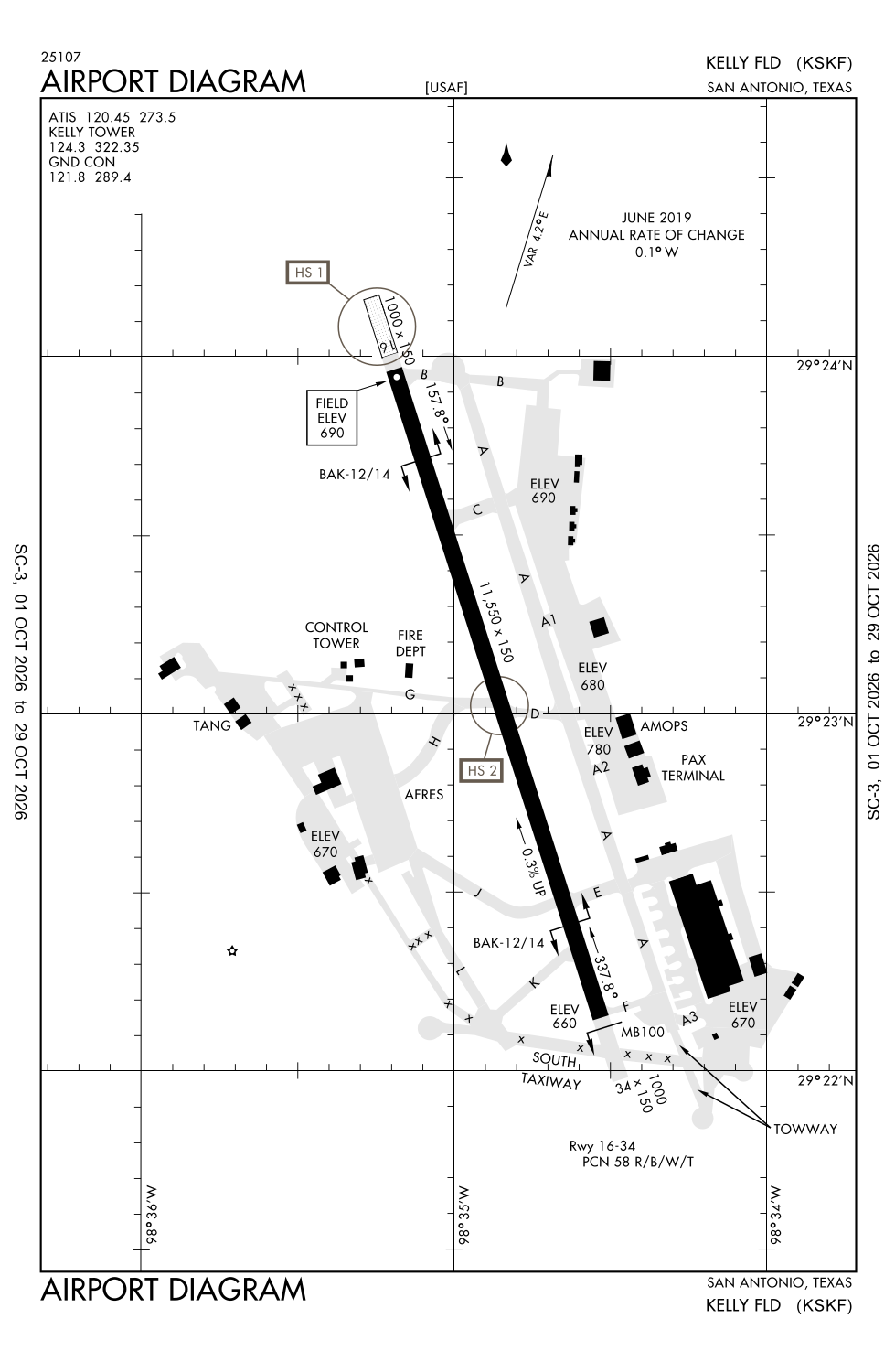
- Airport map annotations
Location:
San Antonio, TX
Elevation:
690ft
Sectional:
San Antonio
Activation date:
Nov 1943
Fuel:
100LL, A+
Runway 16/34:
11,550ft
Access: Open to the public
Current Weather — VFR
-
Weather data is strictly informational and not for flight planning purposes.
-
METAR2026-10-26 01:55:00 CDT
Ceiling: 5,000ft Wind: 060° @ 4kt Temperature: 68°F Dewpoint: 58°F Weather: N/A Visbility: 10SM Clouds: Broken @ 5,000ft Raw:METAR KSKF 260655Z AUTO 06004KT 10SM BKN050 20/15 A3019 RMK AO2 SLP217 T02020145 $ -
TAF2026-10-25 21:00:00 CDT – 2026-10-26 11:00:00 CDT
Ceiling: 6,500ft Wind: 120° @ 9kt Weather: N/A Visbility: 6SM Clouds: Broken @ 6,500ft, Overcast @ 22,000ft Raw:TAF KSKF 260200Z 2602/2708 12009KT 9999 BKN065 OVC220 QNH3016INS WND 05006KT AFT 2608 BECMG 2616/2617 12010KT 9999 BKN070 OVC250 QNH3005INS TX28/2620Z TN17/2612Z -
TAF2026-10-26 11:00:00 CDT – 2026-10-27 03:00:00 CDT
Ceiling: 7,000ft Wind: 120° @ 10kt Weather: N/A Visbility: 6SM Clouds: Broken @ 7,000ft, Overcast @ 25,000ft Raw:TAF KSKF 260200Z 2602/2708 12009KT 9999 BKN065 OVC220 QNH3016INS WND 05006KT AFT 2608 BECMG 2616/2617 12010KT 9999 BKN070 OVC250 QNH3005INS TX28/2620Z TN17/2612Z
Click/tap to add an annotation marker to the map
No webcams added yet.
Remarks
- Caution: probability of hydroplaning at all speeds entire rwy.
- Ang: opr 1345-2230z++ tue-sat. ppr for use of ang ramp, dsn 945-5934, c210-925-5934.
- Afrc: ppr for use of afrc ramp, dsn 945-4330, c210-925-4330.
- Acft with wing span larger than 93 ft not authorized in arm/dearm pads.
- Cstms/ag/img: cstms, plant quarantine and img avbl, ctc amops by fone patch or ptd rdo 2 hr before arr. all pers, excld active us mil, must clear img inbd.
Comments