Pirep is a free, collaborative database of all public and private airports. All pilots are welcome to contribute their local knowledge to any airport, no registration required.
Undocumented
METAR / TAF
Edit Tags
No upcoming events. Is anything happening here soon?
Airport Statistics
- Webcam links
- Transient parking location
- Local flying clubs
Location:
Marysville, CA
Elevation:
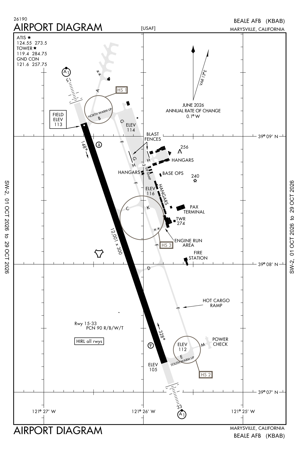
112ft
Sectional:
San Francisco
Activation date:
Jan 1960
Fuel:
None
Runway 15/33:
12,001ft
Access: Private to everyone
This is a military facility.
Current Weather — VFR
-
Weather data is strictly informational and not for flight planning purposes.
-
METAR2026-10-29 00:55:00 PDT
Ceiling: Sky clear Wind: 100° @ 4kt Temperature: 50°F Dewpoint: 39°F Weather: N/A Visbility: 10SM Raw:METAR KBAB 290755Z 10004KT 10SM CLR 11/04 A2994 RMK AO2A SLP142 T01050040 402130048 $ -
TAF2026-10-28 20:00:00 PDT – 2026-10-29 12:00:00 PDT
Ceiling: Sky clear Wind: 090° @ 4kt Weather: N/A Visbility: 6SM Clouds: Few @ 25,000ft Raw:TAF KBAB 290300Z 2903/3009 09004KT 9999 FEW250 QNH2992INS BECMG 2919/2920 19006KT 9999 SCT200 QNH2983INS WND 10004KT AFT 3003 TX21/2923Z TN07/2913Z -
TAF2026-10-29 12:00:00 PDT – 2026-10-30 02:00:00 PDT
Ceiling: Sky clear Wind: 190° @ 6kt Weather: N/A Visbility: 6SM Clouds: Scattered @ 20,000ft Raw:TAF KBAB 290300Z 2903/3009 09004KT 9999 FEW250 QNH2992INS BECMG 2919/2920 19006KT 9999 SCT200 QNH2983INS WND 10004KT AFT 3003 TX21/2923Z TN07/2913Z
Click/tap to add an annotation marker to the map
No webcams added yet.
Remarks
- Bearing strength rwy 15/33: s160 t300 st175 st175 sbtt620 tt490 tdt840.
- Jasu: (am32a-60a) (a/m32a-86) 7(mc-1a) (mc-2a).
- Fuel: j8.
- Fluid: w sp lpox lox.
- Rwylgts: ry 33, sf.
Comments