Pirep is a free, collaborative database of all public and private airports. All pilots are welcome to contribute their local knowledge to any airport, no registration required.


Public
Undocumented
METAR / TAF
Edit Tags
No upcoming events. Is anything happening here soon?
Airport Statistics
- WiFi availability
- Landing & tie-down fees
- Tags
Location:
Wichita, KS
Elevation:
1,408ft
Sectional:
Wichita
Activation date:
Apr 1940
Fuel:
None
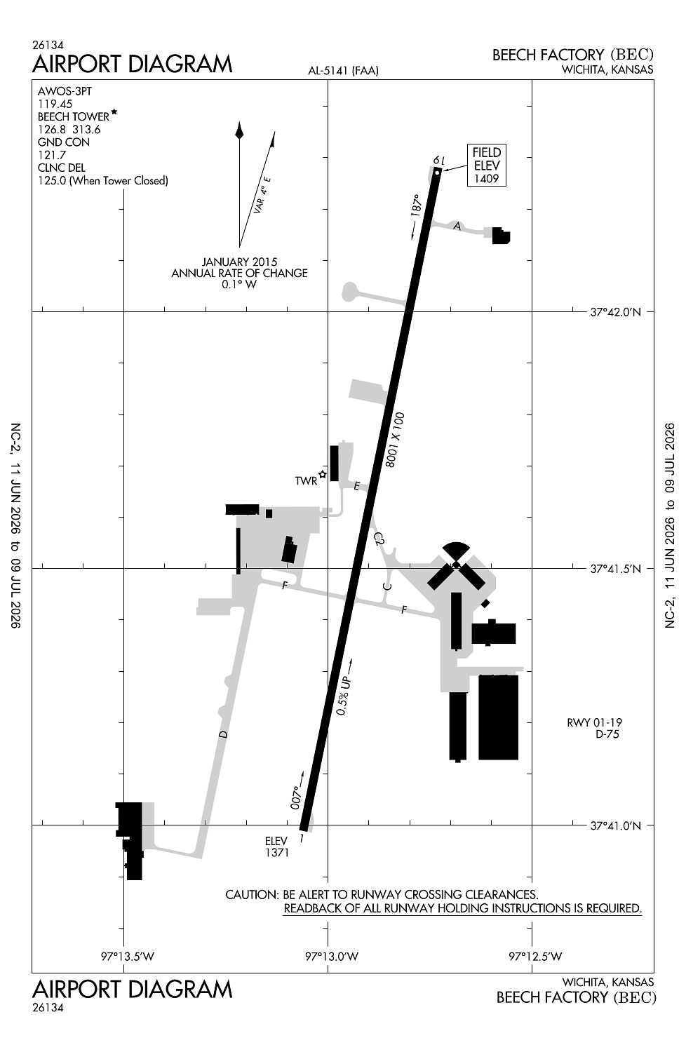
Runway 01/19:
8,001ft
Access: Open to the public
This airport is privately owned but open to the public.
Current Weather — VFR
-
Weather data is strictly informational and not for flight planning purposes.
-
METAR2026-07-21 01:15:00 CDT
Ceiling: Sky clear Wind: 190° @ 4kt Temperature: 80°F Dewpoint: 72°F Weather: N/A Visbility: 10SM Raw:METAR KBEC 210615Z AUTO 19004KT 10SM CLR 27/23 A2987 RMK AO2 T02700225
Click/tap to add an annotation marker to the map
No webcams added yet.
Remarks
- Existed prior to 1959.
- Arr & dep acft maintain 2200 ft msl within 5 miles of field due to afb traffic.
- Arrs from the w cross midfield enter dnwnd.
- Deer, coyote & migratory water fowl on & invof arpt.
- Ppr for parking or taxiing west side of ry.
Comments