Pirep is a free, collaborative database of all public and private airports. All pilots are welcome to contribute their local knowledge to any airport, no registration required.
Public
Undocumented
METAR / TAF
Edit Tags
No upcoming events. Is anything happening here soon?
Airport Statistics
- WiFi availability
- Airport map annotations
- Landing & tie-down fees
Location:
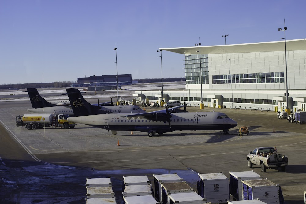
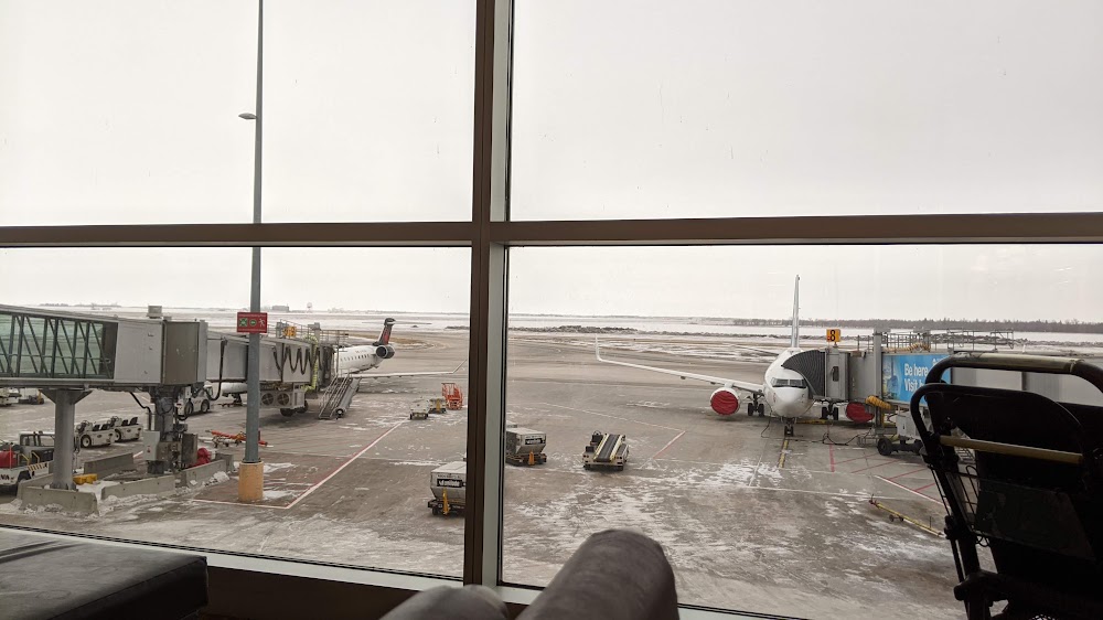
Winnipeg, Manitoba
Elevation:
783ft
Runway 18/36:
11,000ft
Runway 13/31:
8,841ft
Warning: This airport was imported from a non-authoritative source. Its public/private status may not be accurate.
Access: Open to the public
Current Weather — VFR
-
Weather data is strictly informational and not for flight planning purposes.
-
METAR2026-07-16 13:00:00 CDT
Ceiling: 18,000ft Wind: 120° @ 14kt, gusts 19kt Temperature: 68°F Dewpoint: 62°F Weather: N/A Visbility: 11SM Clouds: Scattered @ 10,000ft, Broken @ 18,000ft Raw:METAR CYWG 161800Z 12014G19KT 11SM SCT100 BKN180 20/17 A3002 RMK AC4AS3 SLP167 DENSITY ALT 1500FT -
TAF2026-07-16 13:00:00 CDT – 2026-07-16 15:00:00 CDT
Ceiling: 16,000ft Wind: 150° @ 12kt Weather: N/A Visbility: 6SM Clouds: Broken @ 16,000ft Raw:TAF CYWG 161740Z 1618/1718 15012KT P6SM BKN160 TEMPO 1618/1620 P6SM -SHRA BKN080 FM162000 12012KT P6SM BKN100 FM170100 03010KT P6SM OVC030 TEMPO 1701/1704 5SM -SHRA VCTS BR OVC020CB FM170400 03008KT P6SM -SHRA OVC030 PROB40 1704/1707 VRB20G30KT 3SM TSRA BR OVC015CB FM170700 03006KT P6SM SCT006 OVC012 TEMPO 1707/1716 OVC006 FM171600 30015G25KT P6SM BKN030 RMK NXT FCST BY 170000Z -
TAF2026-07-16 13:00:00 CDT – 2026-07-16 15:00:00 CDT
Ceiling: 8,000ft Wind: 000° @ kt Weather: Light rain showers Visbility: 6SM Clouds: Broken @ 8,000ft Raw:TAF CYWG 161740Z 1618/1718 15012KT P6SM BKN160 TEMPO 1618/1620 P6SM -SHRA BKN080 FM162000 12012KT P6SM BKN100 FM170100 03010KT P6SM OVC030 TEMPO 1701/1704 5SM -SHRA VCTS BR OVC020CB FM170400 03008KT P6SM -SHRA OVC030 PROB40 1704/1707 VRB20G30KT 3SM TSRA BR OVC015CB FM170700 03006KT P6SM SCT006 OVC012 TEMPO 1707/1716 OVC006 FM171600 30015G25KT P6SM BKN030 RMK NXT FCST BY 170000Z -
TAF2026-07-16 15:00:00 CDT – 2026-07-16 20:00:00 CDT
Ceiling: 10,000ft Wind: 120° @ 12kt Weather: N/A Visbility: 6SM Clouds: Broken @ 10,000ft Raw:TAF CYWG 161740Z 1618/1718 15012KT P6SM BKN160 TEMPO 1618/1620 P6SM -SHRA BKN080 FM162000 12012KT P6SM BKN100 FM170100 03010KT P6SM OVC030 TEMPO 1701/1704 5SM -SHRA VCTS BR OVC020CB FM170400 03008KT P6SM -SHRA OVC030 PROB40 1704/1707 VRB20G30KT 3SM TSRA BR OVC015CB FM170700 03006KT P6SM SCT006 OVC012 TEMPO 1707/1716 OVC006 FM171600 30015G25KT P6SM BKN030 RMK NXT FCST BY 170000Z -
TAF2026-07-16 20:00:00 CDT – 2026-07-16 23:00:00 CDT
Ceiling: 2,000ft Wind: 000° @ kt Weather: Light rain showers, thunderstorm in vicinity, mist Visbility: 5SM Clouds: Overcast @ 2,000ft Raw:TAF CYWG 161740Z 1618/1718 15012KT P6SM BKN160 TEMPO 1618/1620 P6SM -SHRA BKN080 FM162000 12012KT P6SM BKN100 FM170100 03010KT P6SM OVC030 TEMPO 1701/1704 5SM -SHRA VCTS BR OVC020CB FM170400 03008KT P6SM -SHRA OVC030 PROB40 1704/1707 VRB20G30KT 3SM TSRA BR OVC015CB FM170700 03006KT P6SM SCT006 OVC012 TEMPO 1707/1716 OVC006 FM171600 30015G25KT P6SM BKN030 RMK NXT FCST BY 170000Z -
TAF2026-07-16 20:00:00 CDT – 2026-07-16 23:00:00 CDT
Ceiling: 3,000ft Wind: 030° @ 10kt Weather: N/A Visbility: 6SM Clouds: Overcast @ 3,000ft Raw:TAF CYWG 161740Z 1618/1718 15012KT P6SM BKN160 TEMPO 1618/1620 P6SM -SHRA BKN080 FM162000 12012KT P6SM BKN100 FM170100 03010KT P6SM OVC030 TEMPO 1701/1704 5SM -SHRA VCTS BR OVC020CB FM170400 03008KT P6SM -SHRA OVC030 PROB40 1704/1707 VRB20G30KT 3SM TSRA BR OVC015CB FM170700 03006KT P6SM SCT006 OVC012 TEMPO 1707/1716 OVC006 FM171600 30015G25KT P6SM BKN030 RMK NXT FCST BY 170000Z -
TAF2026-07-16 23:00:00 CDT – 2026-07-17 02:00:00 CDT
Ceiling: 1,500ft Wind: Variable, gusts 30kt Weather: Thunderstorm rain, mist Visbility: 3SM Clouds: Overcast @ 1,500ft Raw:TAF CYWG 161740Z 1618/1718 15012KT P6SM BKN160 TEMPO 1618/1620 P6SM -SHRA BKN080 FM162000 12012KT P6SM BKN100 FM170100 03010KT P6SM OVC030 TEMPO 1701/1704 5SM -SHRA VCTS BR OVC020CB FM170400 03008KT P6SM -SHRA OVC030 PROB40 1704/1707 VRB20G30KT 3SM TSRA BR OVC015CB FM170700 03006KT P6SM SCT006 OVC012 TEMPO 1707/1716 OVC006 FM171600 30015G25KT P6SM BKN030 RMK NXT FCST BY 170000Z -
TAF2026-07-16 23:00:00 CDT – 2026-07-17 02:00:00 CDT
Ceiling: 3,000ft Wind: 030° @ 8kt Weather: Light rain showers Visbility: 6SM Clouds: Overcast @ 3,000ft Raw:TAF CYWG 161740Z 1618/1718 15012KT P6SM BKN160 TEMPO 1618/1620 P6SM -SHRA BKN080 FM162000 12012KT P6SM BKN100 FM170100 03010KT P6SM OVC030 TEMPO 1701/1704 5SM -SHRA VCTS BR OVC020CB FM170400 03008KT P6SM -SHRA OVC030 PROB40 1704/1707 VRB20G30KT 3SM TSRA BR OVC015CB FM170700 03006KT P6SM SCT006 OVC012 TEMPO 1707/1716 OVC006 FM171600 30015G25KT P6SM BKN030 RMK NXT FCST BY 170000Z -
TAF2026-07-17 02:00:00 CDT – 2026-07-17 11:00:00 CDT
Ceiling: 600ft Wind: 000° @ kt Weather: N/A Visbility: SM Clouds: Overcast @ 600ft Raw:TAF CYWG 161740Z 1618/1718 15012KT P6SM BKN160 TEMPO 1618/1620 P6SM -SHRA BKN080 FM162000 12012KT P6SM BKN100 FM170100 03010KT P6SM OVC030 TEMPO 1701/1704 5SM -SHRA VCTS BR OVC020CB FM170400 03008KT P6SM -SHRA OVC030 PROB40 1704/1707 VRB20G30KT 3SM TSRA BR OVC015CB FM170700 03006KT P6SM SCT006 OVC012 TEMPO 1707/1716 OVC006 FM171600 30015G25KT P6SM BKN030 RMK NXT FCST BY 170000Z -
TAF2026-07-17 02:00:00 CDT – 2026-07-17 11:00:00 CDT
Ceiling: 1,200ft Wind: 030° @ 6kt Weather: N/A Visbility: 6SM Clouds: Scattered @ 600ft, Overcast @ 1,200ft Raw:TAF CYWG 161740Z 1618/1718 15012KT P6SM BKN160 TEMPO 1618/1620 P6SM -SHRA BKN080 FM162000 12012KT P6SM BKN100 FM170100 03010KT P6SM OVC030 TEMPO 1701/1704 5SM -SHRA VCTS BR OVC020CB FM170400 03008KT P6SM -SHRA OVC030 PROB40 1704/1707 VRB20G30KT 3SM TSRA BR OVC015CB FM170700 03006KT P6SM SCT006 OVC012 TEMPO 1707/1716 OVC006 FM171600 30015G25KT P6SM BKN030 RMK NXT FCST BY 170000Z -
TAF2026-07-17 11:00:00 CDT – 2026-07-17 13:00:00 CDT
Ceiling: 3,000ft Wind: 300° @ 15kt, gusts 25kt Weather: N/A Visbility: 6SM Clouds: Broken @ 3,000ft Raw:TAF CYWG 161740Z 1618/1718 15012KT P6SM BKN160 TEMPO 1618/1620 P6SM -SHRA BKN080 FM162000 12012KT P6SM BKN100 FM170100 03010KT P6SM OVC030 TEMPO 1701/1704 5SM -SHRA VCTS BR OVC020CB FM170400 03008KT P6SM -SHRA OVC030 PROB40 1704/1707 VRB20G30KT 3SM TSRA BR OVC015CB FM170700 03006KT P6SM SCT006 OVC012 TEMPO 1707/1716 OVC006 FM171600 30015G25KT P6SM BKN030 RMK NXT FCST BY 170000Z
Click/tap to add an annotation marker to the map
No webcams added yet.
Comments