Pirep is a free, collaborative database of all public and private airports. All pilots are welcome to contribute their local knowledge to any airport, no registration required.
Undocumented
METAR / TAF
Edit Tags
No upcoming events. Is anything happening here soon?
Airport Statistics
- Fuel pump location
- Tags
- WiFi availability
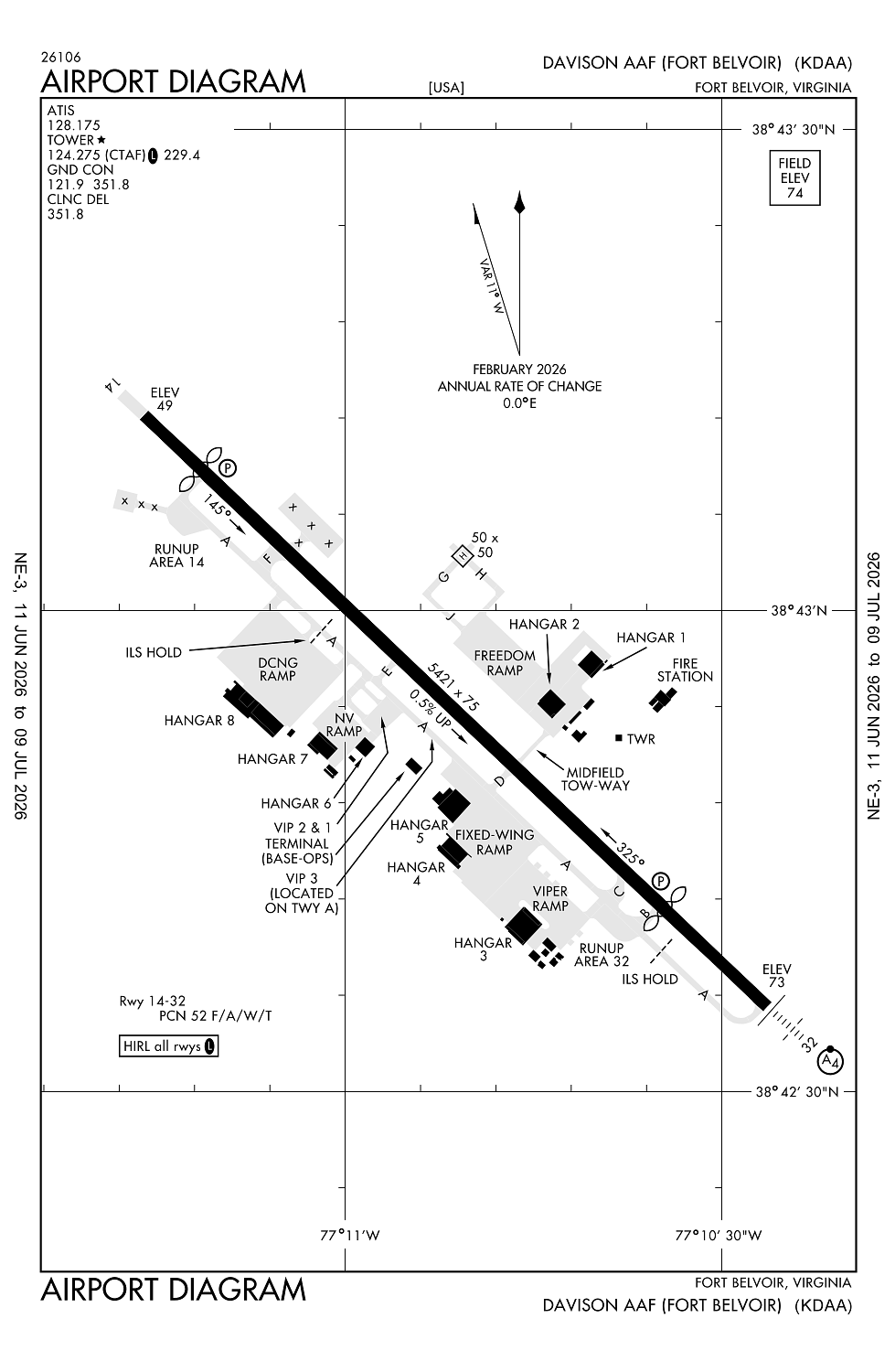
Location:
Fort Belvoir, VA
Elevation:
73ft
Sectional:
Washington
Fuel:
None
Runway 14/32:
5,421ft
Runway H1:
50ft
Access: Private to everyone
This is a military facility.
Current Weather — VFR
-
Weather data is strictly informational and not for flight planning purposes.
-
METAR2026-07-16 11:55:00 EDT
Ceiling: Sky clear Wind: 260° @ 4kt Temperature: 91°F Dewpoint: 73°F Weather: N/A Visbility: 10SM Raw:METAR KDAA 161555Z AUTO 26004KT 10SM CLR 33/23 A2993 RMK AO2 SLP137 T03330230 $ -
TAF2026-07-15 08:00:00 EDT – 2026-07-16 14:00:00 EDT
Ceiling: Sky clear Wind: Variable Weather: N/A Visbility: 6SM Clouds: Scattered @ 25,000ft Raw:TAF AMD KDAA 161020Z 1512/1618 VRB06KT 9999 SCT250 QNH2998INS TEMPO 1620/1624 VRB10G20KT 4800 -TSRA BKN030CB TX37/1521Z TN26/1610Z -
TAF2026-07-16 16:00:00 EDT – 2026-07-16 20:00:00 EDT
Ceiling: 3,000ft Wind: Variable, gusts 20kt Weather: Light thunderstorm rain Visbility: 2SM Clouds: Broken @ 3,000ft Raw:TAF AMD KDAA 161020Z 1512/1618 VRB06KT 9999 SCT250 QNH2998INS TEMPO 1620/1624 VRB10G20KT 4800 -TSRA BKN030CB TX37/1521Z TN26/1610Z
Click/tap to add an annotation marker to the map
No webcams added yet.
Remarks
- Fuel: fuel - a++ (mil); avbl 1200-0300z++ mon-fri.
- Oil: 0-123-128-148-156.
- Offl bus only. ppr 24 hr notice for all non daa based acft, ctc base ops 1100-0500z++ mon-fri 1200-2100z++ sat-sun, c571-515-4226/4228/4424.
- Rstd: 24 hr ppr nvesd ramp, dsn 656-7675/7676, c703-806-7675/7676.
- Cauton: exp shear/crosswind shift tdz rwy 32 dur sw-nw wind. bird and deer haz.
Comments