Pirep is a free, collaborative database of all public and private airports. All pilots are welcome to contribute their local knowledge to any airport, no registration required.
Attribution:
Dallas Love Field Airport
Attribution:
Zane Ferguson
Attribution:
Dallas Love Field Airport
Attribution:
Sonia
Attribution:
Bryan Yoz
Attribution:
Alex Kolkena
Attribution:
Bryan Yoz

Attribution:
Sam Wagner

Attribution:
Alex Kolkena

Attribution:
BranDREWbian
Public
Undocumented
METAR / TAF
Edit Tags
No upcoming events. Is anything happening here soon?
Airport Statistics
- Fuel pump location
- Airport photos
- Tags
Location:
Dallas, TX
Elevation:
486ft
Sectional:
Dallas Ft Worth
Activation date:
Oct 1937
Fuel:
100LL, A
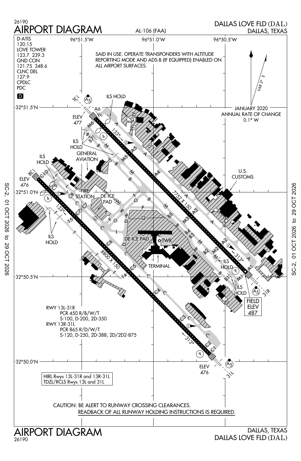
Runway 13R/31L:
8,800ft
Runway 13L/31R:
7,752ft
Access: Open to the public
Current Weather — VFR
-
Weather data is strictly informational and not for flight planning purposes.
-
METAR2026-10-25 10:53:00 CDT
Ceiling: 25,000ft Wind: 170° @ 6kt Temperature: 73°F Dewpoint: 60°F Weather: N/A Visbility: 10SM Clouds: Broken @ 25,000ft Raw:METAR KDAL 251553Z 17006KT 10SM BKN250 23/16 A3033 RMK AO2 SLP266 T02280156 -
TAF2026-10-25 10:00:00 CDT – 2026-10-26 07:00:00 CDT
Ceiling: 25,000ft Wind: 150° @ 8kt Weather: N/A Visbility: 6SM Clouds: Broken @ 25,000ft Raw:TAF KDAL 251454Z 2515/2612 15008KT P6SM BKN250
Click/tap to add an annotation marker to the map
No webcams added yet.
Remarks
- Noise sensitive areas all quadrants; noise abatement procedures in effect jet and aircraft over 12,500 lbs use rwy 13r/31l between 2100-0600 lcl. for information call 214-670-5683.
- Birds on & invof arpt. bird activity trinity river bottom 3 miles sw side
- Pvt pilot cert or btr rqrd to tkof or land.
- No student solo flights permitted.
- Twy k clsd thru traffic.
Comments