Pirep is a free, collaborative database of all public and private airports. All pilots are welcome to contribute their local knowledge to any airport, no registration required.
No upcoming events. Is anything happening here soon?
Last updated: 2024-02-10 22:10:21 MST
Airport Statistics
- Transient parking location
- General description
- WiFi availability
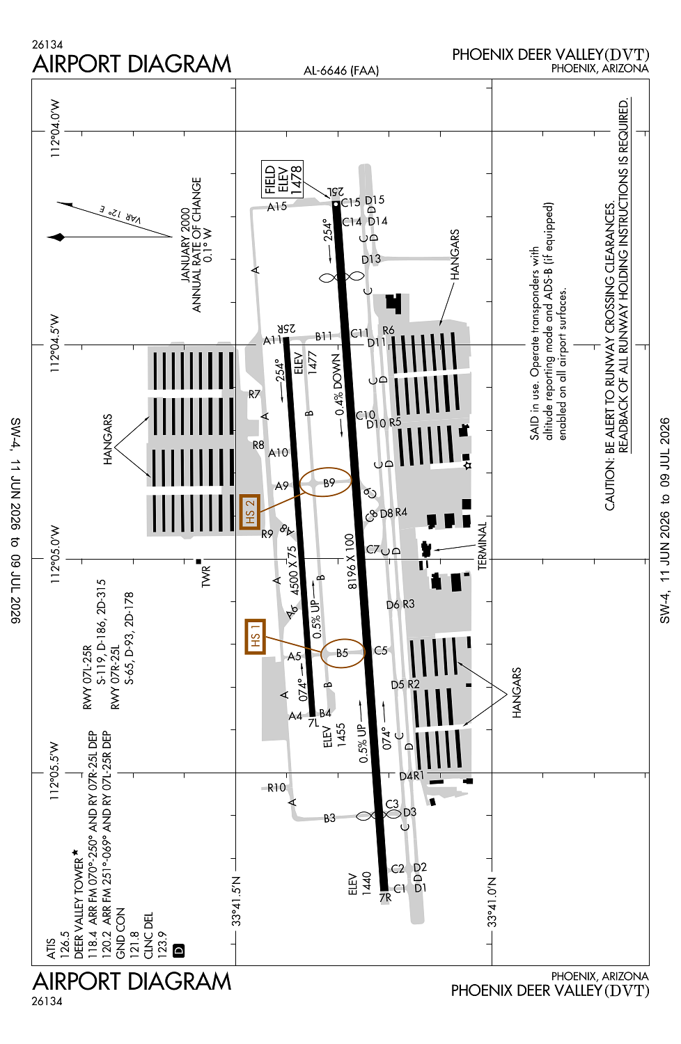
Location:
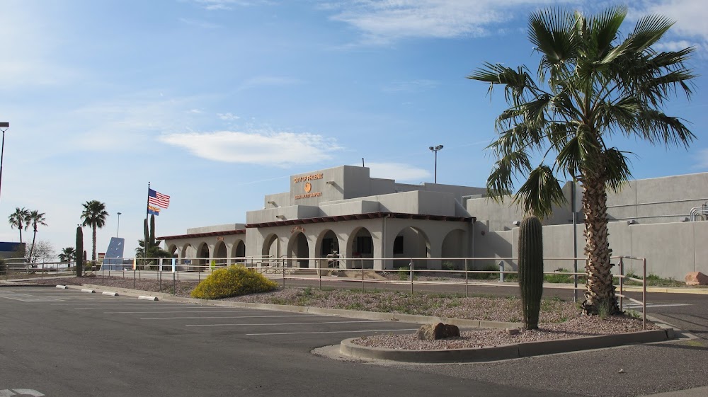
Phoenix, AZ
Elevation:
1,478ft
Sectional:
Phoenix
Activation date:
Sep 1959
Fuel:
100LL, A+ (prices)
Runway 07R/25L:
8,196ft
Runway 07L/25R:
4,500ft
Access: Open to the public
Similar Airports

Current Weather — VFR
-
Weather data is strictly informational and not for flight planning purposes.
-
METAR2026-07-20 06:53:00 MST
Ceiling: Sky clear Wind: 150° @ 5kt Temperature: 89°F Dewpoint: 62°F Weather: N/A Visbility: 10SM Raw:METAR KDVT 201353Z AUTO 15005KT 10SM CLR 32/17 A2991 RMK AO2 SLP100 T03170167 -
TAF2026-07-20 05:00:00 MST – 2026-07-20 10:00:00 MST
Ceiling: 15,000ft Wind: 050° @ 6kt Weather: N/A Visbility: 6SM Clouds: Few @ 9,000ft, Broken @ 15,000ft, Broken @ 25,000ft Raw:TAF KDVT 201120Z 2012/2112 05006KT P6SM FEW090 BKN150 BKN250 FM201700 23008KT P6SM FEW090 SCT150 SCT250 FM210300 04011KT P6SM VCSH FEW080 SCT120 BKN200 TEMPO 2103/2106 04017G25KT FM210700 05007KT P6SM SCT080 BKN120 -
TAF2026-07-20 10:00:00 MST – 2026-07-20 20:00:00 MST
Ceiling: Sky clear Wind: 230° @ 8kt Weather: N/A Visbility: 6SM Clouds: Few @ 9,000ft, Scattered @ 15,000ft, Scattered @ 25,000ft Raw:TAF KDVT 201120Z 2012/2112 05006KT P6SM FEW090 BKN150 BKN250 FM201700 23008KT P6SM FEW090 SCT150 SCT250 FM210300 04011KT P6SM VCSH FEW080 SCT120 BKN200 TEMPO 2103/2106 04017G25KT FM210700 05007KT P6SM SCT080 BKN120 -
TAF2026-07-20 20:00:00 MST – 2026-07-21 00:00:00 MST
Ceiling: 20,000ft Wind: 040° @ 11kt Weather: Showers in vicinity Visbility: 6SM Clouds: Few @ 8,000ft, Scattered @ 12,000ft, Broken @ 20,000ft Raw:TAF KDVT 201120Z 2012/2112 05006KT P6SM FEW090 BKN150 BKN250 FM201700 23008KT P6SM FEW090 SCT150 SCT250 FM210300 04011KT P6SM VCSH FEW080 SCT120 BKN200 TEMPO 2103/2106 04017G25KT FM210700 05007KT P6SM SCT080 BKN120 -
TAF2026-07-20 20:00:00 MST – 2026-07-20 23:00:00 MST
Ceiling: Sky clear Wind: 040° @ 17kt, gusts 25kt Weather: N/A Visbility: SM Raw:TAF KDVT 201120Z 2012/2112 05006KT P6SM FEW090 BKN150 BKN250 FM201700 23008KT P6SM FEW090 SCT150 SCT250 FM210300 04011KT P6SM VCSH FEW080 SCT120 BKN200 TEMPO 2103/2106 04017G25KT FM210700 05007KT P6SM SCT080 BKN120 -
TAF2026-07-21 00:00:00 MST – 2026-07-21 05:00:00 MST
Ceiling: 12,000ft Wind: 050° @ 7kt Weather: N/A Visbility: 6SM Clouds: Scattered @ 8,000ft, Broken @ 12,000ft Raw:TAF KDVT 201120Z 2012/2112 05006KT P6SM FEW090 BKN150 BKN250 FM201700 23008KT P6SM FEW090 SCT150 SCT250 FM210300 04011KT P6SM VCSH FEW080 SCT120 BKN200 TEMPO 2103/2106 04017G25KT FM210700 05007KT P6SM SCT080 BKN120
Click/tap to add an annotation marker to the map
No webcams added yet.
Remarks
- Ctn: lgtd hills ne, e, se & w; hot air bln ops n, ne & nw; pilot trng wi 20 nm; aerobatic practice area 8.5 mi nw; sfc-6000 msl.
- Charter, travel club & revenue acft fee.
- Birds & wildlife on & invof arpt.
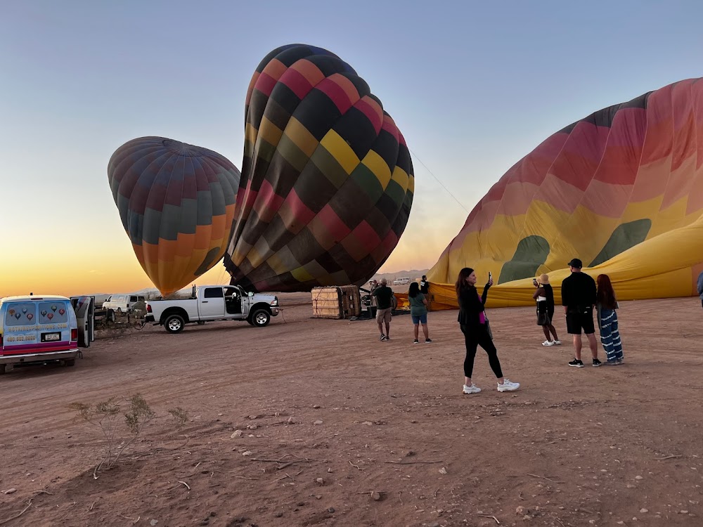
- Hot air balloon opns n, ne & nw of arpt.
- Intensive pilot training area, exercise extreme vigilance within 20 nm.
Comments