Pirep is a free, collaborative database of all public and private airports. All pilots are welcome to contribute their local knowledge to any airport, no registration required.
Public
Undocumented
METAR / TAF
Webcam
Edit Tags
No upcoming events. Is anything happening here soon?
Airport Statistics
- Airport map annotations
- Fuel pump location
- Local flying clubs
Location:
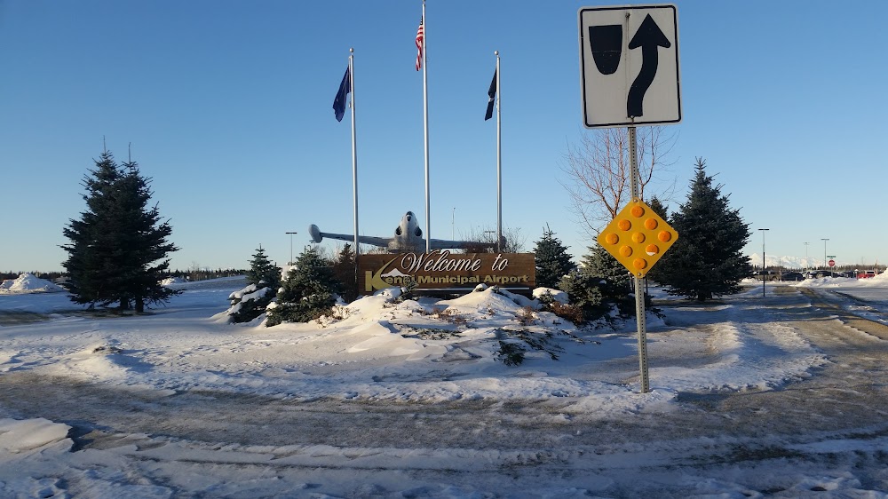
Kenai, AK
Elevation:
99ft
Sectional:
Anchorage
Activation date:
May 1947
Fuel:
100LL, A (prices)
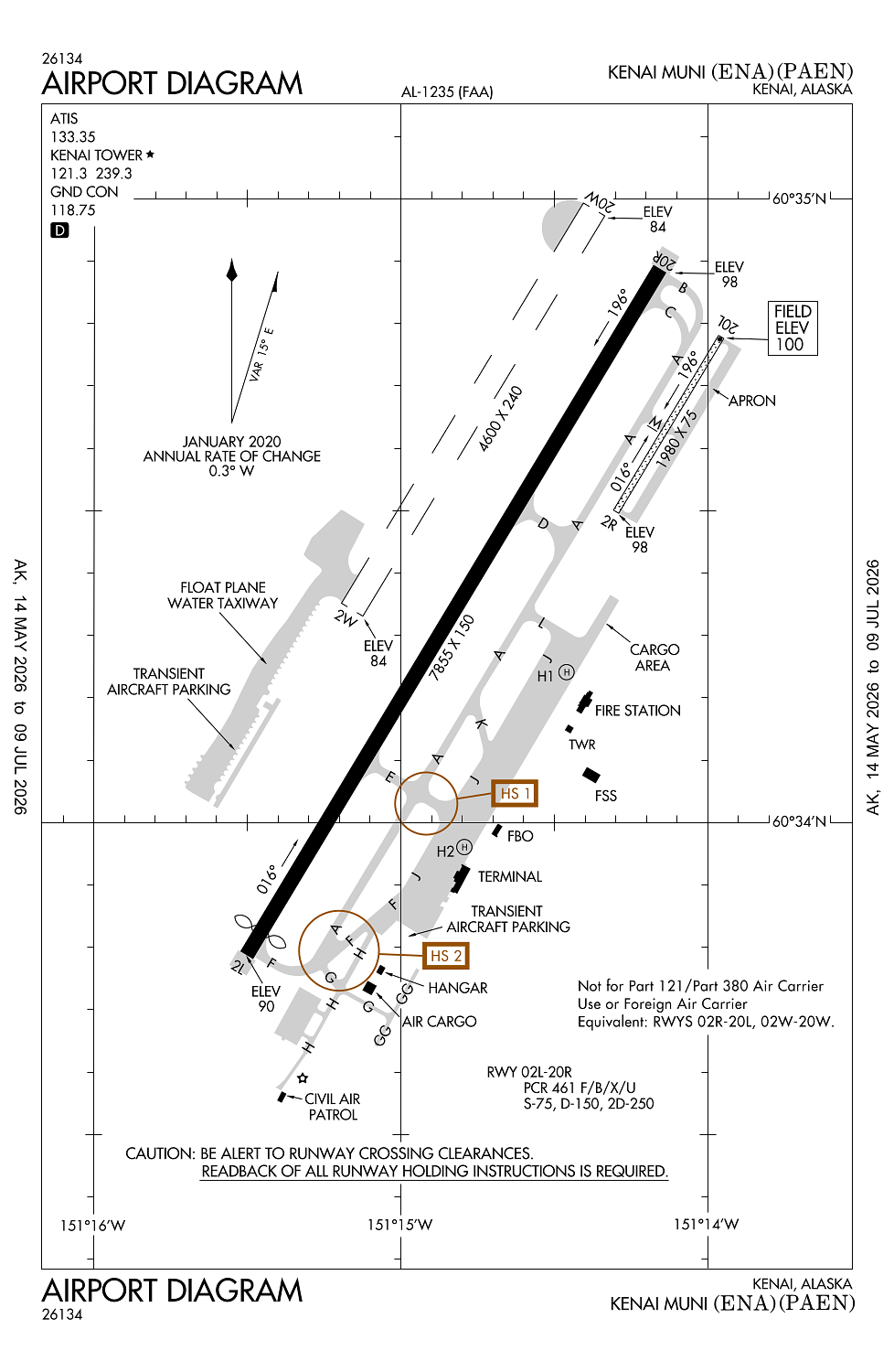
Runway 02L/20R:
7,855ft
Runway 02W/20W:
4,600ft
Runway 02R/20L:
1,980ft
Runway H1:
55ft
Runway H2:
55ft
Access: Open to the public
Current Weather — MVFR
-
Weather data is strictly informational and not for flight planning purposes.
-
METAR2026-07-20 16:53:00 AKDT
Ceiling: 2,800ft Wind: 230° @ 9kt Temperature: 55°F Dewpoint: 46°F Weather: N/A Visbility: 10SM Clouds: Scattered @ 2,200ft, Broken @ 2,800ft, Overcast @ 4,900ft Raw:METAR PAEN 210053Z 23009KT 10SM SCT022 BKN028 OVC049 13/08 A3008 RMK AO2 SLP187 T01280078 -
TAF2026-07-20 16:00:00 AKDT – 2026-07-20 22:00:00 AKDT
Ceiling: 1,800ft Wind: 240° @ 11kt Weather: Showers in vicinity Visbility: 6SM Clouds: Overcast @ 1,800ft Raw:TAF PAEN 202325Z 2100/2124 24011KT P6SM VCSH OVC018 FM210600 19005KT P6SM SCT030 BKN035 FM211200 16002KT 3SM BR VCFG SCT003 BKN060 FM212000 18007KT 6SM -RA BR OVC025 -
TAF2026-07-20 22:00:00 AKDT – 2026-07-21 04:00:00 AKDT
Ceiling: 3,500ft Wind: 190° @ 5kt Weather: N/A Visbility: 6SM Clouds: Scattered @ 3,000ft, Broken @ 3,500ft Raw:TAF PAEN 202325Z 2100/2124 24011KT P6SM VCSH OVC018 FM210600 19005KT P6SM SCT030 BKN035 FM211200 16002KT 3SM BR VCFG SCT003 BKN060 FM212000 18007KT 6SM -RA BR OVC025 -
TAF2026-07-21 04:00:00 AKDT – 2026-07-21 12:00:00 AKDT
Ceiling: 6,000ft Wind: 160° @ 2kt Weather: Mist, fog in vicinity Visbility: 3SM Clouds: Scattered @ 300ft, Broken @ 6,000ft Raw:TAF PAEN 202325Z 2100/2124 24011KT P6SM VCSH OVC018 FM210600 19005KT P6SM SCT030 BKN035 FM211200 16002KT 3SM BR VCFG SCT003 BKN060 FM212000 18007KT 6SM -RA BR OVC025 -
TAF2026-07-21 12:00:00 AKDT – 2026-07-21 16:00:00 AKDT
Ceiling: 2,500ft Wind: 180° @ 7kt Weather: Light rain, mist Visbility: 6SM Clouds: Overcast @ 2,500ft Raw:TAF PAEN 202325Z 2100/2124 24011KT P6SM VCSH OVC018 FM210600 19005KT P6SM SCT030 BKN035 FM211200 16002KT 3SM BR VCFG SCT003 BKN060 FM212000 18007KT 6SM -RA BR OVC025
Click/tap to add an annotation marker to the map
Remarks
- Tsnt & coml tie down slips avbl end of water canal.
- Tsnt prkg s trml ramp; hel prkg n trml ramp. lndg fee ovr 4000 lb.
- Birds 10 nm radius spring-fall.
- Ptns of trml ramp, twy g & h not vsb fm atct.
- Spb ctld by kenai atct durg ops hrs. when kenai atct clsd wx avbl fm kenai atis or kenai fss. noise abatement proc in efct - amgr.
Comments