Pirep is a free, collaborative database of all public and private airports. All pilots are welcome to contribute their local knowledge to any airport, no registration required.


Undocumented
METAR / TAF
Edit Tags
No upcoming events. Is anything happening here soon?
Airport Statistics
- Crew car availability
- Local flying clubs
- General description
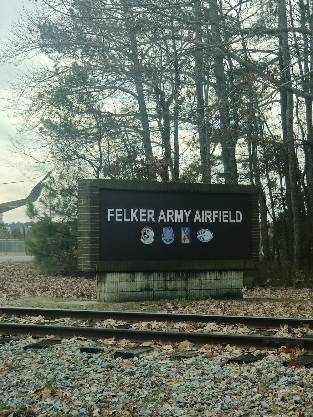
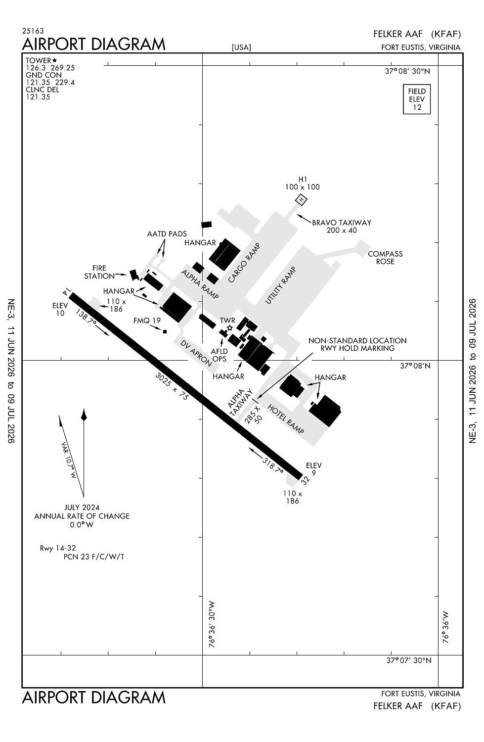
Location:
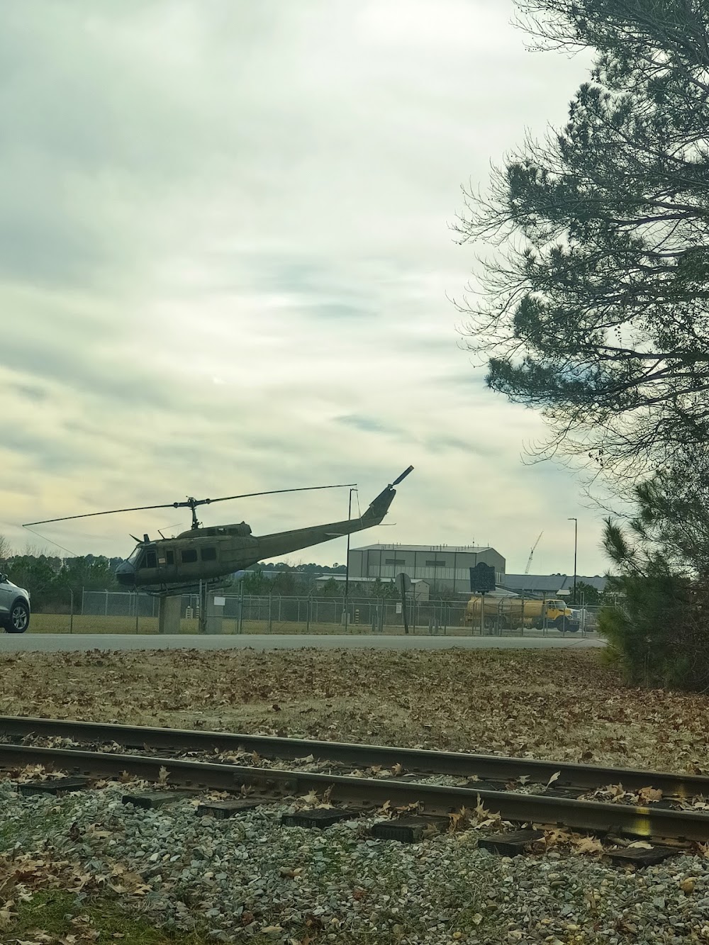
Fort Eustis, VA
Elevation:
11ft
Sectional:
Washington
Fuel:
None
Runway 14/32:
3,025ft
Runway H1:
100ft
Access: Private to everyone
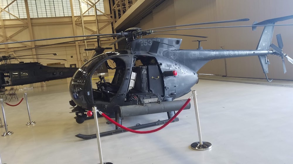
This is a military facility.
Current Weather — VFR
-
Weather data is strictly informational and not for flight planning purposes.
-
METAR2026-07-20 14:55:00 EDT
Ceiling: 16,000ft Wind: 110° @ 9kt Temperature: 83°F Dewpoint: 70°F Weather: N/A Visbility: 10SM Clouds: Scattered @ 4,900ft, Broken @ 16,000ft, Broken @ 18,000ft Raw:METAR KFAF 201855Z 11009KT 10SM SCT049 BKN160 BKN180 29/21 A2996 RMK AO2A LTG DSNT S-SW SLP149 T02880213 $ -
TAF2026-07-20 14:00:00 EDT – 2026-07-20 17:00:00 EDT
Ceiling: 6,000ft Wind: 120° @ 9kt Weather: N/A Visbility: 6SM Clouds: Scattered @ 3,500ft, Broken @ 6,000ft Raw:TAF AMD KFAF 201847Z 2018/2124 12009KT 9999 SCT035 BKN060 QNH2992INS BECMG 2021/2022 13009KT 8000 -SHRA BKN035 OVC050 QNH2990INS BECMG 2123/2024 VRB06KT 9999 NSW BKN030 QNH2989INS BECMG 2104/2105 VRB06KT 9999 BKN015 QNH2987INS TEMPO 2106/2108 6000 -SHRA BECMG 2109/2110 20009KT 9999 BKN025 QNH2982INS BECMG 2117/2118 22009KT 6000 -SHRA BKN030 QNH2978INS TEMPO 2119/2123 VRB10G15KT 6000 -TSRA BKN025CB TX31/2118Z TN25/2110Z -
TAF2026-07-20 17:00:00 EDT – 2026-07-21 19:00:00 EDT
Ceiling: 3,500ft Wind: 130° @ 9kt Weather: Light rain showers Visbility: 4SM Clouds: Broken @ 3,500ft, Overcast @ 5,000ft Raw:TAF AMD KFAF 201847Z 2018/2124 12009KT 9999 SCT035 BKN060 QNH2992INS BECMG 2021/2022 13009KT 8000 -SHRA BKN035 OVC050 QNH2990INS BECMG 2123/2024 VRB06KT 9999 NSW BKN030 QNH2989INS BECMG 2104/2105 VRB06KT 9999 BKN015 QNH2987INS TEMPO 2106/2108 6000 -SHRA BECMG 2109/2110 20009KT 9999 BKN025 QNH2982INS BECMG 2117/2118 22009KT 6000 -SHRA BKN030 QNH2978INS TEMPO 2119/2123 VRB10G15KT 6000 -TSRA BKN025CB TX31/2118Z TN25/2110Z -
TAF2026-07-21 00:00:00 EDT – 2026-07-21 05:00:00 EDT
Ceiling: 1,500ft Wind: Variable Weather: N/A Visbility: 6SM Clouds: Broken @ 1,500ft Raw:TAF AMD KFAF 201847Z 2018/2124 12009KT 9999 SCT035 BKN060 QNH2992INS BECMG 2021/2022 13009KT 8000 -SHRA BKN035 OVC050 QNH2990INS BECMG 2123/2024 VRB06KT 9999 NSW BKN030 QNH2989INS BECMG 2104/2105 VRB06KT 9999 BKN015 QNH2987INS TEMPO 2106/2108 6000 -SHRA BECMG 2109/2110 20009KT 9999 BKN025 QNH2982INS BECMG 2117/2118 22009KT 6000 -SHRA BKN030 QNH2978INS TEMPO 2119/2123 VRB10G15KT 6000 -TSRA BKN025CB TX31/2118Z TN25/2110Z -
TAF2026-07-21 02:00:00 EDT – 2026-07-21 04:00:00 EDT
Ceiling: Sky clear Wind: 000° @ kt Weather: Light rain showers Visbility: 3SM Raw:TAF AMD KFAF 201847Z 2018/2124 12009KT 9999 SCT035 BKN060 QNH2992INS BECMG 2021/2022 13009KT 8000 -SHRA BKN035 OVC050 QNH2990INS BECMG 2123/2024 VRB06KT 9999 NSW BKN030 QNH2989INS BECMG 2104/2105 VRB06KT 9999 BKN015 QNH2987INS TEMPO 2106/2108 6000 -SHRA BECMG 2109/2110 20009KT 9999 BKN025 QNH2982INS BECMG 2117/2118 22009KT 6000 -SHRA BKN030 QNH2978INS TEMPO 2119/2123 VRB10G15KT 6000 -TSRA BKN025CB TX31/2118Z TN25/2110Z -
TAF2026-07-21 05:00:00 EDT – 2026-07-21 13:00:00 EDT
Ceiling: 2,500ft Wind: 200° @ 9kt Weather: N/A Visbility: 6SM Clouds: Broken @ 2,500ft Raw:TAF AMD KFAF 201847Z 2018/2124 12009KT 9999 SCT035 BKN060 QNH2992INS BECMG 2021/2022 13009KT 8000 -SHRA BKN035 OVC050 QNH2990INS BECMG 2123/2024 VRB06KT 9999 NSW BKN030 QNH2989INS BECMG 2104/2105 VRB06KT 9999 BKN015 QNH2987INS TEMPO 2106/2108 6000 -SHRA BECMG 2109/2110 20009KT 9999 BKN025 QNH2982INS BECMG 2117/2118 22009KT 6000 -SHRA BKN030 QNH2978INS TEMPO 2119/2123 VRB10G15KT 6000 -TSRA BKN025CB TX31/2118Z TN25/2110Z -
TAF2026-07-21 13:00:00 EDT – 2026-07-21 20:00:00 EDT
Ceiling: 3,000ft Wind: 220° @ 9kt Weather: Light rain showers Visbility: 3SM Clouds: Broken @ 3,000ft Raw:TAF AMD KFAF 201847Z 2018/2124 12009KT 9999 SCT035 BKN060 QNH2992INS BECMG 2021/2022 13009KT 8000 -SHRA BKN035 OVC050 QNH2990INS BECMG 2123/2024 VRB06KT 9999 NSW BKN030 QNH2989INS BECMG 2104/2105 VRB06KT 9999 BKN015 QNH2987INS TEMPO 2106/2108 6000 -SHRA BECMG 2109/2110 20009KT 9999 BKN025 QNH2982INS BECMG 2117/2118 22009KT 6000 -SHRA BKN030 QNH2978INS TEMPO 2119/2123 VRB10G15KT 6000 -TSRA BKN025CB TX31/2118Z TN25/2110Z -
TAF2026-07-21 15:00:00 EDT – 2026-07-21 19:00:00 EDT
Ceiling: 2,500ft Wind: Variable, gusts 15kt Weather: Light thunderstorm rain Visbility: 3SM Clouds: Broken @ 2,500ft Raw:TAF AMD KFAF 201847Z 2018/2124 12009KT 9999 SCT035 BKN060 QNH2992INS BECMG 2021/2022 13009KT 8000 -SHRA BKN035 OVC050 QNH2990INS BECMG 2123/2024 VRB06KT 9999 NSW BKN030 QNH2989INS BECMG 2104/2105 VRB06KT 9999 BKN015 QNH2987INS TEMPO 2106/2108 6000 -SHRA BECMG 2109/2110 20009KT 9999 BKN025 QNH2982INS BECMG 2117/2118 22009KT 6000 -SHRA BKN030 QNH2978INS TEMPO 2119/2123 VRB10G15KT 6000 -TSRA BKN025CB TX31/2118Z TN25/2110Z -
TAF2026-07-21 19:00:00 EDT – 2026-07-21 20:00:00 EDT
Ceiling: 3,000ft Wind: Variable Weather: N/A Visbility: 6SM Clouds: Broken @ 3,000ft Raw:TAF AMD KFAF 201847Z 2018/2124 12009KT 9999 SCT035 BKN060 QNH2992INS BECMG 2021/2022 13009KT 8000 -SHRA BKN035 OVC050 QNH2990INS BECMG 2123/2024 VRB06KT 9999 NSW BKN030 QNH2989INS BECMG 2104/2105 VRB06KT 9999 BKN015 QNH2987INS TEMPO 2106/2108 6000 -SHRA BECMG 2109/2110 20009KT 9999 BKN025 QNH2982INS BECMG 2117/2118 22009KT 6000 -SHRA BKN030 QNH2978INS TEMPO 2119/2123 VRB10G15KT 6000 -TSRA BKN025CB TX31/2118Z TN25/2110Z
Click/tap to add an annotation marker to the map
No webcams added yet.
Remarks
- Jasu: 2(agpu).
- Fuel: a svc avbl 1200-2130z++ mon - fri exc hol.
- Remarks: base ops 1145-0400z++ mon-fri exc hol, dsn 826-5828/2584, c757-878-5828/2584.
- Rstd: ppr 24 hr notice all non kfaf based acft, ctc base ops. acft entering fr sse max alt 500 ft due to inst apch into newport news/wsmbg arpt. no hazard cargo area avbl.
- Caution: ctc basops for current bash cond. incrd bird actvty 1 oct to 30 nov and 1 feb to 31 mar. sgfnt eagle actvty in vcnty of 1 nm s apch end rwy 32, 1 nm e of arpt on warwick river.no acft otfc of main post. perm movbl crane on watercraft base 3100 ft wnw of rwy 14 apch end. no fly area 1.6 nm se rwy 32 to incl entr pen.
Comments