Pirep is a free, collaborative database of all public and private airports. All pilots are welcome to contribute their local knowledge to any airport, no registration required.
Public
Undocumented
METAR / TAF
Edit Tags
No upcoming events. Is anything happening here soon?
Airport Statistics
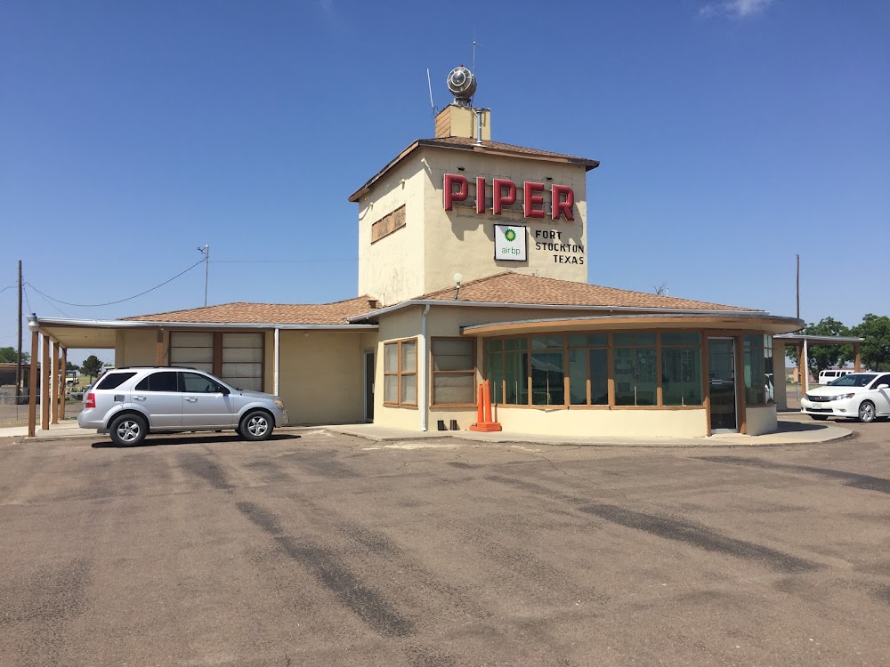
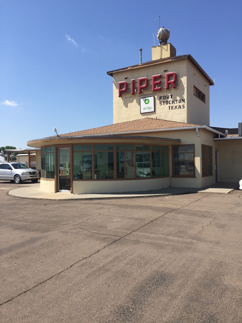
- Transient parking location
- WiFi availability
- Fuel pump location
Location:
Fort Stockton, TX
Elevation:
3,011ft
Sectional:
San Antonio
Activation date:
Jan 1947
Fuel:
100LL, A+ (prices)
Runway 12/30:
7,508ft
Runway 07/25:
4,961ft
Runway 03/21:
4,400ft
Runway 16/34:
3,981ft
Runway 11/29:
3,348ft
Access: Open to the public
Current Weather — VFR
-
Weather data is strictly informational and not for flight planning purposes.
-
METAR2026-07-19 21:53:00 CDT
Ceiling: Sky clear Wind: 190° @ 9kt Temperature: 78°F Dewpoint: 64°F Weather: Light rain Visbility: 10SM Clouds: Few @ 8,000ft, Scattered @ 11,000ft Raw:METAR KFST 200253Z AUTO 19009KT 10SM -RA FEW080 SCT110 26/18 A3000 RMK AO2 RAB36 SLP110 P0000 60000 T02560183 51017 -
TAF2026-07-19 19:00:00 CDT – 2026-07-20 19:00:00 CDT
Ceiling: 20,000ft Wind: 180° @ 11kt Weather: N/A Visbility: 6SM Clouds: Few @ 7,000ft, Broken @ 20,000ft Raw:TAF KFST 192330Z 2000/2024 18011KT P6SM FEW070 BKN200 PROB30 2000/2005 VRB15G30KT -TSRA BKN050CB -
TAF2026-07-19 19:00:00 CDT – 2026-07-20 00:00:00 CDT
Ceiling: 5,000ft Wind: Variable, gusts 30kt Weather: Light thunderstorm rain Visbility: SM Clouds: Broken @ 5,000ft Raw:TAF KFST 192330Z 2000/2024 18011KT P6SM FEW070 BKN200 PROB30 2000/2005 VRB15G30KT -TSRA BKN050CB
Click/tap to add an annotation marker to the map
No webcams added yet.
Remarks
- 3210 ft twr 2 mi ne.
- For cd if una to ctc on fss freq, ctc albuquerque artcc at 505-856-4561.
- Turf rwy 7/25, 11/29,16/34 rough. rwy ends 16 & 25 not inspd due to fld conds.
- Mirl rwys 03/21 & 12/30 preset low intst; to incr intst - ctaf. papi rwys 12 & 30 opr consly.
- County commissioner.
- For fuel & svcs aft hrs call 432-336-9900 or unicom. 24 hr self serve avbl.
- Unusbl byd 8 deg right of rcl.
- Unusbl byd 8 deg right of rcl.
Comments