Pirep is a free, collaborative database of all public and private airports. All pilots are welcome to contribute their local knowledge to any airport, no registration required.

Public
Undocumented
METAR / TAF
Edit Tags
No upcoming events. Is anything happening here soon?
Airport Statistics
- Webcam links
- Transient parking location
- Local flying clubs
Location:
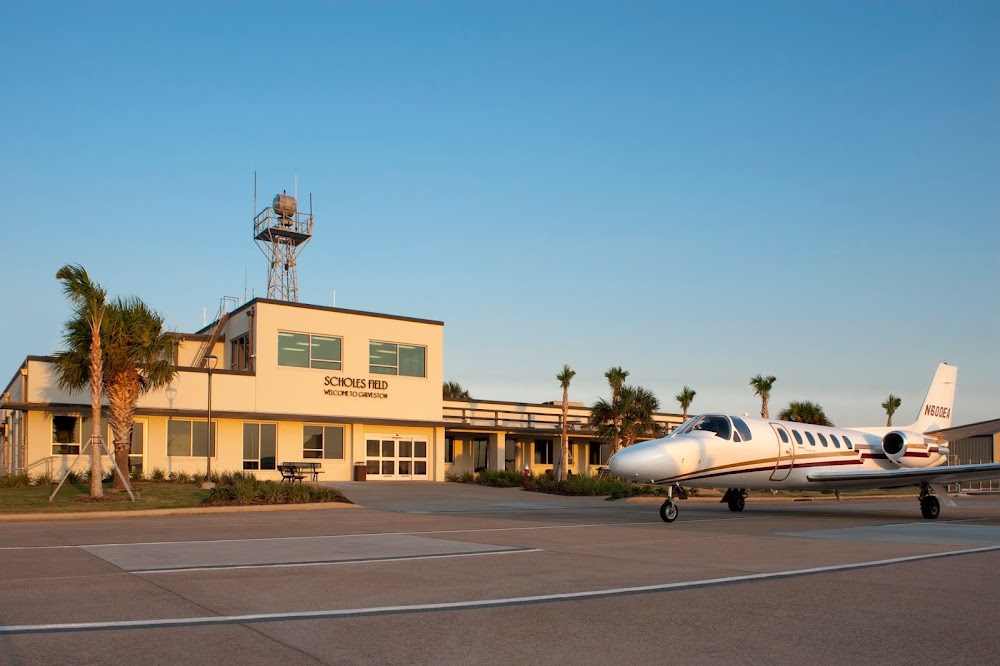
Galveston, TX
Elevation:
5ft
Sectional:
Houston
Activation date:
Aug 1938
Fuel:
100LL, A+ (prices)
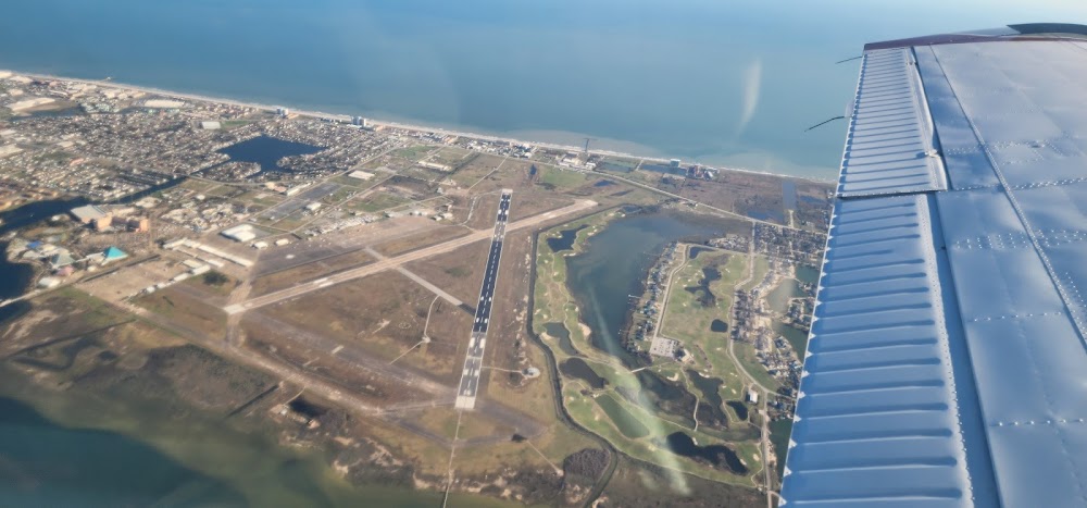
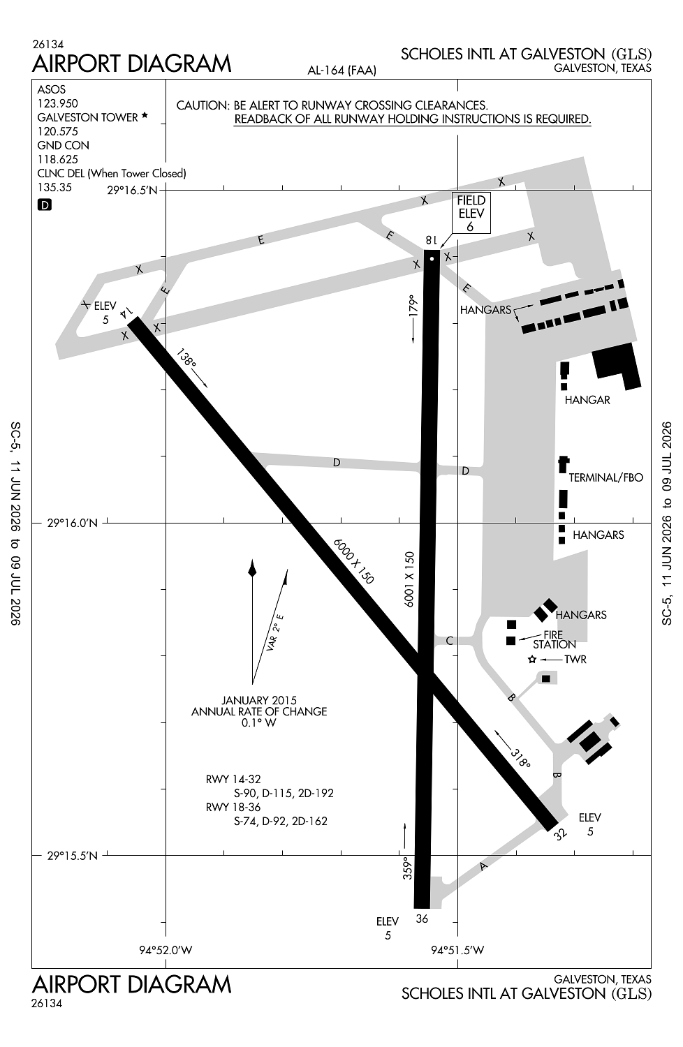
Runway 18/36:
6,001ft
Runway 14/32:
6,000ft
Access: Open to the public
Current Weather — VFR
-
Weather data is strictly informational and not for flight planning purposes.
-
METAR2026-07-20 09:59:00 CDT
Ceiling: Sky clear Wind: 250° @ 5kt Temperature: 84°F Dewpoint: 78°F Weather: N/A Visbility: 10SM Clouds: Scattered @ 1,300ft Raw:SPECI KGLS 201459Z 25005KT 10SM SCT013 29/26 A3000 RMK AO2 T02940256 -
TAF2026-07-20 07:00:00 CDT – 2026-07-20 14:00:00 CDT
Ceiling: Sky clear Wind: 230° @ 9kt Weather: N/A Visbility: 6SM Clouds: Few @ 2,500ft, Few @ 25,000ft Raw:TAF KGLS 201120Z 2012/2112 23009KT P6SM FEW025 FEW250 FM201900 20010KT P6SM SKC -
TAF2026-07-20 14:00:00 CDT – 2026-07-21 07:00:00 CDT
Ceiling: Sky clear Wind: 200° @ 10kt Weather: N/A Visbility: 6SM Clouds: @ ft Raw:TAF KGLS 201120Z 2012/2112 23009KT P6SM FEW025 FEW250 FM201900 20010KT P6SM SKC
Click/tap to add an annotation marker to the map
No webcams added yet.
Remarks
- Flocks of birds invof arpt blw 200 ft agl.
- Hels oprg on & invof arpt.
- 178 ft lgtd bldg 1800 ft ne of rwy 18 thr.
- Paew adj rwys & twys.
- Two 157 ft msl lgtd towers btn rwys 32 & 36.
Comments