Pirep is a free, collaborative database of all public and private airports. All pilots are welcome to contribute their local knowledge to any airport, no registration required.
Public
Undocumented
METAR / TAF
Webcam
Edit Tags
No upcoming events. Is anything happening here soon?
Airport Statistics
- Airport map annotations
- WiFi availability
- Transient parking location
Location:
Granby, CO
Elevation:
8,207ft
Sectional:
Cheyenne
Activation date:
Dec 1945
Fuel:
100LL, A (prices)
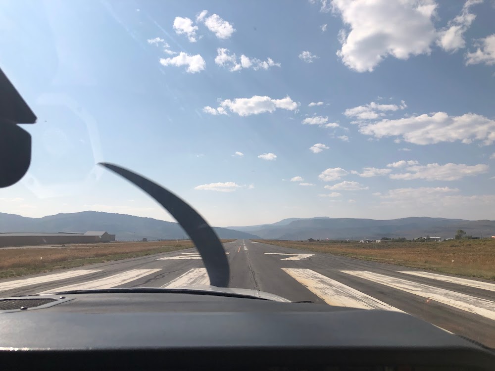
Runway 09/27:
5,001ft
Access: Open to the public
Current Weather — VFR
-
Weather data is strictly informational and not for flight planning purposes.
-
METAR2026-07-20 04:15:00 MDT
Ceiling: Sky clear Wind: 130° @ 4kt Temperature: 53°F Dewpoint: 47°F Weather: N/A Visbility: 10SM Raw:METAR KGNB 201015Z AUTO 13004KT 10SM CLR 12/09 A3042 RMK AO2 T01200085
Click/tap to add an annotation marker to the map
Remarks
- Established prior to 1959.
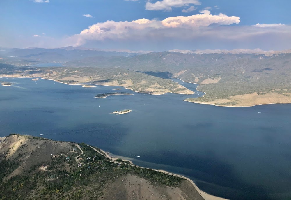
- Rcmd tkof to east only by experienced pilots; high ground rises quickly to the east.
- Rwy 27 has +525 ft terrain 6000 ft fm thld 1400 left of cntrln, +52 ft terrain 1200 ft fm thld on extndd cntrln, +40 ft powerline 965 ft fm thld 260 left of cntrln.
- For cd ctc denver artcc at 303-651-4257.
- Rwy 09 has +563 ft terrain 21277 ft fm thld 371 ft left of cntrln.
- Actvt reil rwy 09 & 27; lirl rwy 09/27 - ctaf.
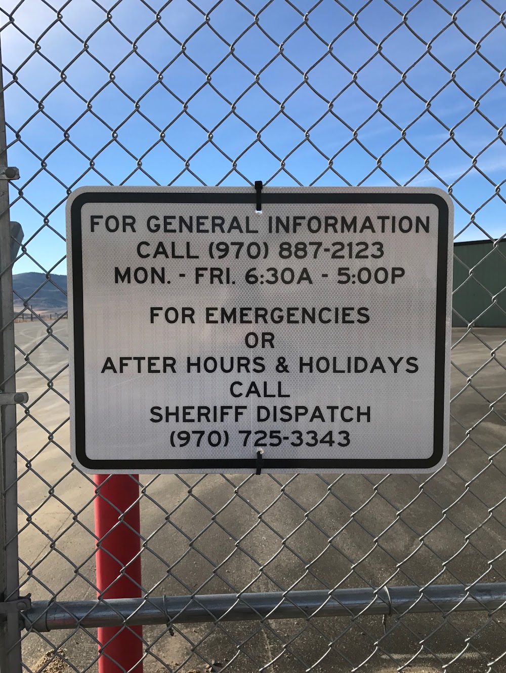
- Arpt contact; joshua schroeder - jschroeder@co.grand.co.us, 970-887-2123.
- Fuel avbl 24 hr self svc.
Comments