Pirep is a free, collaborative database of all public and private airports. All pilots are welcome to contribute their local knowledge to any airport, no registration required.

No upcoming events. Is anything happening here soon?
Last updated: 2023-11-14 23:09:36 EST
Airport Statistics
- Fuel pump location
- WiFi availability
- General description
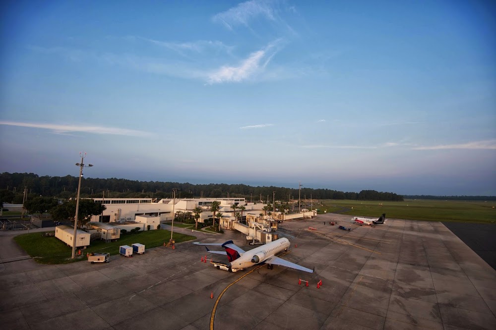
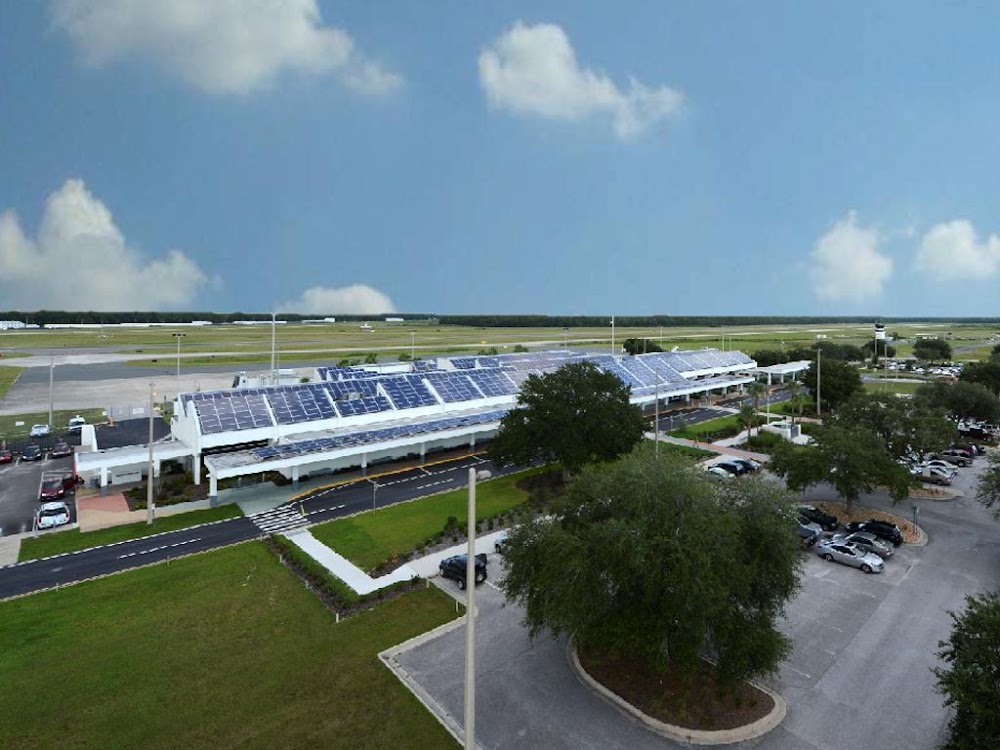
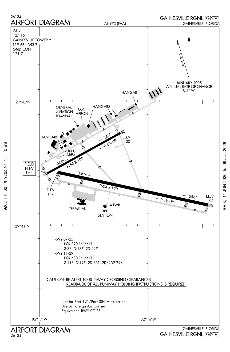
Location:
Gainesville, FL
Elevation:
151ft
Sectional:
Jacksonville
Activation date:
Apr 1940
Fuel:
100, A (prices)
Runway 11/29:
7,504ft
Runway 07/25:
4,158ft
Access: Open to the public
Similar Airports

Current Weather — VFR
-
Weather data is strictly informational and not for flight planning purposes.
-
METAR2026-08-02 11:19:00 EDT
Ceiling: 3,900ft Wind: 200° @ 8kt Temperature: 75°F Dewpoint: 71°F Weather: Light rain, mist Visbility: 6SM Clouds: Broken @ 3,900ft, Broken @ 5,000ft, Overcast @ 6,500ft Raw:SPECI KGNV 021519Z 20008KT 6SM -RA BR BKN039 BKN050 OVC065 24/22 A2994 RMK AO2 LTG DSNT SW TSE1457 P0026 T02390222 -
TAF2026-08-02 11:00:00 EDT – 2026-08-02 15:00:00 EDT
Ceiling: 2,000ft Wind: Variable, gusts 25kt Weather: Thunderstorm rain, mist Visbility: 1SM Clouds: Broken @ 2,000ft, Overcast @ 4,000ft Raw:TAF KGNV 021500Z 0215/0312 21010G15KT 5SM -RA BR VCTS BKN025CB OVC050 TEMPO 0215/0219 VRB15G25KT 1SM TSRA BR BKN020CB OVC040 FM030200 20008KT P6SM VCSH OVC050 -
TAF2026-08-02 11:00:00 EDT – 2026-08-02 22:00:00 EDT
Ceiling: 2,500ft Wind: 210° @ 10kt, gusts 15kt Weather: Light rain, mist, thunderstorm in vicinity Visbility: 5SM Clouds: Broken @ 2,500ft, Overcast @ 5,000ft Raw:TAF KGNV 021500Z 0215/0312 21010G15KT 5SM -RA BR VCTS BKN025CB OVC050 TEMPO 0215/0219 VRB15G25KT 1SM TSRA BR BKN020CB OVC040 FM030200 20008KT P6SM VCSH OVC050 -
TAF2026-08-02 22:00:00 EDT – 2026-08-03 08:00:00 EDT
Ceiling: 5,000ft Wind: 200° @ 8kt Weather: Showers in vicinity Visbility: 6SM Clouds: Overcast @ 5,000ft Raw:TAF KGNV 021500Z 0215/0312 21010G15KT 5SM -RA BR VCTS BKN025CB OVC050 TEMPO 0215/0219 VRB15G25KT 1SM TSRA BR BKN020CB OVC040 FM030200 20008KT P6SM VCSH OVC050
Click/tap to add an annotation marker to the map
No webcams added yet.
Remarks
- This airport has been surveyed by the national geodetic survey.
- Rwy 7/25 not avbl for sked acr ops with more than 9 pax seats or unsked acr at least 31 pax seats.
- When atct clsd acft more than 12500 lbs ctc fbo for prkg instr prior to exiting twy a due to ireg pavement strengths - 352-335-4681.
- Portions of rwy 07/25 & ne 1000 ft of twy a not vsb fm atct; blocked by vortac bldg.
- Wildlife on & invof arpt.
Comments