Pirep is a free, collaborative database of all public and private airports. All pilots are welcome to contribute their local knowledge to any airport, no registration required.

Public
Undocumented
METAR / TAF
Edit Tags
No upcoming events. Is anything happening here soon?
Airport Statistics
- Landing & tie-down fees
- Airport photos
- WiFi availability
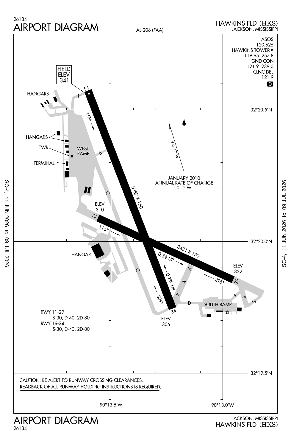
Location:
Jackson, MS
Elevation:
341ft
Sectional:
Memphis
Activation date:
Apr 1940
Fuel:
100LL, A+ (prices)
Runway 16/34:
5,387ft
Runway 11/29:
3,431ft
Access: Open to the public
Current Weather — VFR
-
Weather data is strictly informational and not for flight planning purposes.
-
METAR2026-07-20 14:53:00 CDT
Ceiling: Sky clear Wind: 290° @ 7kt Temperature: 95°F Dewpoint: 71°F Weather: N/A Visbility: 10SM Clouds: Few @ 7,000ft Raw:METAR KHKS 201953Z 29007KT 10SM FEW070 35/22 A2990 RMK AO2 SLP114 T03500217 -
TAF2026-07-20 13:00:00 CDT – 2026-07-21 13:00:00 CDT
Ceiling: Sky clear Wind: Variable Weather: N/A Visbility: 6SM Clouds: Few @ 25,000ft Raw:TAF KHKS 201720Z 2018/2118 VRB03KT P6SM FEW250
Click/tap to add an annotation marker to the map
No webcams added yet.
Remarks
- This airport has been surveyed by the national geodetic survey.
- Arng ops 1300-2230z++.
- Twys f & g clsd indefly.
- S apn not lgtd.
- Paew rwys ngtly by notam.
Comments