Pirep is a free, collaborative database of all public and private airports. All pilots are welcome to contribute their local knowledge to any airport, no registration required.
Undocumented
METAR / TAF
Edit Tags
No upcoming events. Is anything happening here soon?
Airport Statistics
- Local flying clubs
- General description
- Crew car availability
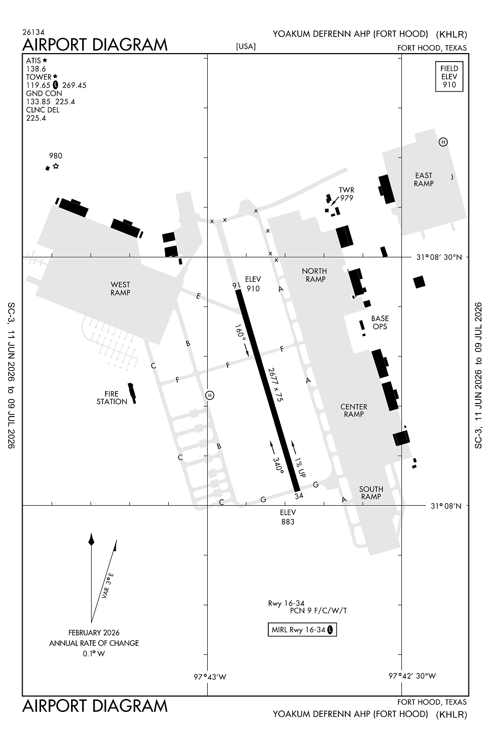
Location:
Fort Hood (Killeen), TX
Elevation:
910ft
Sectional:
San Antonio
Fuel:
None
Runway 16/34:
2,676ft
Access: Private to everyone
This is a military facility.
Current Weather — VFR
-
Weather data is strictly informational and not for flight planning purposes.
-
METAR2026-07-20 21:55:00 CDT
Ceiling: Sky clear Wind: 180° @ 6kt Temperature: 86°F Dewpoint: 65°F Weather: N/A Visbility: 10SM Raw:METAR KHLR 210255Z AUTO 18006KT 10SM CLR 31/19 A2989 RMK AO2 SLP109 T03050185 52004
Click/tap to add an annotation marker to the map
No webcams added yet.
Remarks
- Caution: r6302 lctd 1.1 nm n of afld.
- Caution: some acft opr in area wo conspicuous mrk and blend with terrain.
- Caution: inst final apch crs cross 1 nm sw killeen muni.
- Caution: ints copter opr vcnty ft hood.
- Rstd: no base ops svc avbl at yoakum-defrenn ahp, ctc robert gray base ops c254-288-9200, dsn 738-9200.
Comments