Pirep is a free, collaborative database of all public and private airports. All pilots are welcome to contribute their local knowledge to any airport, no registration required.


Public
Undocumented
METAR / TAF
Edit Tags
No upcoming events. Is anything happening here soon?
Airport Statistics
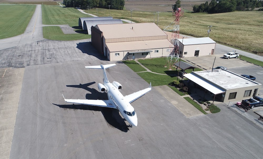
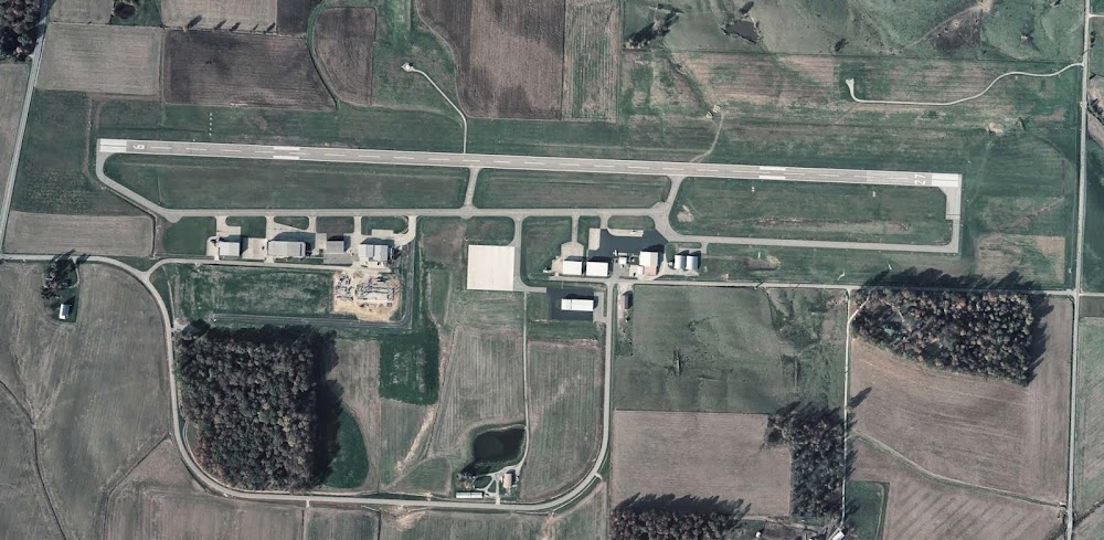
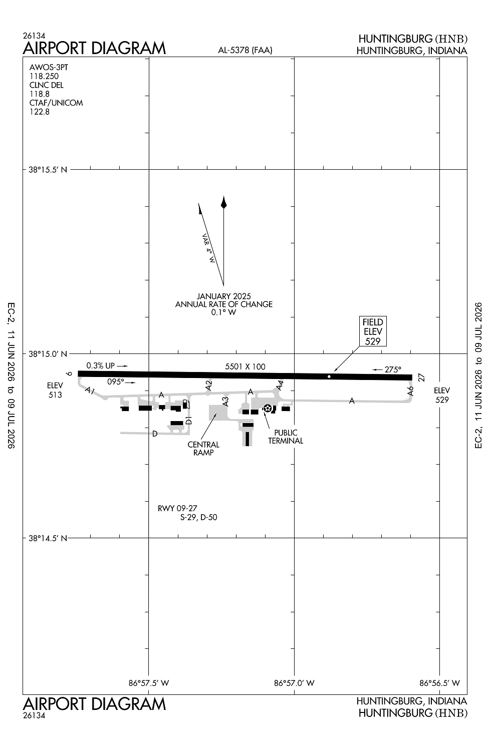
- Airport map annotations
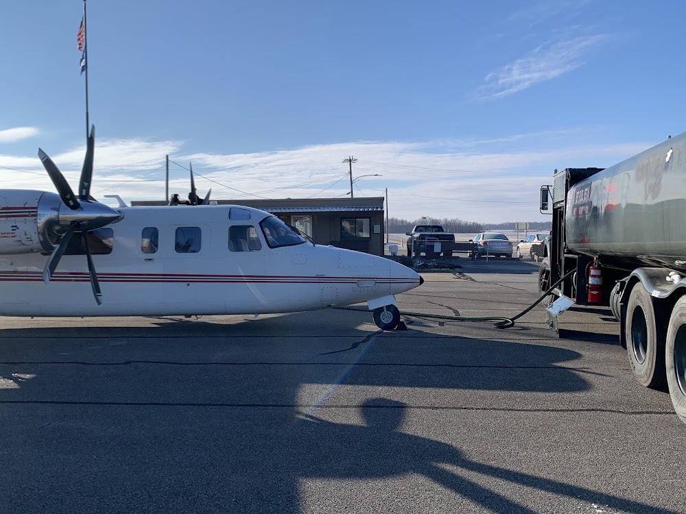
- Fuel pump location
- General description
Location:
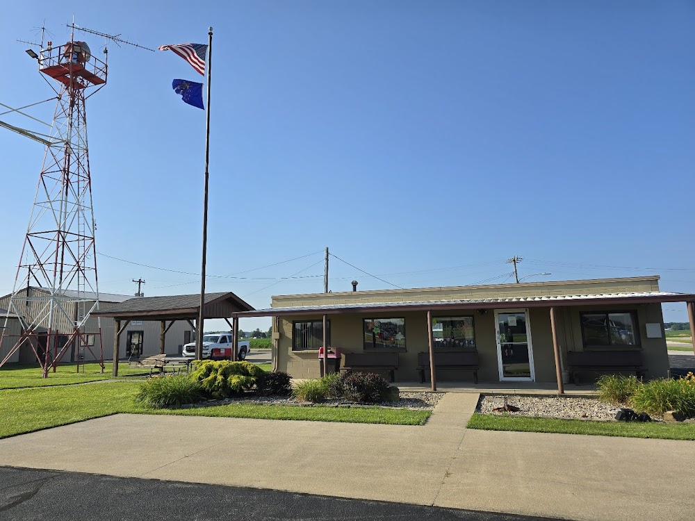
Huntingburg, IN
Elevation:
529ft
Sectional:
St Louis
Activation date:
Mar 1941
Fuel:
100LL, A1+ (prices)
Runway 09/27:
5,501ft
Access: Open to the public
Current Weather — VFR
-
Weather data is strictly informational and not for flight planning purposes.
-
METAR2026-07-20 14:56:00 EDT
Ceiling: Sky clear Wind: 260° @ 8kt Temperature: 87°F Dewpoint: 78°F Weather: N/A Visbility: 9SM Raw:METAR KHNB 201856Z AUTO 26008KT 9SM CLR 31/26 A2992 RMK AO2 RAB1758E08B40E54 SLPNO P0000 T03060256 -
TAF2026-07-20 14:00:00 EDT – 2026-07-20 16:00:00 EDT
Ceiling: Sky clear Wind: 240° @ 7kt Weather: N/A Visbility: 6SM Clouds: Scattered @ 5,000ft Raw:TAF KHNB 201722Z 2018/2118 24007KT P6SM SCT050 FM202000 22004KT P6SM BKN250 FM211600 24010KT P6SM BKN090 -
TAF2026-07-20 16:00:00 EDT – 2026-07-21 12:00:00 EDT
Ceiling: 25,000ft Wind: 220° @ 4kt Weather: N/A Visbility: 6SM Clouds: Broken @ 25,000ft Raw:TAF KHNB 201722Z 2018/2118 24007KT P6SM SCT050 FM202000 22004KT P6SM BKN250 FM211600 24010KT P6SM BKN090 -
TAF2026-07-21 12:00:00 EDT – 2026-07-21 14:00:00 EDT
Ceiling: 9,000ft Wind: 240° @ 10kt Weather: N/A Visbility: 6SM Clouds: Broken @ 9,000ft Raw:TAF KHNB 201722Z 2018/2118 24007KT P6SM SCT050 FM202000 22004KT P6SM BKN250 FM211600 24010KT P6SM BKN090
Click/tap to add an annotation marker to the map
No webcams added yet.
Remarks
- Ss-sr; actvt rotg bcn sr-ss ctaf.
- Twy edge mrkd by blue reflectors.
- For cd when rco 118.8 ots ctc evansville apch at 812-436-4689, when apch clsd ctc indianapolis artcc at 317-247-2411.
- Self svc fuel avbl with credit card.
- Actvt reil rwy 09 & 27; papi rwy 09 & 27; mirl rwy 09/27 - ctaf.
Comments