Pirep is a free, collaborative database of all public and private airports. All pilots are welcome to contribute their local knowledge to any airport, no registration required.


Public
Undocumented
METAR / TAF
Edit Tags
No upcoming events. Is anything happening here soon?
Airport Statistics
- General description
- Transient parking location
- Tags
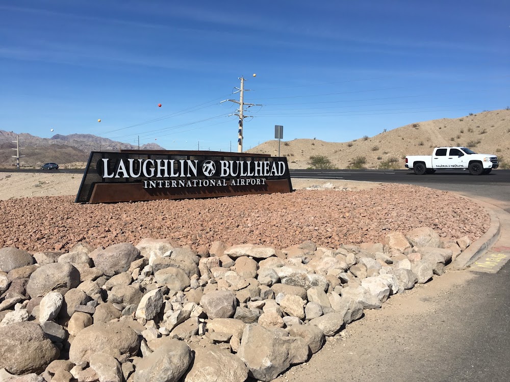
Location:
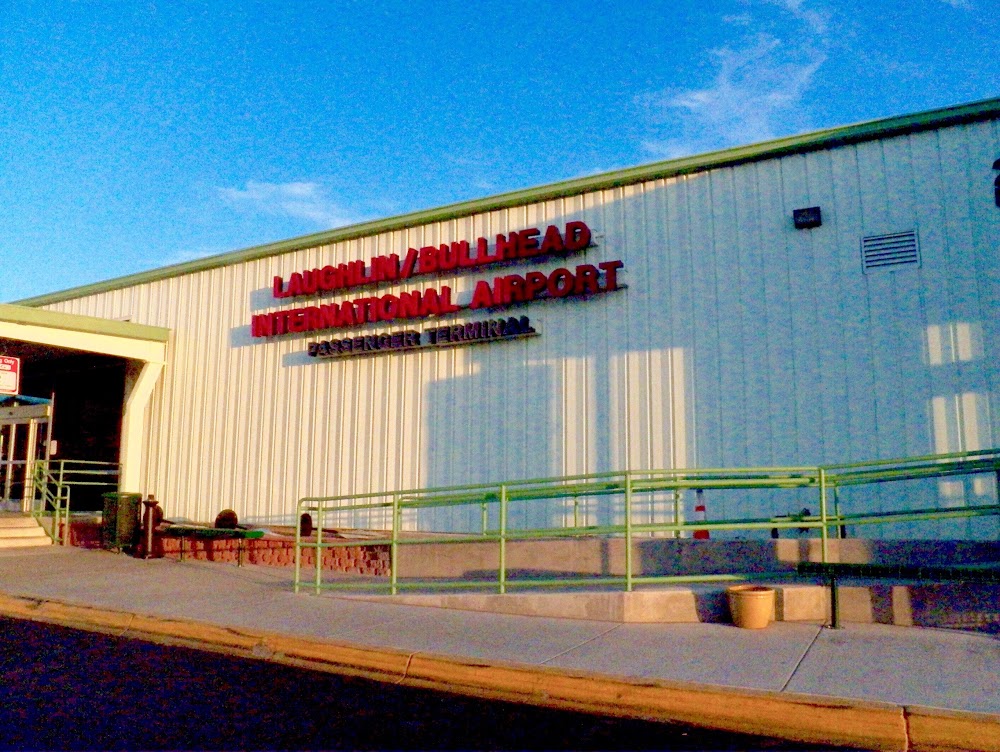
Bullhead City, AZ
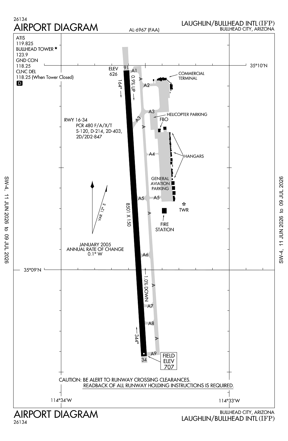
Elevation:
707ft
Sectional:
Phoenix
Fuel:
100LL, A (prices)
Runway 16/34:
8,501ft
Access: Open to the public
Current Weather — VFR
-
Weather data is strictly informational and not for flight planning purposes.
-
METAR2026-07-16 05:15:00 MST
Ceiling: Sky clear Wind: 200° @ 5kt, gusts 11kt Temperature: 96°F Dewpoint: 62°F Weather: N/A Visbility: 10SM Raw:METAR KIFP 161215Z AUTO 20005G11KT 10SM CLR 36/17 A2974 RMK AO2 -
TAF2026-07-16 05:00:00 MST – 2026-07-16 08:00:00 MST
Ceiling: Sky clear Wind: 160° @ 10kt Weather: N/A Visbility: 6SM Clouds: Scattered @ 10,000ft, Scattered @ 15,000ft Raw:TAF KIFP 161120Z 1612/1712 16010KT P6SM SCT100 SCT150 FM161500 18011KT P6SM SCT100 BKN150 FM170300 16010KT P6SM FEW100 SCT150 -
TAF2026-07-16 08:00:00 MST – 2026-07-16 20:00:00 MST
Ceiling: 15,000ft Wind: 180° @ 11kt Weather: N/A Visbility: 6SM Clouds: Scattered @ 10,000ft, Broken @ 15,000ft Raw:TAF KIFP 161120Z 1612/1712 16010KT P6SM SCT100 SCT150 FM161500 18011KT P6SM SCT100 BKN150 FM170300 16010KT P6SM FEW100 SCT150 -
TAF2026-07-16 20:00:00 MST – 2026-07-17 05:00:00 MST
Ceiling: Sky clear Wind: 160° @ 10kt Weather: N/A Visbility: 6SM Clouds: Few @ 10,000ft, Scattered @ 15,000ft Raw:TAF KIFP 161120Z 1612/1712 16010KT P6SM SCT100 SCT150 FM161500 18011KT P6SM SCT100 BKN150 FM170300 16010KT P6SM FEW100 SCT150
Click/tap to add an annotation marker to the map
No webcams added yet.
Remarks
- Estabd prior to 1959.
- Mtns nw, ne, e and se. rising trrn n & s of rwy ends.
- Rising terrain to the north & south of ry ends.
- Powerline parallel to ry 16 625 ft left of cntrln 1300 ft from ry end 66 ft high.
- Tpa for light acft 999 ft agl, tpa for high performance acft 1499 ft agl.
Comments