Pirep is a free, collaborative database of all public and private airports. All pilots are welcome to contribute their local knowledge to any airport, no registration required.
Public
Undocumented
METAR / TAF
Edit Tags
No upcoming events. Is anything happening here soon?
Airport Statistics
- Local flying clubs
- Crew car availability
- Transient parking location
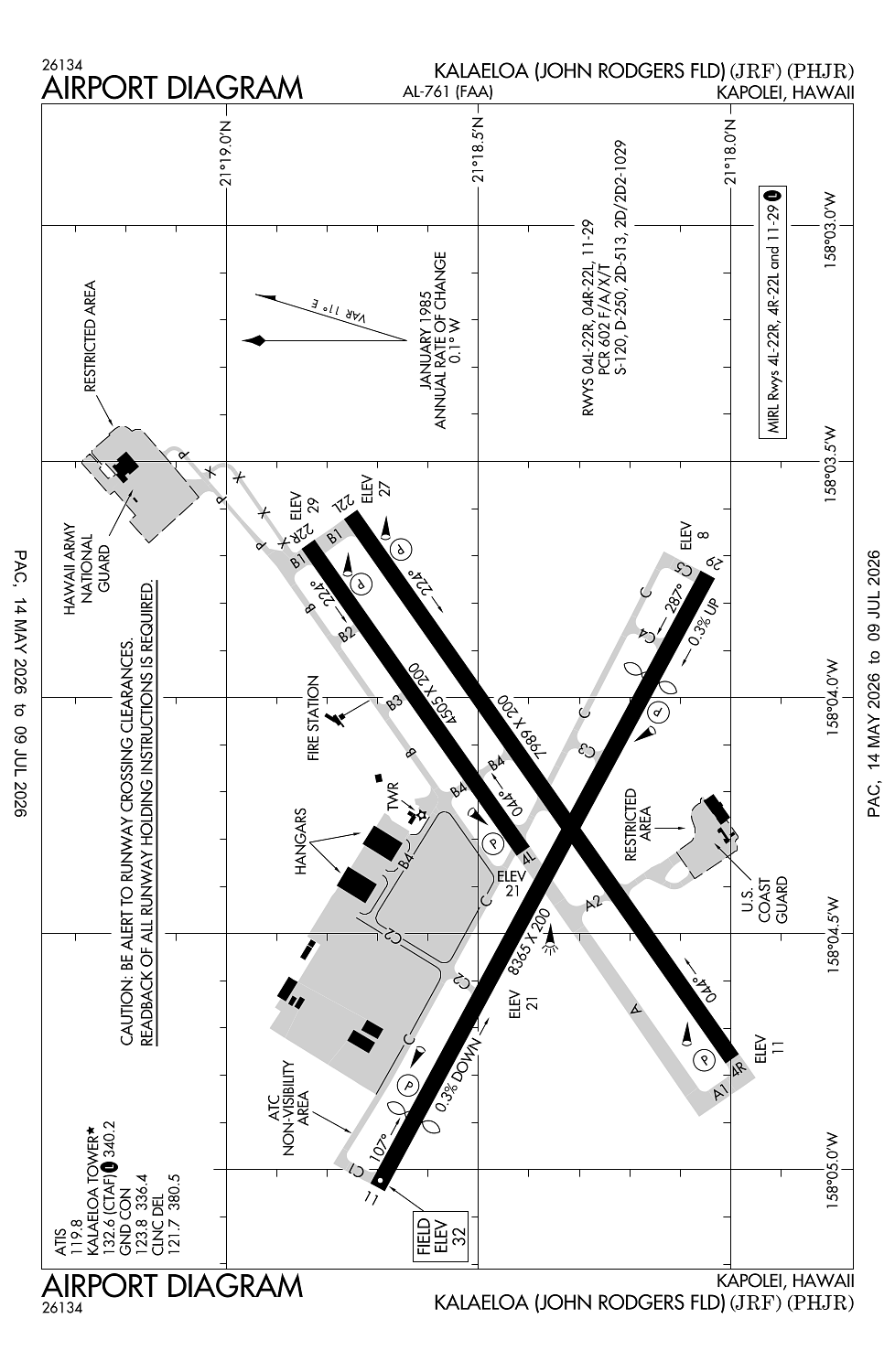
Location:
Kapolei, HI
Elevation:
32ft
Sectional:
Hawaiian Islands
Activation date:
Sep 1946
Fuel:
100LL, A, A1 (prices)
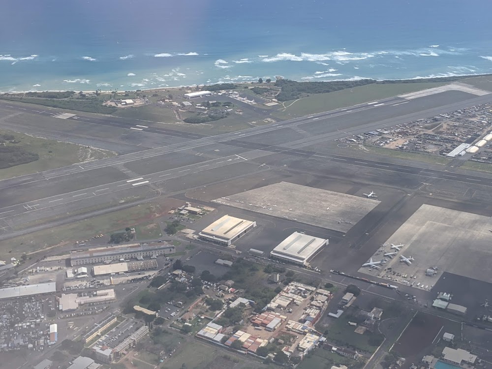
Runway 11/29:
8,365ft
Runway 04R/22L:
7,989ft
Runway 04L/22R:
4,505ft
Access: Open to the public
Current Weather — VFR
-
Weather data is strictly informational and not for flight planning purposes.
-
METAR2026-07-15 15:53:00 HST
Ceiling: 4,800ft Wind: 130° @ 10kt Temperature: 82°F Dewpoint: 69°F Weather: N/A Visbility: 10SM Clouds: Broken @ 4,800ft, Broken @ 6,500ft Raw:METAR PHJR 160153Z 13010KT 10SM BKN048 BKN065 28/21 A2991 RMK AO2 SLP133 T02830206 -
TAF2026-07-15 14:00:00 HST – 2026-07-15 20:00:00 HST
Ceiling: Sky clear Wind: 130° @ 10kt, gusts 16kt Weather: N/A Visbility: 6SM Clouds: Few @ 5,000ft Raw:TAF PHJR 152322Z 1600/1624 13010G16KT P6SM FEW050 FM160600 VRB05KT P6SM FEW035 FM162000 10011G17KT P6SM FEW050 -
TAF2026-07-15 20:00:00 HST – 2026-07-16 10:00:00 HST
Ceiling: Sky clear Wind: Variable Weather: N/A Visbility: 6SM Clouds: Few @ 3,500ft Raw:TAF PHJR 152322Z 1600/1624 13010G16KT P6SM FEW050 FM160600 VRB05KT P6SM FEW035 FM162000 10011G17KT P6SM FEW050 -
TAF2026-07-16 10:00:00 HST – 2026-07-16 14:00:00 HST
Ceiling: Sky clear Wind: 100° @ 11kt, gusts 17kt Weather: N/A Visbility: 6SM Clouds: Few @ 5,000ft Raw:TAF PHJR 152322Z 1600/1624 13010G16KT P6SM FEW050 FM160600 VRB05KT P6SM FEW035 FM162000 10011G17KT P6SM FEW050
Click/tap to add an annotation marker to the map
No webcams added yet.
Remarks
- Potential hydroplaning all acft due standing water at intxn ry 04r and ry 11.
- Ocnl bird haz apch end ry 04l and ry 04r.
- Military helicopter opns on & invof arpt due to uscg military helipad near ry 04r.
- Avoid overflight refineries west of arpt, gaseous exhaust plumes and flames may rise to 267 ft agl without warning.
- Navair 0800 r-14 natops us navy aircraft firefighters and rescue manual, category ii airfield (arff index b equivalent).
Comments