Pirep is a free, collaborative database of all public and private airports. All pilots are welcome to contribute their local knowledge to any airport, no registration required.


Public
Undocumented
METAR / TAF
Edit Tags
No upcoming events. Is anything happening here soon?
Airport Statistics
- Landing & tie-down fees
- Tags
- Webcam links
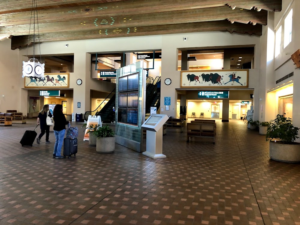
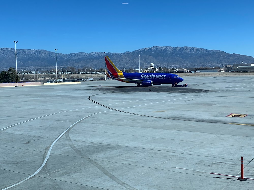
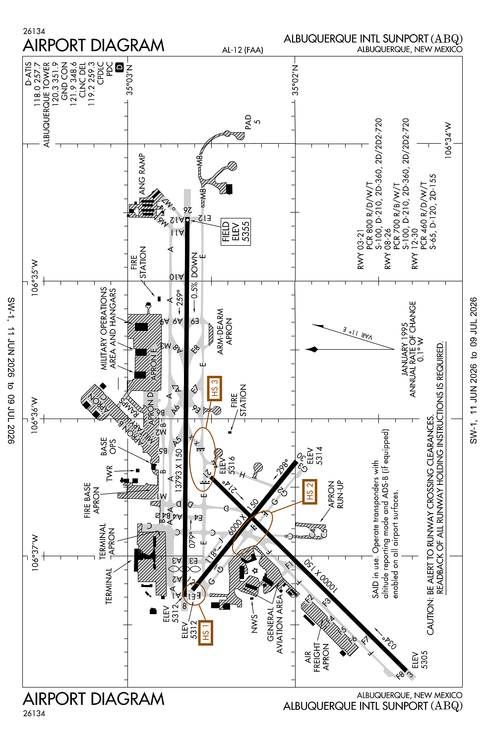
Location:
Albuquerque, NM
Elevation:
5,354ft
Sectional:
Albuquerque
Activation date:
Nov 1938
Fuel:
100LL, A, A1, A1+ (prices)
Runway 08/26:
13,793ft
Runway 03/21:
10,000ft
Runway 12/30:
6,000ft
Access: Open to the public
Current Weather — VFR
-
Weather data is strictly informational and not for flight planning purposes.
-
METAR2026-07-14 03:52:00 MDT
Ceiling: Sky clear Wind: 100° @ 8kt Temperature: 73°F Dewpoint: 53°F Weather: N/A Visbility: 10SM Raw:METAR KABQ 140952Z 10008KT 10SM CLR 23/12 A3028 RMK AO2 SLP156 T02330117 $ -
TAF2026-07-14 00:00:00 MDT – 2026-07-14 06:00:00 MDT
Ceiling: Sky clear Wind: 110° @ 11kt Weather: N/A Visbility: 6SM Clouds: Few @ 11,000ft Raw:TAF KABQ 140530Z 1406/1506 11011KT P6SM FEW110 FM141200 VRB06KT P6SM FEW110 FM141800 15007KT P6SM SCT100 BKN150 PROB30 1420/1423 VRB20G35KT 6SM -TSRA BLDU BKN100CB FM142300 11025G35KT P6SM BKN100 FM150200 11010KT P6SM BKN100 -
TAF2026-07-14 06:00:00 MDT – 2026-07-14 12:00:00 MDT
Ceiling: Sky clear Wind: Variable Weather: N/A Visbility: 6SM Clouds: Few @ 11,000ft Raw:TAF KABQ 140530Z 1406/1506 11011KT P6SM FEW110 FM141200 VRB06KT P6SM FEW110 FM141800 15007KT P6SM SCT100 BKN150 PROB30 1420/1423 VRB20G35KT 6SM -TSRA BLDU BKN100CB FM142300 11025G35KT P6SM BKN100 FM150200 11010KT P6SM BKN100 -
TAF2026-07-14 12:00:00 MDT – 2026-07-14 17:00:00 MDT
Ceiling: 15,000ft Wind: 150° @ 7kt Weather: N/A Visbility: 6SM Clouds: Scattered @ 10,000ft, Broken @ 15,000ft Raw:TAF KABQ 140530Z 1406/1506 11011KT P6SM FEW110 FM141200 VRB06KT P6SM FEW110 FM141800 15007KT P6SM SCT100 BKN150 PROB30 1420/1423 VRB20G35KT 6SM -TSRA BLDU BKN100CB FM142300 11025G35KT P6SM BKN100 FM150200 11010KT P6SM BKN100 -
TAF2026-07-14 14:00:00 MDT – 2026-07-14 17:00:00 MDT
Ceiling: 10,000ft Wind: Variable, gusts 35kt Weather: Light thunderstorm rain, blowing widespread dust Visbility: 6SM Clouds: Broken @ 10,000ft Raw:TAF KABQ 140530Z 1406/1506 11011KT P6SM FEW110 FM141200 VRB06KT P6SM FEW110 FM141800 15007KT P6SM SCT100 BKN150 PROB30 1420/1423 VRB20G35KT 6SM -TSRA BLDU BKN100CB FM142300 11025G35KT P6SM BKN100 FM150200 11010KT P6SM BKN100 -
TAF2026-07-14 17:00:00 MDT – 2026-07-14 20:00:00 MDT
Ceiling: 10,000ft Wind: 110° @ 25kt, gusts 35kt Weather: N/A Visbility: 6SM Clouds: Broken @ 10,000ft Raw:TAF KABQ 140530Z 1406/1506 11011KT P6SM FEW110 FM141200 VRB06KT P6SM FEW110 FM141800 15007KT P6SM SCT100 BKN150 PROB30 1420/1423 VRB20G35KT 6SM -TSRA BLDU BKN100CB FM142300 11025G35KT P6SM BKN100 FM150200 11010KT P6SM BKN100 -
TAF2026-07-14 20:00:00 MDT – 2026-07-15 00:00:00 MDT
Ceiling: 10,000ft Wind: 110° @ 10kt Weather: N/A Visbility: 6SM Clouds: Broken @ 10,000ft Raw:TAF KABQ 140530Z 1406/1506 11011KT P6SM FEW110 FM141200 VRB06KT P6SM FEW110 FM141800 15007KT P6SM SCT100 BKN150 PROB30 1420/1423 VRB20G35KT 6SM -TSRA BLDU BKN100CB FM142300 11025G35KT P6SM BKN100 FM150200 11010KT P6SM BKN100
Click/tap to add an annotation marker to the map
No webcams added yet.
Remarks
- Bird haz oct-dec & mar-may; student hel tfc.
- Ctl firing area s.
- Arff prvdd by usaf.
- Ramp north of rwy 08/26 clsd to helicopters & ga acft.
- Twy d north of twy b clsd indefly.
Comments