Pirep is a free, collaborative database of all public and private airports. All pilots are welcome to contribute their local knowledge to any airport, no registration required.


Public
Undocumented
METAR / TAF
Edit Tags
No upcoming events. Is anything happening here soon?
Airport Statistics
- Tags
- Airport photos
- Transient parking location
Location:
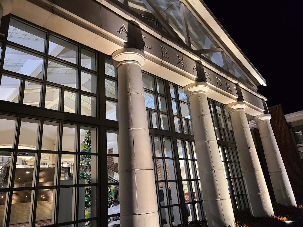
Alexandria, LA
Elevation:
88ft
Sectional:
Houston
Activation date:
Feb 1944
Fuel:
100, A, MOGAS (prices)
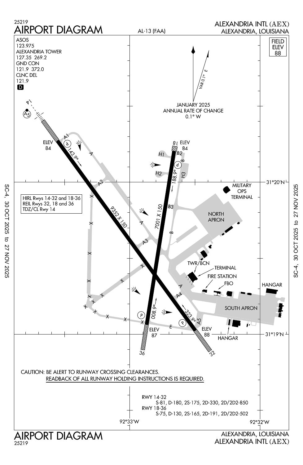
Runway 14/32:
9,352ft
Runway 18/36:
7,001ft
Access: Open to the public
Current Weather — VFR
-
Weather data is strictly informational and not for flight planning purposes.
-
METAR2025-12-13 10:53:00 CST
Ceiling: Sky clear Wind: Calm Temperature: 66°F Dewpoint: 64°F Weather: Mist Visbility: 6SM Raw:METAR KAEX 131653Z 00000KT 6SM BR CLR 19/18 A3008 RMK AO2 SLP191 T01890178 -
TAF2025-12-13 12:00:00 CST – 2025-12-13 14:00:00 CST
Ceiling: 5,000ft Wind: 170° @ 5kt Weather: N/A Visbility: 6SM Clouds: Broken @ 5,000ft Raw:TAF KAEX 131723Z 1318/1418 17005KT P6SM BKN050 FM132000 20006KT P6SM VCSH OVC050 FM140400 VRB05KT 4SM BR VCSH OVC007 FM140900 36012KT 6SM BR OVC015 FM141200 01015KT P6SM OVC050 -
TAF2025-12-13 14:00:00 CST – 2025-12-13 22:00:00 CST
Ceiling: 5,000ft Wind: 200° @ 6kt Weather: Showers in vicinity Visbility: 6SM Clouds: Overcast @ 5,000ft Raw:TAF KAEX 131723Z 1318/1418 17005KT P6SM BKN050 FM132000 20006KT P6SM VCSH OVC050 FM140400 VRB05KT 4SM BR VCSH OVC007 FM140900 36012KT 6SM BR OVC015 FM141200 01015KT P6SM OVC050 -
TAF2025-12-13 22:00:00 CST – 2025-12-14 03:00:00 CST
Ceiling: 700ft Wind: Variable Weather: Mist, showers in vicinity Visbility: 4SM Clouds: Overcast @ 700ft Raw:TAF KAEX 131723Z 1318/1418 17005KT P6SM BKN050 FM132000 20006KT P6SM VCSH OVC050 FM140400 VRB05KT 4SM BR VCSH OVC007 FM140900 36012KT 6SM BR OVC015 FM141200 01015KT P6SM OVC050 -
TAF2025-12-14 03:00:00 CST – 2025-12-14 06:00:00 CST
Ceiling: 1,500ft Wind: 360° @ 12kt Weather: Mist Visbility: 6SM Clouds: Overcast @ 1,500ft Raw:TAF KAEX 131723Z 1318/1418 17005KT P6SM BKN050 FM132000 20006KT P6SM VCSH OVC050 FM140400 VRB05KT 4SM BR VCSH OVC007 FM140900 36012KT 6SM BR OVC015 FM141200 01015KT P6SM OVC050 -
TAF2025-12-14 06:00:00 CST – 2025-12-14 12:00:00 CST
Ceiling: 5,000ft Wind: 010° @ 15kt Weather: N/A Visbility: 6SM Clouds: Overcast @ 5,000ft Raw:TAF KAEX 131723Z 1318/1418 17005KT P6SM BKN050 FM132000 20006KT P6SM VCSH OVC050 FM140400 VRB05KT 4SM BR VCSH OVC007 FM140900 36012KT 6SM BR OVC015 FM141200 01015KT P6SM OVC050
Click/tap to add an annotation marker to the map
No webcams added yet.
Remarks
- Prvdd vfr only.
- Lgt acft freq cross apch zones to rwy 14/32 blw 2000 ft msl.
- Extv lgt acft tfc (cropdusters) blw 900 ft to civ arpt 3.5 nm wsw of field.
- Locked wheel and sharp turns prohibited on asph sfc.
- Twy e btn twy f & rwy 36 clsd indefly.
Comments