Pirep is a free, collaborative database of all public and private airports. All pilots are welcome to contribute their local knowledge to any airport, no registration required.
Public
Undocumented
METAR / TAF
Edit Tags
No upcoming events. Is anything happening here soon?
Airport Statistics
- Landing & tie-down fees
- Transient parking location
- Webcam links
Location:
Boston, MA
Elevation:
19ft
Sectional:
New York
Activation date:
Apr 1940
Fuel:
100LL, A (prices)
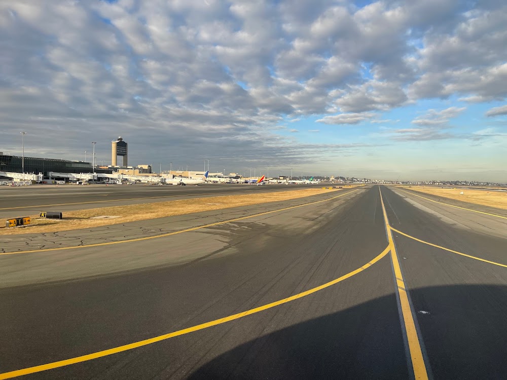
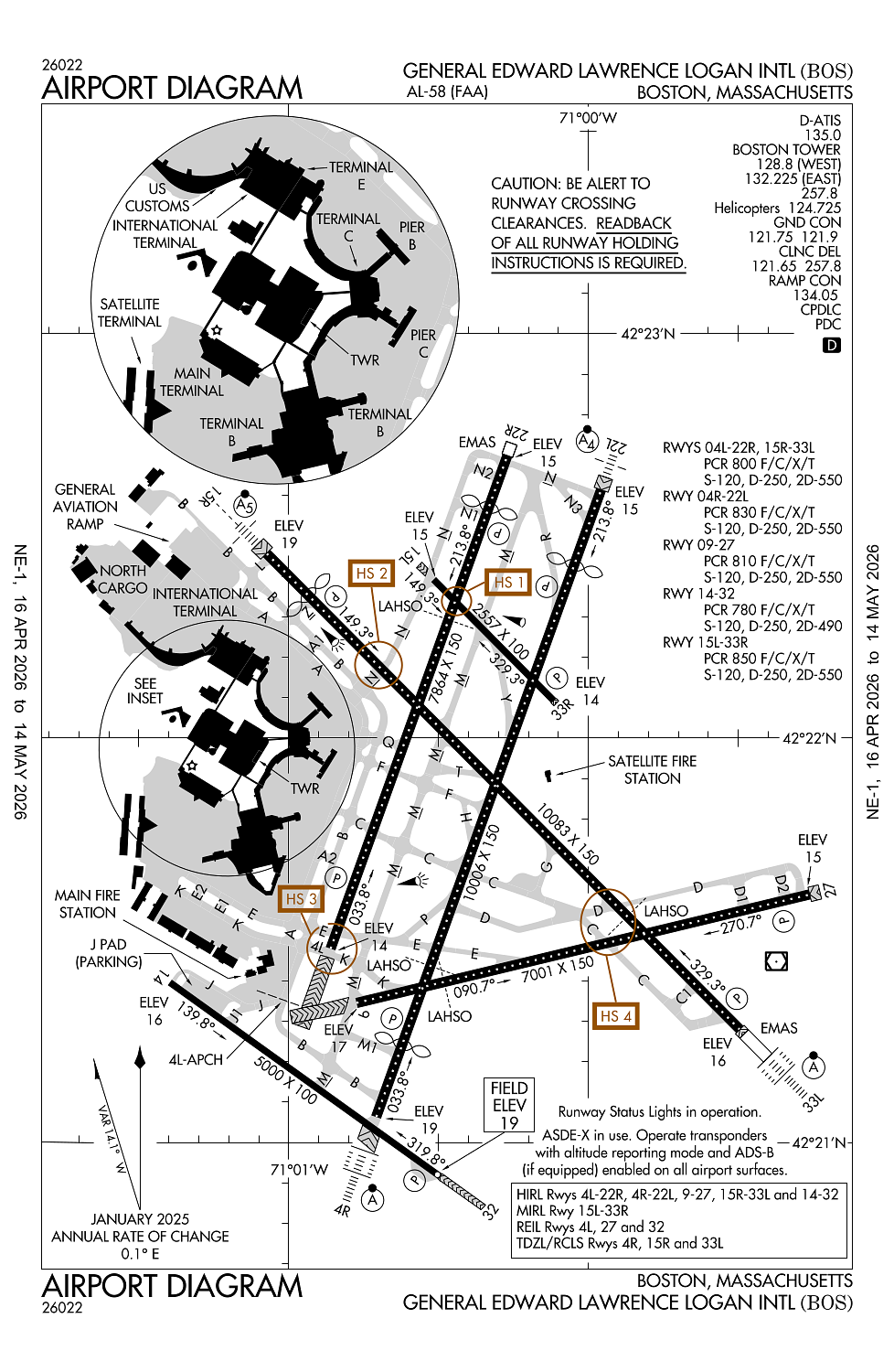
Runway 15R/33L:
10,083ft
Runway 04R/22L:
10,006ft
Runway 04L/22R:
7,864ft
Runway 09/27:
7,001ft
Runway 14/32:
5,000ft
Runway 15L/33R:
2,557ft
Access: Open to the public
Current Weather — VFR
-
Weather data is strictly informational and not for flight planning purposes.
-
METAR2026-05-05 06:54:00 EDT
Ceiling: 22,000ft Wind: 200° @ 10kt Temperature: 55°F Dewpoint: 48°F Weather: N/A Visbility: 10SM Clouds: Few @ 10,000ft, Broken @ 22,000ft Raw:METAR KBOS 051054Z 20010KT 10SM FEW100 BKN220 13/09 A2983 RMK AO2 SLP100 T01280089 -
TAF2026-05-05 08:00:00 EDT – 2026-05-05 10:00:00 EDT
Ceiling: Sky clear Wind: 210° @ 11kt, gusts 21kt Weather: N/A Visbility: 6SM Clouds: Few @ 8,000ft Raw:TAF KBOS 051120Z 0512/0618 21011G21KT P6SM FEW080 FM051400 22016G29KT P6SM FEW130 FM051630 21021G41KT P6SM FEW060 FM060200 21018G35KT P6SM FEW060 FM060900 21015G30KT P6SM BKN020 WS020/22045KT FM061400 21017G33KT P6SM BKN025 -
TAF2026-05-05 10:00:00 EDT – 2026-05-05 12:30:00 EDT
Ceiling: Sky clear Wind: 220° @ 16kt, gusts 29kt Weather: N/A Visbility: 6SM Clouds: Few @ 13,000ft Raw:TAF KBOS 051120Z 0512/0618 21011G21KT P6SM FEW080 FM051400 22016G29KT P6SM FEW130 FM051630 21021G41KT P6SM FEW060 FM060200 21018G35KT P6SM FEW060 FM060900 21015G30KT P6SM BKN020 WS020/22045KT FM061400 21017G33KT P6SM BKN025 -
TAF2026-05-05 12:30:00 EDT – 2026-05-05 22:00:00 EDT
Ceiling: Sky clear Wind: 210° @ 21kt, gusts 41kt Weather: N/A Visbility: 6SM Clouds: Few @ 6,000ft Raw:TAF KBOS 051120Z 0512/0618 21011G21KT P6SM FEW080 FM051400 22016G29KT P6SM FEW130 FM051630 21021G41KT P6SM FEW060 FM060200 21018G35KT P6SM FEW060 FM060900 21015G30KT P6SM BKN020 WS020/22045KT FM061400 21017G33KT P6SM BKN025 -
TAF2026-05-05 22:00:00 EDT – 2026-05-06 05:00:00 EDT
Ceiling: Sky clear Wind: 210° @ 18kt, gusts 35kt Weather: N/A Visbility: 6SM Clouds: Few @ 6,000ft Raw:TAF KBOS 051120Z 0512/0618 21011G21KT P6SM FEW080 FM051400 22016G29KT P6SM FEW130 FM051630 21021G41KT P6SM FEW060 FM060200 21018G35KT P6SM FEW060 FM060900 21015G30KT P6SM BKN020 WS020/22045KT FM061400 21017G33KT P6SM BKN025 -
TAF2026-05-06 05:00:00 EDT – 2026-05-06 10:00:00 EDT
Ceiling: 2,000ft Wind: 210° @ 15kt, gusts 30kt Weather: N/A Visbility: 6SM Clouds: Broken @ 2,000ft Raw:TAF KBOS 051120Z 0512/0618 21011G21KT P6SM FEW080 FM051400 22016G29KT P6SM FEW130 FM051630 21021G41KT P6SM FEW060 FM060200 21018G35KT P6SM FEW060 FM060900 21015G30KT P6SM BKN020 WS020/22045KT FM061400 21017G33KT P6SM BKN025 -
TAF2026-05-06 10:00:00 EDT – 2026-05-06 14:00:00 EDT
Ceiling: 2,500ft Wind: 210° @ 17kt, gusts 33kt Weather: N/A Visbility: 6SM Clouds: Broken @ 2,500ft Raw:TAF KBOS 051120Z 0512/0618 21011G21KT P6SM FEW080 FM051400 22016G29KT P6SM FEW130 FM051630 21021G41KT P6SM FEW060 FM060200 21018G35KT P6SM FEW060 FM060900 21015G30KT P6SM BKN020 WS020/22045KT FM061400 21017G33KT P6SM BKN025
Click/tap to add an annotation marker to the map
No webcams added yet.
Remarks
- Prvdd the designation of a movement area associated with the relctn is coordinated with & designated by boston atct; appropriate hold lines established & marked for service vehicle movement & taxilanes; relctn marked in accordance with faa advisory circular/5930-2.
- Birds on & invof arpt.
- Noise sensitive area; hop wi ctzl are reqd to maint the highest psbl alt.
- Btn 0000-0600 lcl - ry 15r is preferential ngt ry for tkof & ry 33l is preferential ngt ry for lndg.
- Noise abatement proc mon-fri 0900-1700 - 617-561-1636.
Comments