Pirep is a free, collaborative database of all public and private airports. All pilots are welcome to contribute their local knowledge to any airport, no registration required.


Public
Undocumented
METAR / TAF
Edit Tags
No upcoming events. Is anything happening here soon?
Airport Statistics
- Local flying clubs
- Transient parking location
- Airport map annotations
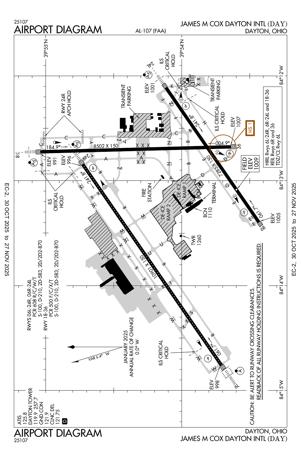
Location:
Dayton, OH
Elevation:
1,009ft
Sectional:
Cincinnati
Activation date:
Oct 1937
Fuel:
100, A (prices)
Runway 06L/24R:
10,901ft
Runway 18/36:
8,502ft
Runway 06R/24L:
7,285ft
Access: Open to the public
Click/tap to add an annotation marker to the map
No webcams added yet.
Remarks
- Runups prohibited on rwy 24l hold pad.
- Twy z, twy t, & twy s btn rwy 06l/24r & twy w clsd indefly.
- Deer, coyotes, birds, & waterfowl on & invof arpt.
- Twy c btn twy n & twy z not avbl for group iv & gtr acft. twy k, twy h, twy j, & twy l not avbl for group iv & gtr acft.
- Ne 1400 ft conc, sw 9501 ft asph.
Comments