Pirep is a free, collaborative database of all public and private airports. All pilots are welcome to contribute their local knowledge to any airport, no registration required.


Public
Undocumented
METAR / TAF
Edit Tags
No upcoming events. Is anything happening here soon?
Airport Statistics
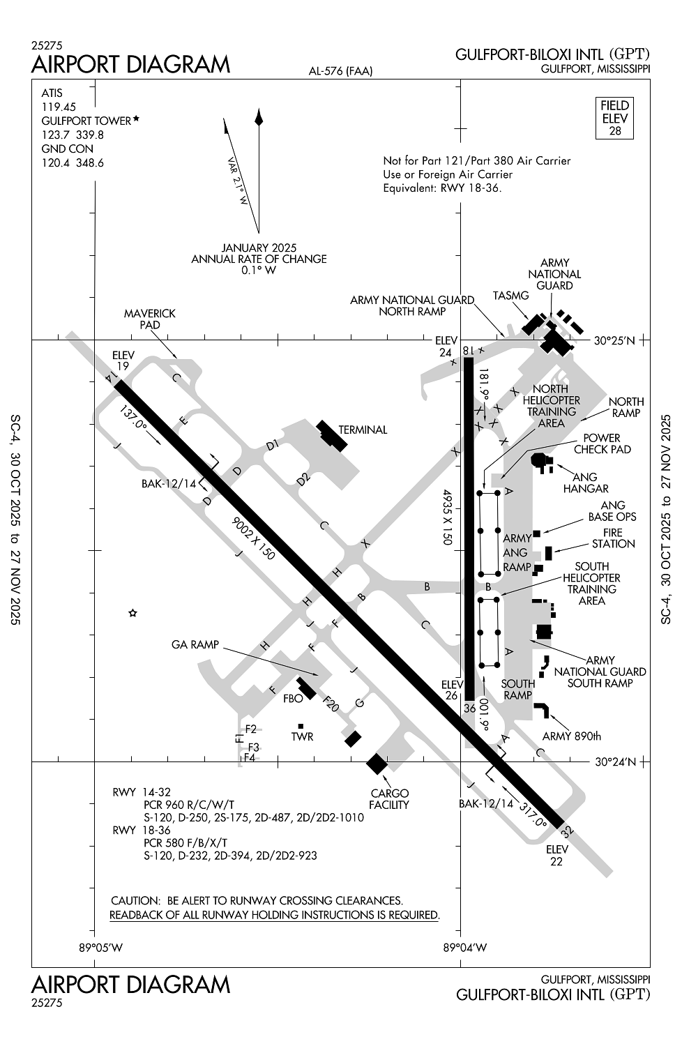
- General description
- Local flying clubs
- Airport map annotations
Location:
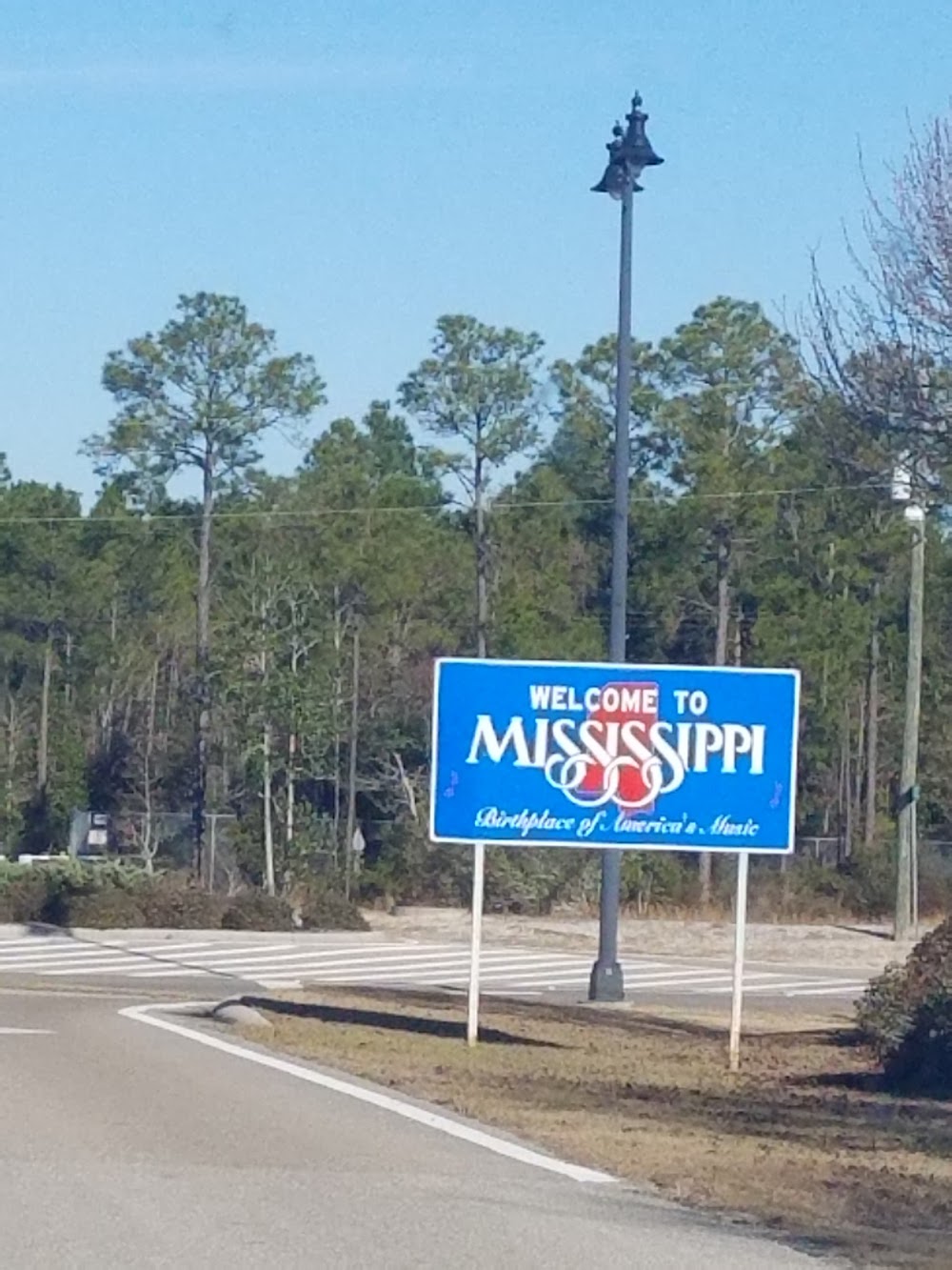
Gulfport, MS
Elevation:
28ft
Sectional:
New Orleans
Fuel:
100LL, A, A+ (prices)
Runway 14/32:
9,002ft
Runway 18/36:
4,935ft
Access: Open to the public
Current Weather — MVFR
-
Weather data is strictly informational and not for flight planning purposes.
-
METAR2025-12-14 05:16:00 CST
Ceiling: 1,400ft Wind: 320° @ 6kt Temperature: 60°F Dewpoint: 60°F Weather: N/A Visbility: 10SM Clouds: Broken @ 1,400ft, Broken @ 7,000ft, Overcast @ 11,000ft Raw:SPECI KGPT 141116Z AUTO 32006KT 10SM BKN014 BKN070 OVC110 16/16 A3012 RMK AO2 T01610156 -
TAF2025-12-14 06:00:00 CST – 2025-12-14 08:00:00 CST
Ceiling: 1,500ft Wind: 340° @ 11kt, gusts 20kt Weather: N/A Visbility: 6SM Clouds: Broken @ 1,500ft, Overcast @ 7,000ft Raw:TAF KGPT 141127Z 1412/1512 34011G20KT P6SM BKN015 OVC070 TEMPO 1412/1414 2SM -RA BR OVC010 FM141400 01016G25KT P6SM BKN010 OVC030 TEMPO 1414/1416 2SM -RA BR OVC008 FM141600 01017G27KT P6SM BKN015 BKN110 FM141800 01017G28KT P6SM FEW025 SCT250 FM150000 36010KT P6SM SKC -
TAF2025-12-14 06:00:00 CST – 2025-12-14 08:00:00 CST
Ceiling: 1,000ft Wind: 000° @ kt Weather: Light rain, mist Visbility: 2SM Clouds: Overcast @ 1,000ft Raw:TAF KGPT 141127Z 1412/1512 34011G20KT P6SM BKN015 OVC070 TEMPO 1412/1414 2SM -RA BR OVC010 FM141400 01016G25KT P6SM BKN010 OVC030 TEMPO 1414/1416 2SM -RA BR OVC008 FM141600 01017G27KT P6SM BKN015 BKN110 FM141800 01017G28KT P6SM FEW025 SCT250 FM150000 36010KT P6SM SKC -
TAF2025-12-14 08:00:00 CST – 2025-12-14 10:00:00 CST
Ceiling: 1,000ft Wind: 010° @ 16kt, gusts 25kt Weather: N/A Visbility: 6SM Clouds: Broken @ 1,000ft, Overcast @ 3,000ft Raw:TAF KGPT 141127Z 1412/1512 34011G20KT P6SM BKN015 OVC070 TEMPO 1412/1414 2SM -RA BR OVC010 FM141400 01016G25KT P6SM BKN010 OVC030 TEMPO 1414/1416 2SM -RA BR OVC008 FM141600 01017G27KT P6SM BKN015 BKN110 FM141800 01017G28KT P6SM FEW025 SCT250 FM150000 36010KT P6SM SKC -
TAF2025-12-14 08:00:00 CST – 2025-12-14 10:00:00 CST
Ceiling: 800ft Wind: 000° @ kt Weather: Light rain, mist Visbility: 2SM Clouds: Overcast @ 800ft Raw:TAF KGPT 141127Z 1412/1512 34011G20KT P6SM BKN015 OVC070 TEMPO 1412/1414 2SM -RA BR OVC010 FM141400 01016G25KT P6SM BKN010 OVC030 TEMPO 1414/1416 2SM -RA BR OVC008 FM141600 01017G27KT P6SM BKN015 BKN110 FM141800 01017G28KT P6SM FEW025 SCT250 FM150000 36010KT P6SM SKC -
TAF2025-12-14 10:00:00 CST – 2025-12-14 12:00:00 CST
Ceiling: 1,500ft Wind: 010° @ 17kt, gusts 27kt Weather: N/A Visbility: 6SM Clouds: Broken @ 1,500ft, Broken @ 11,000ft Raw:TAF KGPT 141127Z 1412/1512 34011G20KT P6SM BKN015 OVC070 TEMPO 1412/1414 2SM -RA BR OVC010 FM141400 01016G25KT P6SM BKN010 OVC030 TEMPO 1414/1416 2SM -RA BR OVC008 FM141600 01017G27KT P6SM BKN015 BKN110 FM141800 01017G28KT P6SM FEW025 SCT250 FM150000 36010KT P6SM SKC -
TAF2025-12-14 12:00:00 CST – 2025-12-14 18:00:00 CST
Ceiling: Sky clear Wind: 010° @ 17kt, gusts 28kt Weather: N/A Visbility: 6SM Clouds: Few @ 2,500ft, Scattered @ 25,000ft Raw:TAF KGPT 141127Z 1412/1512 34011G20KT P6SM BKN015 OVC070 TEMPO 1412/1414 2SM -RA BR OVC010 FM141400 01016G25KT P6SM BKN010 OVC030 TEMPO 1414/1416 2SM -RA BR OVC008 FM141600 01017G27KT P6SM BKN015 BKN110 FM141800 01017G28KT P6SM FEW025 SCT250 FM150000 36010KT P6SM SKC -
TAF2025-12-14 18:00:00 CST – 2025-12-15 06:00:00 CST
Ceiling: Sky clear Wind: 360° @ 10kt Weather: N/A Visbility: 6SM Clouds: @ ft Raw:TAF KGPT 141127Z 1412/1512 34011G20KT P6SM BKN015 OVC070 TEMPO 1412/1414 2SM -RA BR OVC010 FM141400 01016G25KT P6SM BKN010 OVC030 TEMPO 1414/1416 2SM -RA BR OVC008 FM141600 01017G27KT P6SM BKN015 BKN110 FM141800 01017G28KT P6SM FEW025 SCT250 FM150000 36010KT P6SM SKC
Click/tap to add an annotation marker to the map
No webcams added yet.
Remarks
- Existed prior to 1959.
- Nmrs low flying fish spotter acft operg the shoreline btn pascagoula & gulfport sr-ss.
- Acft ovr 115000 lbs are rstrd fm 180 deg turns on rwy 18/36. acft with wingspan gtr than 223 ft are rstrd fm oprg on twy c btn twy a & aer 32.
- Acft ovr 155000 lbs are rstrd fm using the n part of twy a at rwy 18/36. acft ovr 316000 lbs are rstrd fm using the s part of twy a btn twy c & rwy 14/32.
- Due to apn actvty acft with wingspan gtr than 170 ft should be alert on twy a btn twy c & twy b.
Comments