Pirep is a free, collaborative database of all public and private airports. All pilots are welcome to contribute their local knowledge to any airport, no registration required.
Public
Undocumented
METAR / TAF
Edit Tags
No upcoming events. Is anything happening here soon?
Airport Statistics
- Landing & tie-down fees
- Airport map annotations
- Webcam links
Location:
Imperial, CA
Elevation:
-53ft
Sectional:
Phoenix
Activation date:
Apr 1940
Fuel:
100LL, A (prices)
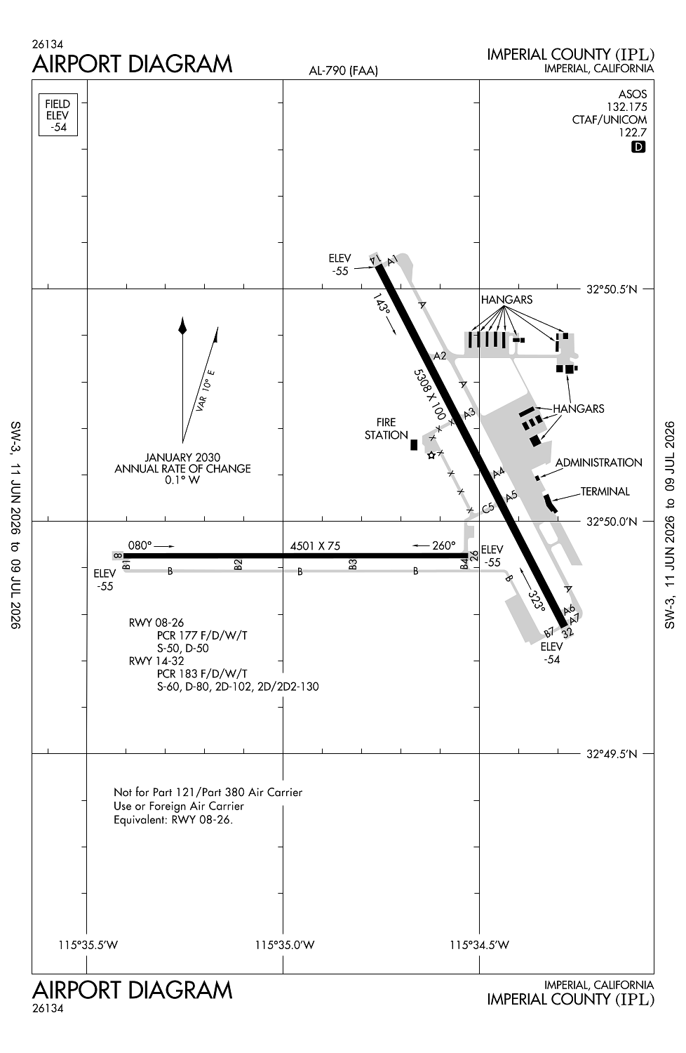
Runway 14/32:
5,308ft
Runway 08/26:
4,501ft
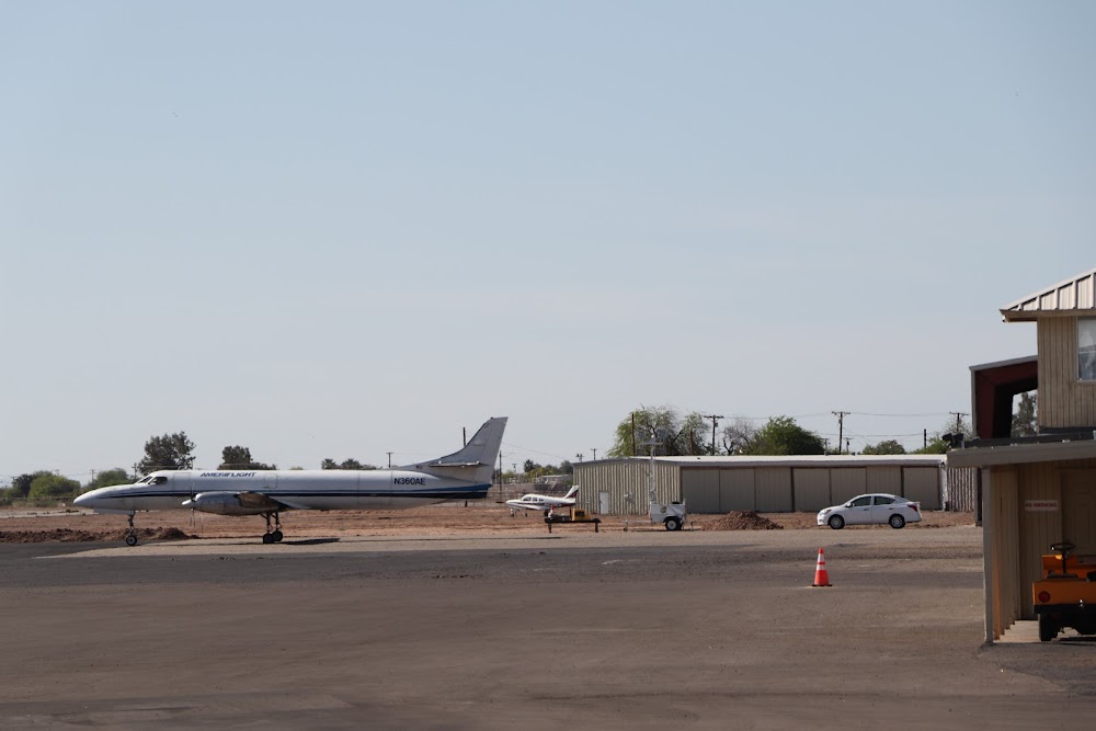
Access: Open to the public
Current Weather — VFR
-
Weather data is strictly informational and not for flight planning purposes.
-
METAR2026-06-18 07:53:00 PDT
Ceiling: Sky clear Wind: 210° @ 4kt Temperature: 82°F Dewpoint: 46°F Weather: N/A Visbility: 10SM Raw:METAR KIPL 181453Z AUTO 21004KT 10SM CLR 28/08 A2977 RMK AO2 SLP081 T02830078 51021 -
TAF2026-06-18 05:00:00 PDT – 2026-06-18 16:00:00 PDT
Ceiling: Sky clear Wind: 250° @ 7kt Weather: N/A Visbility: 6SM Clouds: @ ft Raw:TAF KIPL 181120Z 1812/1912 25007KT P6SM SKC FM182300 26012G19KT P6SM SKC TEMPO 1901/1905 26018G28KT P6SM FM190800 26007KT P6SM SKC -
TAF2026-06-18 16:00:00 PDT – 2026-06-19 01:00:00 PDT
Ceiling: Sky clear Wind: 260° @ 12kt, gusts 19kt Weather: N/A Visbility: 6SM Clouds: @ ft Raw:TAF KIPL 181120Z 1812/1912 25007KT P6SM SKC FM182300 26012G19KT P6SM SKC TEMPO 1901/1905 26018G28KT P6SM FM190800 26007KT P6SM SKC -
TAF2026-06-18 18:00:00 PDT – 2026-06-18 22:00:00 PDT
Ceiling: Sky clear Wind: 260° @ 18kt, gusts 28kt Weather: N/A Visbility: 6SM Raw:TAF KIPL 181120Z 1812/1912 25007KT P6SM SKC FM182300 26012G19KT P6SM SKC TEMPO 1901/1905 26018G28KT P6SM FM190800 26007KT P6SM SKC -
TAF2026-06-19 01:00:00 PDT – 2026-06-19 05:00:00 PDT
Ceiling: Sky clear Wind: 260° @ 7kt Weather: N/A Visbility: 6SM Clouds: @ ft Raw:TAF KIPL 181120Z 1812/1912 25007KT P6SM SKC FM182300 26012G19KT P6SM SKC TEMPO 1901/1905 26018G28KT P6SM FM190800 26007KT P6SM SKC
Click/tap to add an annotation marker to the map
No webcams added yet.
Remarks
- Rwy 8/26 not avbl for sked acr opns with more than 9 psgr seats or unsked acr at least 31 psgr seats.
- In vfr conds, avoid naf el centro tfc; acft depg kipl rwy 26 make an imt right turn & stay below 1000 ft; ctc naf twr 119.1 for adzy.
- Frq high-spd mil jet tfc transits imperial county tfc area wb descending vfr to naf el cenrto. avoid 2500 ft to 3500 ft msl near imperial county. ctc naf twr 119.1 for navy tfc adzy.
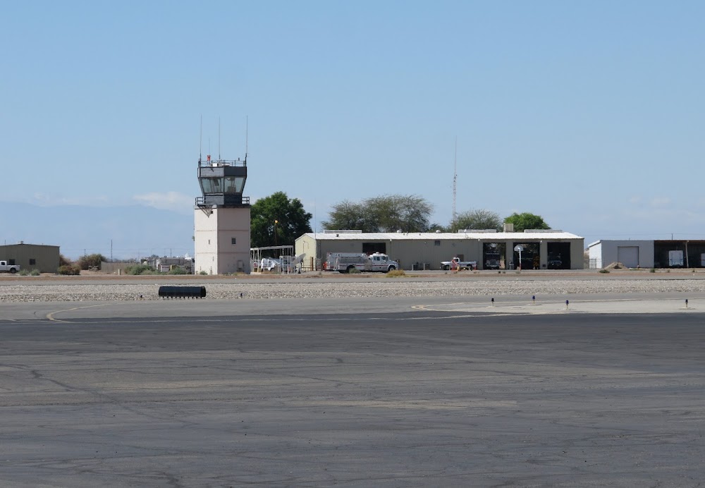
- Radio ant +70 ft lctd on ctl twr at midfield rwy 14/32 and 500 ft west rwy cntrln.
- Ppr for non-skedd air carrier arff ser, contact amer 442-264-3220.
Comments