Pirep is a free, collaborative database of all public and private airports. All pilots are welcome to contribute their local knowledge to any airport, no registration required.


Public
Undocumented
METAR / TAF
Edit Tags
No upcoming events. Is anything happening here soon?
Airport Statistics
- Crew car availability
- Tags
- General description
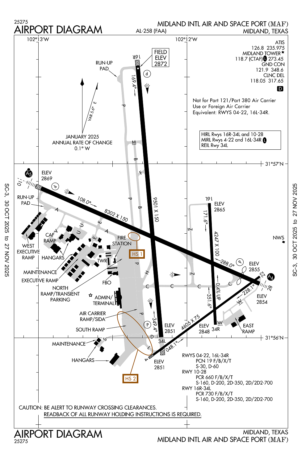
Location:
Midland, TX
Elevation:
2,872ft
Sectional:
San Antonio
Activation date:
Sep 1937
Fuel:
100LL, A, A1 (prices)
Runway 16R/34L:
9,501ft
Runway 10/28:
8,302ft
Runway 04/22:
4,605ft
Runway 16L/34R:
4,247ft
Access: Open to the public
Click/tap to add an annotation marker to the map
No webcams added yet.
Remarks
- This airport has been surveyed by the national geodetic survey.
- For arff svc btn 0000-0600 dly ctc fss at 800-992-7433.
- Rwys 04/22 & 16l/34r clsd to acft over 60000 lbs.
- Twys b & f north rwy 10/28 clsd to acft over 60000 lbs.
- Bird activity on & invof arpt.
Comments