Pirep is a free, collaborative database of all public and private airports located within the United States. All pilots are welcome to contribute, edit, and improve any airport they have local knowledge about, no registration required.
Are you familiar with this airport? Help out other pilots by adding your local knowledge.


Public
Undocumented
METAR / TAF
Edit Tags
Upcoming Events
No upcoming events. Is anything happening here soon?
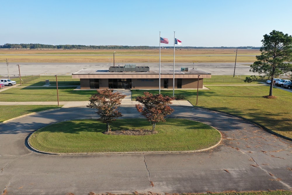
Airport Statistics
Location:
Maxton, NC
Elevation:
215ft
Sectional:
Charlotte
Activation date:
May 1943
Fuel:
100LL, A1+ (prices)
Runway 05/23:
6,503ft
Runway 13/31:
3,536ft
Access: Open to the public
Current Weather — VFR
-
Weather data is strictly informational and not for flight planning purposes.
-
METAR2024-05-18 04:52:00 EDT
Ceiling Wind Temperature Dewpoint Weather Visbility 5,500ft 260° @ 8kt 69°F 68°F N/A 10SM Clouds: Few @ 4,600ft, Overcast @ 5,500ft Raw:KMEB 180852Z AUTO 26008KT 10SM FEW046 OVC055 21/20 A2989 RMK AO2 SLP120 T02060200 53008
Click/tap to add an annotation marker to the map
No webcams added yet.
Remarks
- Call airport to arrange for service.
- Existed prior to 1959.
- Mil acft frqly oper fm clsd ptn of rwy 13/31 & clsd rwy 18/36.
- Hvy paja at south end of clsd rwy 18/36 & south side rwy 13/31.
- Gco avbl on freq 135.075 thru fay cd.
- Farming eqpt and mil ops on & invof arpt.
- Rwy 13/31 dalgt use only.
- No ln of sight btn rwy ends.
Comments