Pirep is a free, collaborative database of all public and private airports. All pilots are welcome to contribute their local knowledge to any airport, no registration required.


No upcoming events. Is anything happening here soon?
Last updated: 2023-06-13 23:23:34 EDT
Airport Statistics
- WiFi availability
- Transient parking location
- Local flying clubs
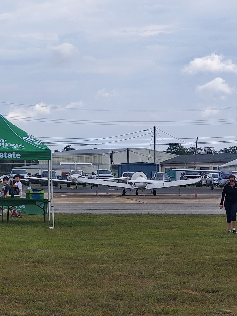
Location:
Millville, NJ
Elevation:
84ft
Sectional:
Washington
Activation date:
May 1943
Fuel:
100LL, A (prices)
Runway 10/28:
6,003ft
Runway 14/32:
5,058ft
Access: Open to the public
Similar Airports
Current Weather — VFR
-
Weather data is strictly informational and not for flight planning purposes.
-
METAR2025-12-13 11:54:00 EST
Ceiling: Sky clear Wind: Variable Temperature: 41°F Dewpoint: 28°F Weather: N/A Visbility: 10SM Raw:METAR KMIV 131654Z AUTO VRB06KT 10SM CLR 05/M02 A3008 RMK AO2 SLP185 T00501017 -
TAF2025-12-13 07:00:00 EST – 2025-12-13 11:00:00 EST
Ceiling: 9,000ft Wind: 210° @ 7kt Weather: N/A Visbility: 6SM Clouds: Scattered @ 4,500ft, Broken @ 9,000ft Raw:TAF KMIV 131120Z 1312/1412 21007KT P6SM SCT045 BKN090 FM131600 22009KT P6SM SCT045 BKN120 FM131900 24008KT P6SM SCT140 BKN230 FM132100 25005KT P6SM SCT130 OVC170 FM140000 VRB03KT P6SM VCSH SCT025 OVC070 FM140400 VRB04KT 3SM -RA BR BKN021 OVC045 FM140600 VRB04KT 1SM -SN BR SCT004 OVC007 -
TAF2025-12-13 11:00:00 EST – 2025-12-13 14:00:00 EST
Ceiling: 12,000ft Wind: 220° @ 9kt Weather: N/A Visbility: 6SM Clouds: Scattered @ 4,500ft, Broken @ 12,000ft Raw:TAF KMIV 131120Z 1312/1412 21007KT P6SM SCT045 BKN090 FM131600 22009KT P6SM SCT045 BKN120 FM131900 24008KT P6SM SCT140 BKN230 FM132100 25005KT P6SM SCT130 OVC170 FM140000 VRB03KT P6SM VCSH SCT025 OVC070 FM140400 VRB04KT 3SM -RA BR BKN021 OVC045 FM140600 VRB04KT 1SM -SN BR SCT004 OVC007 -
TAF2025-12-13 14:00:00 EST – 2025-12-13 16:00:00 EST
Ceiling: 23,000ft Wind: 240° @ 8kt Weather: N/A Visbility: 6SM Clouds: Scattered @ 14,000ft, Broken @ 23,000ft Raw:TAF KMIV 131120Z 1312/1412 21007KT P6SM SCT045 BKN090 FM131600 22009KT P6SM SCT045 BKN120 FM131900 24008KT P6SM SCT140 BKN230 FM132100 25005KT P6SM SCT130 OVC170 FM140000 VRB03KT P6SM VCSH SCT025 OVC070 FM140400 VRB04KT 3SM -RA BR BKN021 OVC045 FM140600 VRB04KT 1SM -SN BR SCT004 OVC007 -
TAF2025-12-13 16:00:00 EST – 2025-12-13 19:00:00 EST
Ceiling: 17,000ft Wind: 250° @ 5kt Weather: N/A Visbility: 6SM Clouds: Scattered @ 13,000ft, Overcast @ 17,000ft Raw:TAF KMIV 131120Z 1312/1412 21007KT P6SM SCT045 BKN090 FM131600 22009KT P6SM SCT045 BKN120 FM131900 24008KT P6SM SCT140 BKN230 FM132100 25005KT P6SM SCT130 OVC170 FM140000 VRB03KT P6SM VCSH SCT025 OVC070 FM140400 VRB04KT 3SM -RA BR BKN021 OVC045 FM140600 VRB04KT 1SM -SN BR SCT004 OVC007 -
TAF2025-12-13 19:00:00 EST – 2025-12-13 23:00:00 EST
Ceiling: 7,000ft Wind: Variable Weather: Showers in vicinity Visbility: 6SM Clouds: Scattered @ 2,500ft, Overcast @ 7,000ft Raw:TAF KMIV 131120Z 1312/1412 21007KT P6SM SCT045 BKN090 FM131600 22009KT P6SM SCT045 BKN120 FM131900 24008KT P6SM SCT140 BKN230 FM132100 25005KT P6SM SCT130 OVC170 FM140000 VRB03KT P6SM VCSH SCT025 OVC070 FM140400 VRB04KT 3SM -RA BR BKN021 OVC045 FM140600 VRB04KT 1SM -SN BR SCT004 OVC007 -
TAF2025-12-13 23:00:00 EST – 2025-12-14 01:00:00 EST
Ceiling: 2,100ft Wind: Variable Weather: Light rain, mist Visbility: 3SM Clouds: Broken @ 2,100ft, Overcast @ 4,500ft Raw:TAF KMIV 131120Z 1312/1412 21007KT P6SM SCT045 BKN090 FM131600 22009KT P6SM SCT045 BKN120 FM131900 24008KT P6SM SCT140 BKN230 FM132100 25005KT P6SM SCT130 OVC170 FM140000 VRB03KT P6SM VCSH SCT025 OVC070 FM140400 VRB04KT 3SM -RA BR BKN021 OVC045 FM140600 VRB04KT 1SM -SN BR SCT004 OVC007 -
TAF2025-12-14 01:00:00 EST – 2025-12-14 07:00:00 EST
Ceiling: 700ft Wind: Variable Weather: Light snow, mist Visbility: 1SM Clouds: Scattered @ 400ft, Overcast @ 700ft Raw:TAF KMIV 131120Z 1312/1412 21007KT P6SM SCT045 BKN090 FM131600 22009KT P6SM SCT045 BKN120 FM131900 24008KT P6SM SCT140 BKN230 FM132100 25005KT P6SM SCT130 OVC170 FM140000 VRB03KT P6SM VCSH SCT025 OVC070 FM140400 VRB04KT 3SM -RA BR BKN021 OVC045 FM140600 VRB04KT 1SM -SN BR SCT004 OVC007
Click/tap to add an annotation marker to the map
No webcams added yet.
Remarks
- All ultralight acft, gldr ops & frmn flts ppr. call 856-825-1244 mon-fri 0800-1600.
- Paew wi all rwy & twy safety areas dly may-oct.
- Twy g not to be used by acft with wingspan gtr than 48 ft n of twy a.
- Main apn clsd to tsnt acft n of twy k.
- Birds on & invof arpt.
- For cd if una to ctc on fss freq, ctc atlantic city approach at 609-485-6193.
- Actvt malsr rwy 10; mirl 10/28 & 14/32 - ctaf.
- Self serv avbl 24 hrs with credit card.
Comments