Pirep is a free, collaborative database of all public and private airports. All pilots are welcome to contribute their local knowledge to any airport, no registration required.
No upcoming events. Is anything happening here soon?
Last updated: 2024-02-27 23:04:18 EST
Airport Statistics
- General description
- Airport map annotations
- Landing & tie-down fees
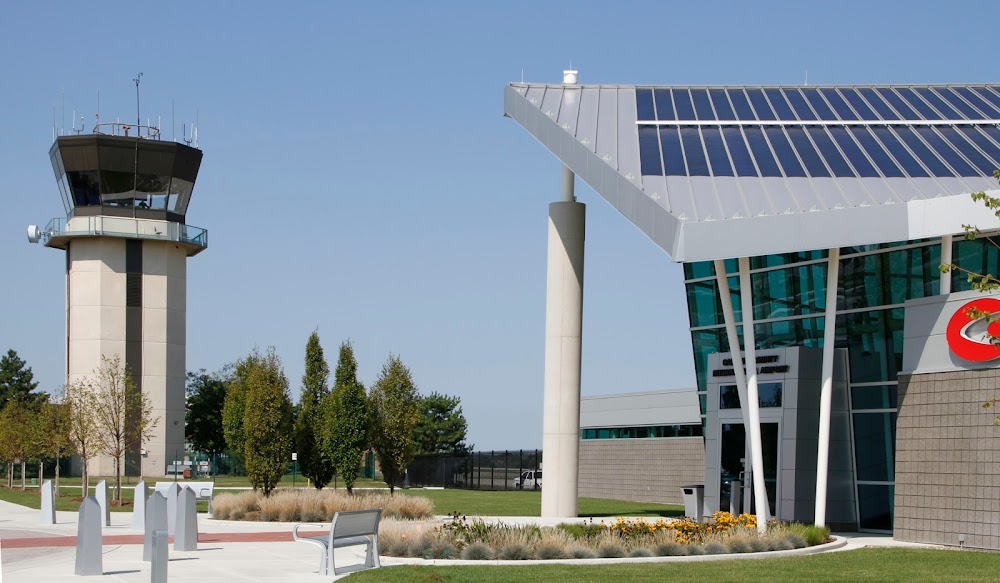
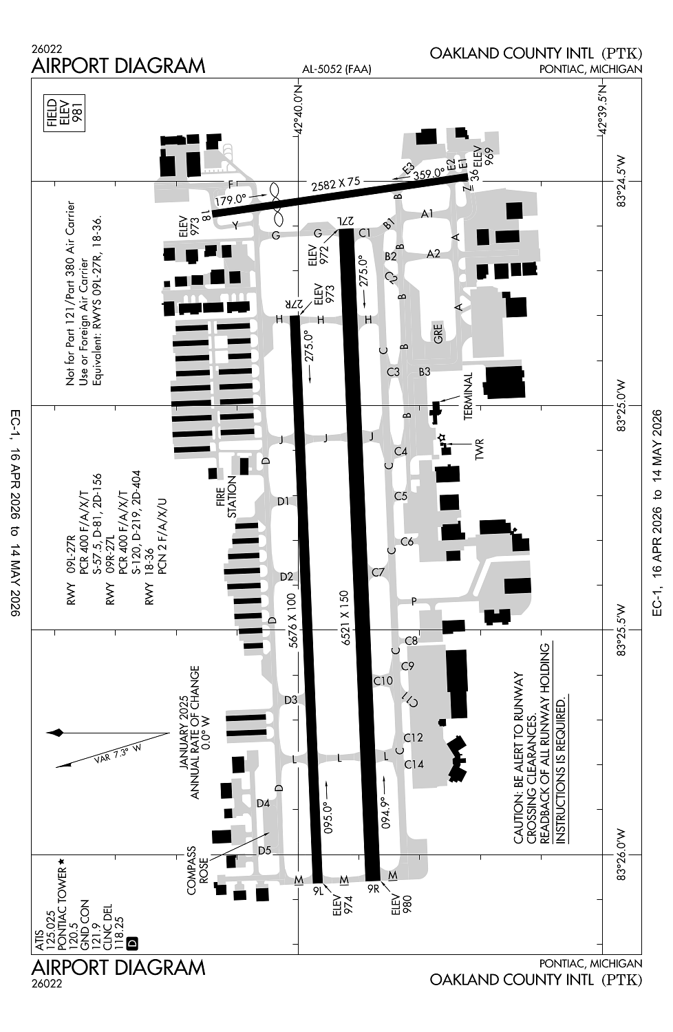
Location:
Pontiac, MI
Elevation:
980ft
Sectional:
Detroit
Activation date:
Apr 1940
Fuel:
100LL, A (prices)
Runway 09R/27L:
6,521ft
Runway 09L/27R:
5,676ft
Runway 18/36:
2,582ft
Access: Open to the public
Similar Airports

Current Weather — VFR
-
Weather data is strictly informational and not for flight planning purposes.
-
METAR2026-06-02 11:53:00 EDT
Ceiling: Sky clear Wind: 030° @ 9kt, gusts 17kt Temperature: 71°F Dewpoint: 39°F Weather: N/A Visbility: 10SM Clouds: Few @ 5,000ft, Scattered @ 25,000ft Raw:METAR KPTK 021553Z 03009G17KT 350V050 10SM FEW050 SCT250 22/04 A3036 RMK AO2 SLP281 T02170044 -
TAF2026-06-02 08:00:00 EDT – 2026-06-02 12:00:00 EDT
Ceiling: Sky clear Wind: 030° @ 3kt Weather: N/A Visbility: 6SM Clouds: @ ft Raw:TAF KPTK 021120Z 0212/0312 03003KT P6SM SKC FM021600 06011KT P6SM FEW250 FM030000 06006KT P6SM SKC -
TAF2026-06-02 12:00:00 EDT – 2026-06-02 20:00:00 EDT
Ceiling: Sky clear Wind: 060° @ 11kt Weather: N/A Visbility: 6SM Clouds: Few @ 25,000ft Raw:TAF KPTK 021120Z 0212/0312 03003KT P6SM SKC FM021600 06011KT P6SM FEW250 FM030000 06006KT P6SM SKC -
TAF2026-06-02 20:00:00 EDT – 2026-06-03 08:00:00 EDT
Ceiling: Sky clear Wind: 060° @ 6kt Weather: N/A Visbility: 6SM Clouds: @ ft Raw:TAF KPTK 021120Z 0212/0312 03003KT P6SM SKC FM021600 06011KT P6SM FEW250 FM030000 06006KT P6SM SKC
Click/tap to add an annotation marker to the map
No webcams added yet.
Remarks
- Clsd to skedd acr ops gtr than 9 pax seats. 48 hr ppr for index b svc & unsked acr ops gtr than 30 pax seats - call amgr.
- Atct una to see more than 200 ft south of rwy 36 thr and twy a2 btn twys a & b.
- Birds & deer on & invof arpt.
- Seaplane tkofs & ldgs prohibited on lake angelus 4.5 nm ene.
- Us cust user fee arpt call mon-fri 0700-1500 at 248-666-7717; mnm 3 hrs pn aft hrs call 734-942-9000.
Comments