Pirep is a free, collaborative database of all public and private airports. All pilots are welcome to contribute their local knowledge to any airport, no registration required.
Public
Undocumented
METAR / TAF
Edit Tags
No upcoming events. Is anything happening here soon?
Airport Statistics
- Local flying clubs
- Webcam links
- WiFi availability
Location:
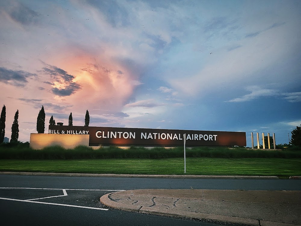
Little Rock, AR
Elevation:
266ft
Sectional:
Memphis
Activation date:
Apr 1940
Fuel:
100LL, A (prices)
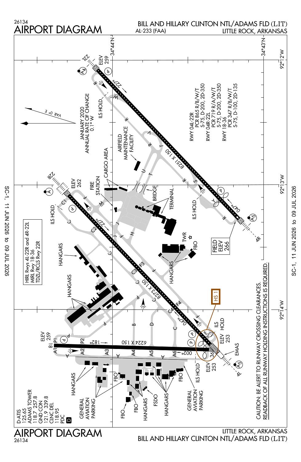
Runway 04L/22R:
8,273ft
Runway 04R/22L:
8,251ft
Runway 18/36:
6,224ft
Access: Open to the public
Current Weather — VFR
-
Weather data is strictly informational and not for flight planning purposes.
-
METAR2026-07-21 07:53:00 CDT
Ceiling: Sky clear Wind: 330° @ 6kt Temperature: 87°F Dewpoint: 75°F Weather: N/A Visbility: 10SM Clouds: Scattered @ 25,000ft Raw:METAR KLIT 211253Z 33006KT 10SM SCT250 31/24 A2988 RMK AO2 SLP116 T03060244 -
TAF2026-07-21 07:00:00 CDT – 2026-07-21 20:00:00 CDT
Ceiling: Sky clear Wind: 320° @ 8kt Weather: N/A Visbility: 6SM Clouds: @ ft Raw:TAF KLIT 211120Z 2112/2212 32008KT P6SM SKC FM220100 VRB06KT P6SM SCT250 TEMPO 2201/2204 3SM -TSRA SCT050CB FM220500 35010KT P6SM BKN250 -
TAF2026-07-21 20:00:00 CDT – 2026-07-22 00:00:00 CDT
Ceiling: Sky clear Wind: Variable Weather: N/A Visbility: 6SM Clouds: Scattered @ 25,000ft Raw:TAF KLIT 211120Z 2112/2212 32008KT P6SM SKC FM220100 VRB06KT P6SM SCT250 TEMPO 2201/2204 3SM -TSRA SCT050CB FM220500 35010KT P6SM BKN250 -
TAF2026-07-21 20:00:00 CDT – 2026-07-21 23:00:00 CDT
Ceiling: Sky clear Wind: 000° @ kt Weather: Light thunderstorm rain Visbility: 3SM Clouds: Scattered @ 5,000ft Raw:TAF KLIT 211120Z 2112/2212 32008KT P6SM SKC FM220100 VRB06KT P6SM SCT250 TEMPO 2201/2204 3SM -TSRA SCT050CB FM220500 35010KT P6SM BKN250 -
TAF2026-07-22 00:00:00 CDT – 2026-07-22 07:00:00 CDT
Ceiling: 25,000ft Wind: 350° @ 10kt Weather: N/A Visbility: 6SM Clouds: Broken @ 25,000ft Raw:TAF KLIT 211120Z 2112/2212 32008KT P6SM SKC FM220100 VRB06KT P6SM SCT250 TEMPO 2201/2204 3SM -TSRA SCT050CB FM220500 35010KT P6SM BKN250
Click/tap to add an annotation marker to the map
No webcams added yet.
Remarks
- Large concentrations of birds invof arpt; most activity btn sr-ss up to 1500 ft msl.
- Cargo & terminal ramps are non-movement areas.
- No general aviation parking on terminal or cargo ramp.
- Twy a 315 ft south of twy a6 intersection to rwy 36 clsd except acft with wingspan less than 79 ft.
- Be alert: north little rock muni airport is lctd 6 miles nnw with similar runway configurations.
Comments