Pirep is a free, collaborative database of all public and private airports. All pilots are welcome to contribute their local knowledge to any airport, no registration required.


No upcoming events. Is anything happening here soon?
Last updated: 2023-06-13 23:23:34 EDT
Airport Statistics
- Fuel pump location
- Crew car availability
- Landing & tie-down fees
Location:
Millville, NJ
Elevation:
84ft
Sectional:
Washington
Activation date:
May 1943
Fuel:
100LL, A (prices)
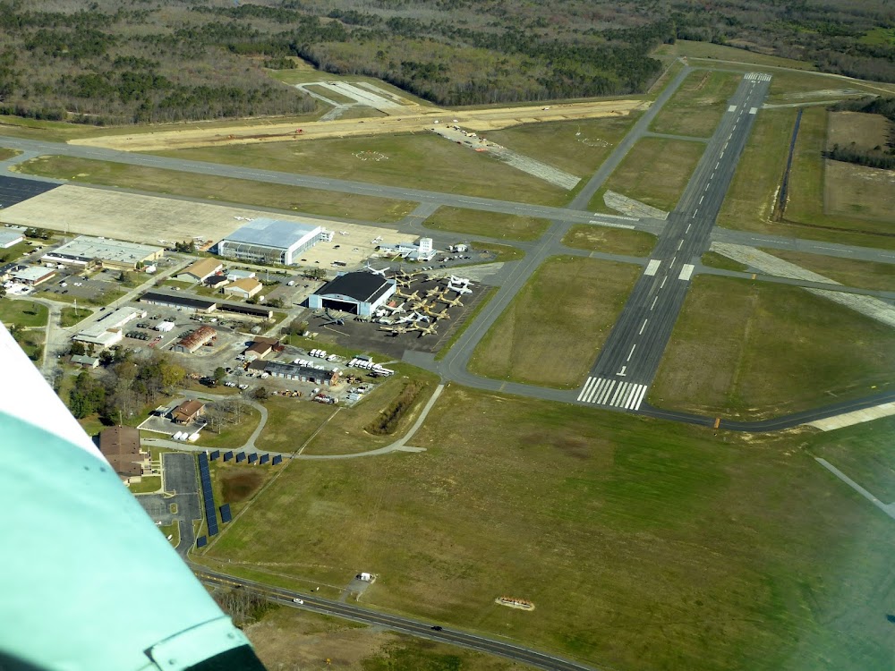
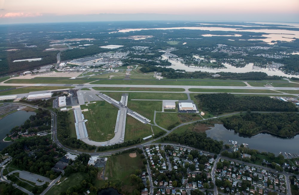
Runway 10/28:
6,003ft
Runway 14/32:
5,058ft
Access: Open to the public
Similar Airports
Current Weather — MVFR
-
Weather data is strictly informational and not for flight planning purposes.
-
METAR2026-07-29 04:54:00 EDT
Ceiling: 1,400ft Wind: 270° @ 6kt Temperature: 68°F Dewpoint: 66°F Weather: N/A Visbility: 8SM Clouds: Few @ 400ft, Overcast @ 1,400ft Raw:METAR KMIV 290854Z AUTO 27006KT 8SM FEW004 OVC014 20/19 A2957 RMK AO2 SLP010 T02000194 55005 -
TAF2026-07-29 02:00:00 EDT – 2026-07-29 03:00:00 EDT
Ceiling: 25,000ft Wind: 240° @ 3kt Weather: N/A Visbility: 6SM Clouds: Few @ 1,500ft, Broken @ 25,000ft Raw:TAF KMIV 290520Z 2906/3006 24003KT P6SM FEW015 BKN250 FM290700 29005KT P6SM BKN015 FM291200 31008KT P6SM BKN025 FM291600 31012G20KT P6SM BKN050 FM300000 30006KT P6SM FEW060 SCT250 -
TAF2026-07-29 03:00:00 EDT – 2026-07-29 08:00:00 EDT
Ceiling: 1,500ft Wind: 290° @ 5kt Weather: N/A Visbility: 6SM Clouds: Broken @ 1,500ft Raw:TAF KMIV 290520Z 2906/3006 24003KT P6SM FEW015 BKN250 FM290700 29005KT P6SM BKN015 FM291200 31008KT P6SM BKN025 FM291600 31012G20KT P6SM BKN050 FM300000 30006KT P6SM FEW060 SCT250 -
TAF2026-07-29 08:00:00 EDT – 2026-07-29 12:00:00 EDT
Ceiling: 2,500ft Wind: 310° @ 8kt Weather: N/A Visbility: 6SM Clouds: Broken @ 2,500ft Raw:TAF KMIV 290520Z 2906/3006 24003KT P6SM FEW015 BKN250 FM290700 29005KT P6SM BKN015 FM291200 31008KT P6SM BKN025 FM291600 31012G20KT P6SM BKN050 FM300000 30006KT P6SM FEW060 SCT250 -
TAF2026-07-29 12:00:00 EDT – 2026-07-29 20:00:00 EDT
Ceiling: 5,000ft Wind: 310° @ 12kt, gusts 20kt Weather: N/A Visbility: 6SM Clouds: Broken @ 5,000ft Raw:TAF KMIV 290520Z 2906/3006 24003KT P6SM FEW015 BKN250 FM290700 29005KT P6SM BKN015 FM291200 31008KT P6SM BKN025 FM291600 31012G20KT P6SM BKN050 FM300000 30006KT P6SM FEW060 SCT250 -
TAF2026-07-29 20:00:00 EDT – 2026-07-30 02:00:00 EDT
Ceiling: Sky clear Wind: 300° @ 6kt Weather: N/A Visbility: 6SM Clouds: Few @ 6,000ft, Scattered @ 25,000ft Raw:TAF KMIV 290520Z 2906/3006 24003KT P6SM FEW015 BKN250 FM290700 29005KT P6SM BKN015 FM291200 31008KT P6SM BKN025 FM291600 31012G20KT P6SM BKN050 FM300000 30006KT P6SM FEW060 SCT250
Click/tap to add an annotation marker to the map
No webcams added yet.
Remarks
- All ultralight acft, gldr ops & frmn flts ppr. call 856-825-1244 mon-fri 0800-1600.
- Paew wi all rwy & twy safety areas dly may-oct.
- Twy g not to be used by acft with wingspan gtr than 48 ft n of twy a.
- Main apn clsd to tsnt acft n of twy k.
- Birds on & invof arpt.
- For cd if una to ctc on fss freq, ctc atlantic city approach at 609-485-6193.
- Actvt malsr rwy 10; mirl 10/28 & 14/32 - ctaf.
- Self serv avbl 24 hrs with credit card.
Comments