Pirep is a free, collaborative database of all public and private airports. All pilots are welcome to contribute their local knowledge to any airport, no registration required.


Public
Undocumented
METAR / TAF
Edit Tags
No upcoming events. Is anything happening here soon?
Airport Statistics
- Fuel pump location
- Crew car availability
- Local flying clubs
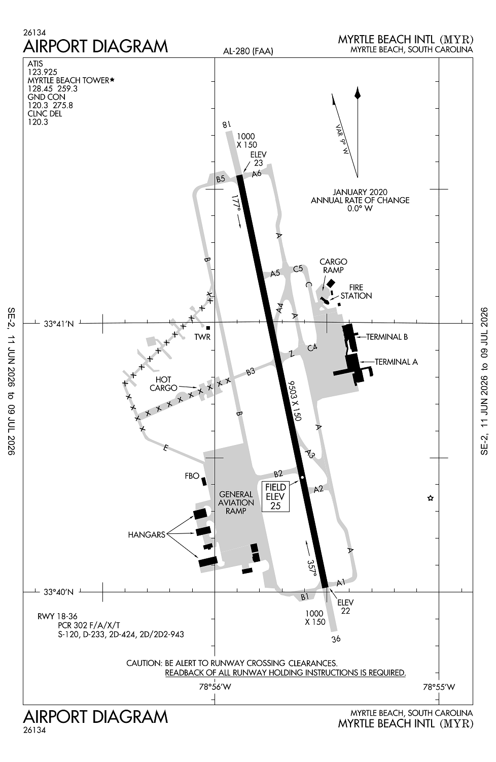
Location:
Myrtle Beach, SC
Elevation:
25ft
Sectional:
Charlotte
Activation date:
Oct 1937
Fuel:
100LL, A (prices)
Runway 18/36:
9,503ft
Access: Open to the public
Current Weather — VFR
-
Weather data is strictly informational and not for flight planning purposes.
-
METAR2026-07-16 01:53:00 EDT
Ceiling: Sky clear Wind: 250° @ 5kt Temperature: 78°F Dewpoint: 75°F Weather: N/A Visbility: 10SM Raw:METAR KMYR 160553Z AUTO 25005KT 10SM CLR 26/24 A3004 RMK AO2 SLP173 T02610239 10283 20256 58004 $ -
TAF2026-07-16 02:00:00 EDT – 2026-07-16 13:00:00 EDT
Ceiling: Sky clear Wind: Variable Weather: N/A Visbility: 6SM Clouds: @ ft Raw:TAF KMYR 160520Z 1606/1706 VRB03KT P6SM SKC FM161700 19012KT P6SM FEW150 -
TAF2026-07-16 13:00:00 EDT – 2026-07-17 02:00:00 EDT
Ceiling: Sky clear Wind: 190° @ 12kt Weather: N/A Visbility: 6SM Clouds: Few @ 15,000ft Raw:TAF KMYR 160520Z 1606/1706 VRB03KT P6SM SKC FM161700 19012KT P6SM FEW150
Click/tap to add an annotation marker to the map
No webcams added yet.
Remarks
- Existed prior to 1959.
- Gulls on & invof arpt.
- Apvl rqrd for pushback at trml gates a9, a10, a11, a12, a14. ctc myr gc 120.3; push is at pilot discretion all otr gates; rmn clr of twys.
- Ctc myr ops on ctaf 128.45 prior to lndg 2300-0600.
- Sightseeing hels oprg in close proximity of arpt and rwy at or blw 1200 ft. hel rtes and hldg points rmn clr of rwy cntrlns. hels depg/arrg pad lctd 700 ft sse apch end rwy 36.
Comments