Pirep is a free, collaborative database of all public and private airports. All pilots are welcome to contribute their local knowledge to any airport, no registration required.


No upcoming events. Is anything happening here soon?
Airport Statistics
- Webcam links
- Crew car availability
- Transient parking location
Location:
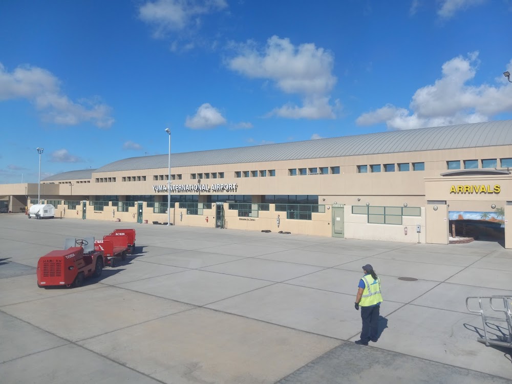
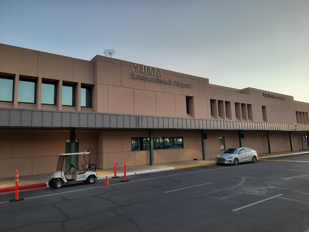
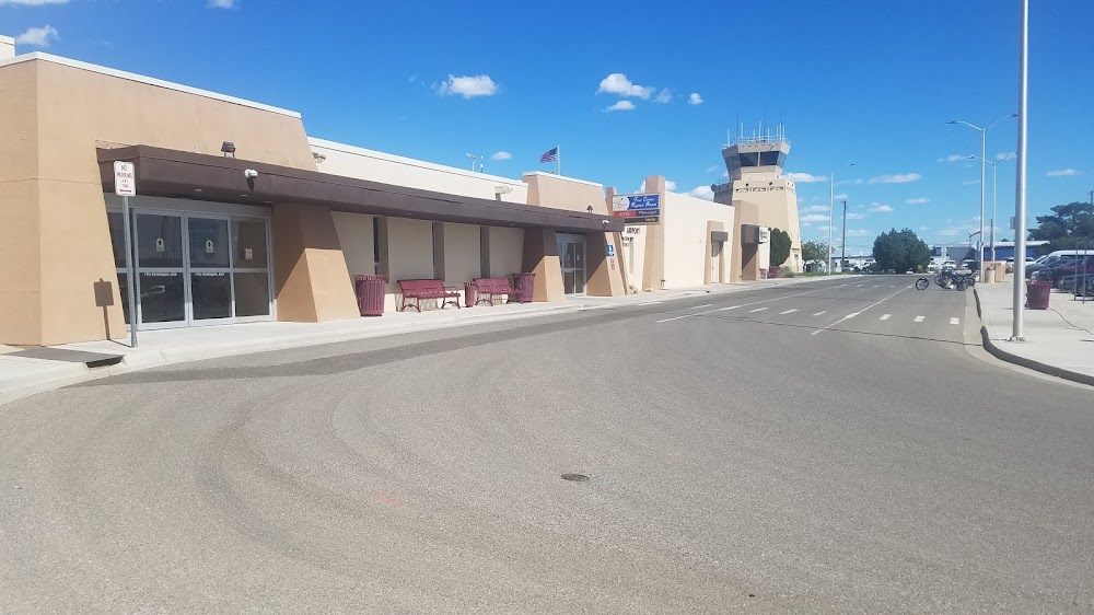
Yuma, AZ
Elevation:
213ft
Sectional:
Phoenix
Activation date:
Apr 1940
Fuel:
100, A, A+ (prices)
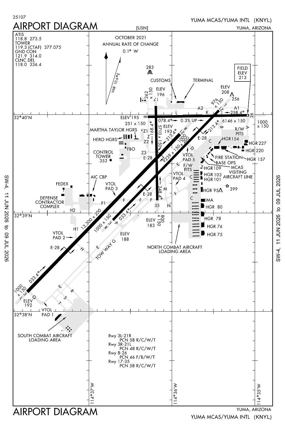
Runway 03L/21R:
13,300ft
Runway 03R/21L:
9,240ft
Runway 08/26:
6,146ft
Runway 17/35:
5,710ft
Access: Open to the public
Similar Airports
Current Weather — VFR
-
Weather data is strictly informational and not for flight planning purposes.
-
METAR2026-07-20 14:57:00 MST
Ceiling: Sky clear Wind: 180° @ 4kt Temperature: 105°F Dewpoint: 64°F Weather: N/A Visbility: 10SM Clouds: Scattered @ 11,000ft Raw:METAR KNYL 202157Z 18004KT 10SM SCT110 41/18 A2975 RMK AO2 SLP071 T04060183 -
TAF2026-07-20 09:00:00 MST – 2026-07-20 18:00:00 MST
Ceiling: 10,000ft Wind: 170° @ 9kt Weather: N/A Visbility: 6SM Clouds: Broken @ 10,000ft Raw:TAF KNYL 201600Z 2016/2122 17009KT 9999 BKN100 QNH2982INS BECMG 2101/2103 23010KT 9999 SCT110 QNH2975INS FM211500 16006KT 9999 SCT110 QNH2987INS BECMG 2118/2120 23007KT 9999 FEW110 QNH2986INS TX42/2121Z TN26/2113Z -
TAF2026-07-20 18:00:00 MST – 2026-07-21 08:00:00 MST
Ceiling: Sky clear Wind: 230° @ 10kt Weather: N/A Visbility: 6SM Clouds: Scattered @ 11,000ft Raw:TAF KNYL 201600Z 2016/2122 17009KT 9999 BKN100 QNH2982INS BECMG 2101/2103 23010KT 9999 SCT110 QNH2975INS FM211500 16006KT 9999 SCT110 QNH2987INS BECMG 2118/2120 23007KT 9999 FEW110 QNH2986INS TX42/2121Z TN26/2113Z -
TAF2026-07-21 08:00:00 MST – 2026-07-21 11:00:00 MST
Ceiling: Sky clear Wind: 160° @ 6kt Weather: N/A Visbility: 6SM Clouds: Scattered @ 11,000ft Raw:TAF KNYL 201600Z 2016/2122 17009KT 9999 BKN100 QNH2982INS BECMG 2101/2103 23010KT 9999 SCT110 QNH2975INS FM211500 16006KT 9999 SCT110 QNH2987INS BECMG 2118/2120 23007KT 9999 FEW110 QNH2986INS TX42/2121Z TN26/2113Z -
TAF2026-07-21 11:00:00 MST – 2026-07-21 15:00:00 MST
Ceiling: Sky clear Wind: 230° @ 7kt Weather: N/A Visbility: 6SM Clouds: Few @ 11,000ft Raw:TAF KNYL 201600Z 2016/2122 17009KT 9999 BKN100 QNH2982INS BECMG 2101/2103 23010KT 9999 SCT110 QNH2975INS FM211500 16006KT 9999 SCT110 QNH2987INS BECMG 2118/2120 23007KT 9999 FEW110 QNH2986INS TX42/2121Z TN26/2113Z
Click/tap to add an annotation marker to the map
No webcams added yet.
Remarks
- Established prior to 5/15/59.
- Ctn: tfc pat rwy 03l/r & 21l/r overlap tfc pat rwy 08/26 & 17/35.
- 976 ft stwy rwy 03r; 1000 ft stwy rwy 21l; 1000 ft stwy rwy 03l; 1000 ft stwy rwy 21r; 1000 ft stwy rwy 08; 251 ft stwy rwy 26; 800 ft stwy rwy 17; 262 ft stwy rwy 35.
- Mil arpt ops - 928-269-2077.
- Gen avn & acr vfr dep fly rwy hdg mntn 1200 ft until outside ata unless otrw apvd by twr.
Comments