Pirep is a free, collaborative database of all public and private airports. All pilots are welcome to contribute their local knowledge to any airport, no registration required.

Public
Undocumented
METAR / TAF
Edit Tags
No upcoming events. Is anything happening here soon?
Airport Statistics
- General description
- Webcam links
- Local flying clubs
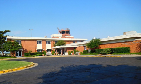
Location:
Norman, OK
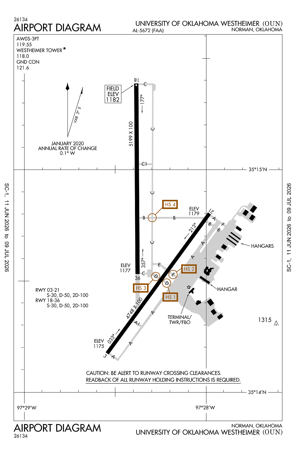
Elevation:
1,181ft
Sectional:
Dallas Ft Worth
Activation date:
Jan 1941
Fuel:
100LL, A+ (prices)
Runway 18/36:
5,199ft
Runway 03/21:
4,748ft
Access: Open to the public
Current Weather — VFR
-
Weather data is strictly informational and not for flight planning purposes.
-
METAR2026-07-15 20:45:00 CDT
Ceiling: Sky clear Wind: 070° @ 7kt Temperature: 78°F Dewpoint: 71°F Weather: N/A Visbility: 10SM Raw:METAR KOUN 160145Z 07007KT 10SM CLR 26/22 A3002 -
TAF2026-07-15 19:00:00 CDT – 2026-07-16 01:00:00 CDT
Ceiling: 25,000ft Wind: 140° @ 6kt Weather: N/A Visbility: 6SM Clouds: Scattered @ 4,000ft, Broken @ 25,000ft Raw:TAF KOUN 152320Z 1600/1624 14006KT P6SM SCT040 BKN250 FM160600 17005KT P6SM SCT250 FM161500 18013G22KT P6SM SCT035 SCT250 -
TAF2026-07-16 01:00:00 CDT – 2026-07-16 10:00:00 CDT
Ceiling: Sky clear Wind: 170° @ 5kt Weather: N/A Visbility: 6SM Clouds: Scattered @ 25,000ft Raw:TAF KOUN 152320Z 1600/1624 14006KT P6SM SCT040 BKN250 FM160600 17005KT P6SM SCT250 FM161500 18013G22KT P6SM SCT035 SCT250 -
TAF2026-07-16 10:00:00 CDT – 2026-07-16 19:00:00 CDT
Ceiling: Sky clear Wind: 180° @ 13kt, gusts 22kt Weather: N/A Visbility: 6SM Clouds: Scattered @ 3,500ft, Scattered @ 25,000ft Raw:TAF KOUN 152320Z 1600/1624 14006KT P6SM SCT040 BKN250 FM160600 17005KT P6SM SCT250 FM161500 18013G22KT P6SM SCT035 SCT250
Click/tap to add an annotation marker to the map
No webcams added yet.
Remarks
- This airport has been surveyed by the national geodetic survey.
- Pre dates the act.
- 180 deg turns prohibited on rwys for all other than single engine light acft.
- Ctn: coyotes & birds on & invof of rwys.
- High density student opns invof arpt & 5 miles south.
Comments