Pirep is a free, collaborative database of all public and private airports. All pilots are welcome to contribute their local knowledge to any airport, no registration required.
No upcoming events. Is anything happening here soon?
Last updated: 2023-12-10 16:54:50 EST
Last updated: 2023-03-29 09:45:31 EDT
Last updated: 2024-03-04 22:13:59 EST
Airport Statistics
- Landing & tie-down fees
- WiFi availability
- Crew car availability
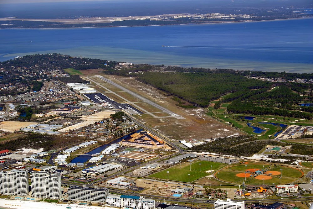
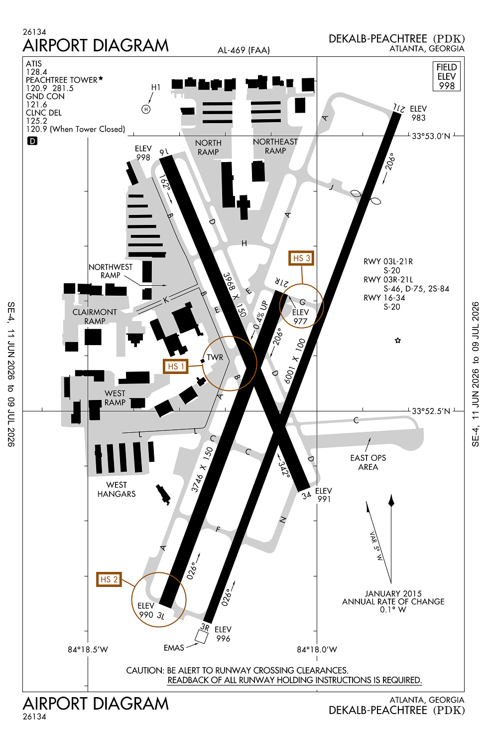
Location:
Atlanta, GA
Elevation:
998ft
Sectional:
Atlanta
Fuel:
100LL, A, A+ (prices)
Runway 03R/21L:
6,001ft
Runway 16/34:
3,968ft
Runway 03L/21R:
3,746ft
Runway H1:
56ft
Access: Open to the public
Similar Airports
Current Weather — VFR
-
Weather data is strictly informational and not for flight planning purposes.
-
METAR2026-07-20 03:53:00 EDT
Ceiling: Sky clear Wind: Calm Temperature: 71°F Dewpoint: 71°F Weather: N/A Visbility: 7SM Raw:METAR KPDK 200753Z 00000KT 7SM CLR 22/22 A2996 RMK AO2 SLP132 T02220217 -
TAF2026-07-20 02:00:00 EDT – 2026-07-20 10:00:00 EDT
Ceiling: Sky clear Wind: Calm Weather: N/A Visbility: 6SM Clouds: Scattered @ 25,000ft Raw:TAF KPDK 200520Z 2006/2106 00000KT P6SM SCT250 FM201400 21004KT P6SM SCT025 SCT100 FM201600 20005KT P6SM SCT040 PROB30 2020/2024 4SM -TSRA BKN035CB FM210000 VRB03KT P6SM FEW100 SCT250 -
TAF2026-07-20 10:00:00 EDT – 2026-07-20 12:00:00 EDT
Ceiling: Sky clear Wind: 210° @ 4kt Weather: N/A Visbility: 6SM Clouds: Scattered @ 2,500ft, Scattered @ 10,000ft Raw:TAF KPDK 200520Z 2006/2106 00000KT P6SM SCT250 FM201400 21004KT P6SM SCT025 SCT100 FM201600 20005KT P6SM SCT040 PROB30 2020/2024 4SM -TSRA BKN035CB FM210000 VRB03KT P6SM FEW100 SCT250 -
TAF2026-07-20 12:00:00 EDT – 2026-07-20 20:00:00 EDT
Ceiling: Sky clear Wind: 200° @ 5kt Weather: N/A Visbility: 6SM Clouds: Scattered @ 4,000ft Raw:TAF KPDK 200520Z 2006/2106 00000KT P6SM SCT250 FM201400 21004KT P6SM SCT025 SCT100 FM201600 20005KT P6SM SCT040 PROB30 2020/2024 4SM -TSRA BKN035CB FM210000 VRB03KT P6SM FEW100 SCT250 -
TAF2026-07-20 16:00:00 EDT – 2026-07-20 20:00:00 EDT
Ceiling: 3,500ft Wind: 000° @ kt Weather: Light thunderstorm rain Visbility: 4SM Clouds: Broken @ 3,500ft Raw:TAF KPDK 200520Z 2006/2106 00000KT P6SM SCT250 FM201400 21004KT P6SM SCT025 SCT100 FM201600 20005KT P6SM SCT040 PROB30 2020/2024 4SM -TSRA BKN035CB FM210000 VRB03KT P6SM FEW100 SCT250 -
TAF2026-07-20 20:00:00 EDT – 2026-07-21 02:00:00 EDT
Ceiling: Sky clear Wind: Variable Weather: N/A Visbility: 6SM Clouds: Few @ 10,000ft, Scattered @ 25,000ft Raw:TAF KPDK 200520Z 2006/2106 00000KT P6SM SCT250 FM201400 21004KT P6SM SCT025 SCT100 FM201600 20005KT P6SM SCT040 PROB30 2020/2024 4SM -TSRA BKN035CB FM210000 VRB03KT P6SM FEW100 SCT250
Click/tap to add an annotation marker to the map
No webcams added yet.
Remarks
- Existed prior to 1959.
- Arff on field, no index.
- Voluntary night curfew in effect from 2300-0600. no high power engine/maintenance runups from 2200-0700.
- Noise sensitive areas all quadrants. pilots use close-in departure procedures.
- Heavy vfr helo ops nw corner and eastside of arpt. heli lctd north of ry 16 thld.
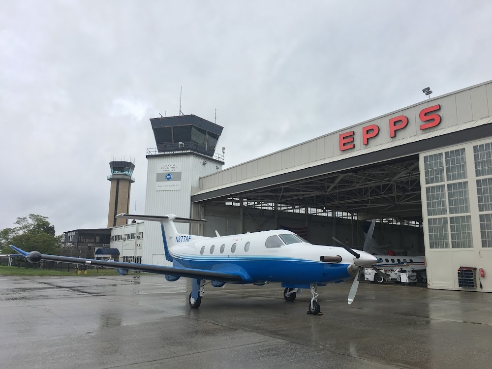
The Downwind Restaurant is located on the airport, and is a short walk from transient parking at Epps Aviation.