Pirep is a free, collaborative database of all public and private airports. All pilots are welcome to contribute their local knowledge to any airport, no registration required.


No upcoming events. Is anything happening here soon?
Last updated: 2023-05-09 22:24:57 MST
Airport Statistics
- Crew car availability
- Transient parking location
- Local flying clubs
Location:
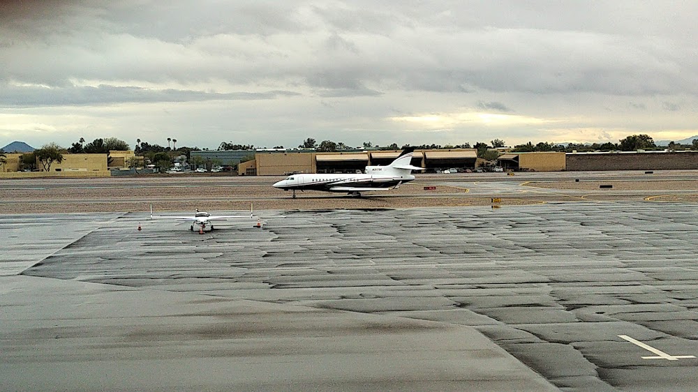
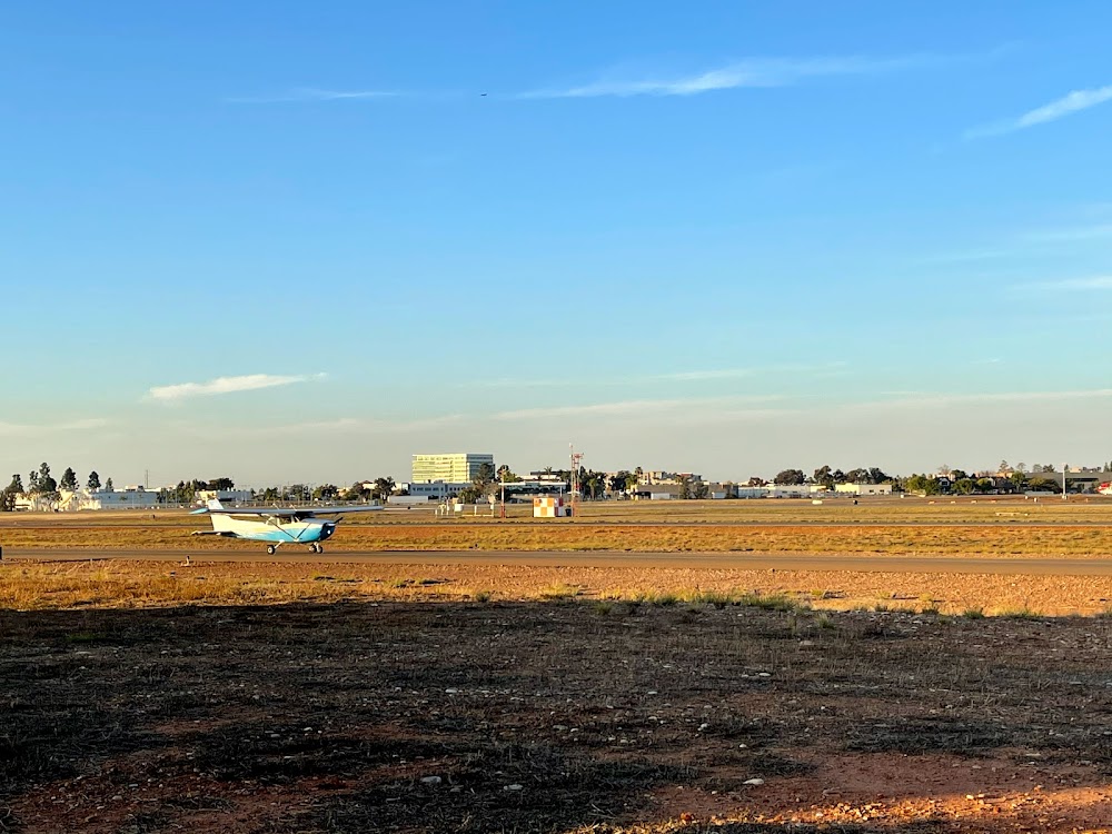
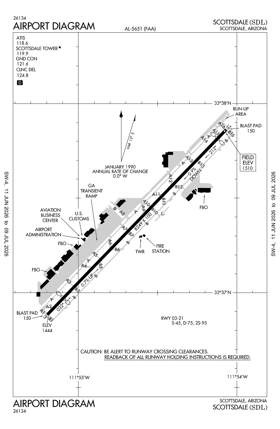
Scottsdale, AZ
Elevation:
1,510ft
Sectional:
Phoenix
Activation date:
Mar 1943
Fuel:
100LL, A1+ (prices)
Runway 03/21:
8,249ft
Access: Open to the public
Similar Airports

Current Weather — VFR
-
Weather data is strictly informational and not for flight planning purposes.
-
METAR2026-07-20 20:53:00 MST
Ceiling: 10,000ft Wind: 080° @ 11kt, gusts 36kt Temperature: 80°F Dewpoint: 66°F Weather: Rain Visbility: 6SM Clouds: Few @ 2,300ft, Broken @ 10,000ft, Broken @ 12,000ft Raw:METAR KSDL 210353Z 08011G36KT 6SM RA FEW023 BKN100 BKN120 27/19 A2991 RMK AO2 PK WND 06044/0332 WSHFT 0312 LTG DSNT N-E RAB33 SLP101 P0007 T02670194 -
TAF2026-07-20 20:00:00 MST – 2026-07-20 23:00:00 MST
Ceiling: 8,000ft Wind: 040° @ 13kt, gusts 22kt Weather: Showers in vicinity Visbility: 6SM Clouds: Broken @ 8,000ft, Broken @ 12,000ft, Broken @ 20,000ft Raw:TAF KSDL 210255Z 2103/2124 04013G22KT P6SM VCSH BKN080 BKN120 BKN200 TEMPO 2103/2105 04020G32KT FM210600 08006KT P6SM SCT080 BKN140 BKN250 FM210900 VRB04KT P6SM SCT080 BKN140 BKN250 FM211600 16005KT P6SM FEW090 SCT140 SCT250 FM211900 22006KT P6SM FEW090 SCT140 SCT250 -
TAF2026-07-20 20:00:00 MST – 2026-07-20 22:00:00 MST
Ceiling: Sky clear Wind: 040° @ 20kt, gusts 32kt Weather: N/A Visbility: SM Raw:TAF KSDL 210255Z 2103/2124 04013G22KT P6SM VCSH BKN080 BKN120 BKN200 TEMPO 2103/2105 04020G32KT FM210600 08006KT P6SM SCT080 BKN140 BKN250 FM210900 VRB04KT P6SM SCT080 BKN140 BKN250 FM211600 16005KT P6SM FEW090 SCT140 SCT250 FM211900 22006KT P6SM FEW090 SCT140 SCT250 -
TAF2026-07-20 23:00:00 MST – 2026-07-21 02:00:00 MST
Ceiling: 14,000ft Wind: 080° @ 6kt Weather: N/A Visbility: 6SM Clouds: Scattered @ 8,000ft, Broken @ 14,000ft, Broken @ 25,000ft Raw:TAF KSDL 210255Z 2103/2124 04013G22KT P6SM VCSH BKN080 BKN120 BKN200 TEMPO 2103/2105 04020G32KT FM210600 08006KT P6SM SCT080 BKN140 BKN250 FM210900 VRB04KT P6SM SCT080 BKN140 BKN250 FM211600 16005KT P6SM FEW090 SCT140 SCT250 FM211900 22006KT P6SM FEW090 SCT140 SCT250 -
TAF2026-07-21 02:00:00 MST – 2026-07-21 09:00:00 MST
Ceiling: 14,000ft Wind: Variable Weather: N/A Visbility: 6SM Clouds: Scattered @ 8,000ft, Broken @ 14,000ft, Broken @ 25,000ft Raw:TAF KSDL 210255Z 2103/2124 04013G22KT P6SM VCSH BKN080 BKN120 BKN200 TEMPO 2103/2105 04020G32KT FM210600 08006KT P6SM SCT080 BKN140 BKN250 FM210900 VRB04KT P6SM SCT080 BKN140 BKN250 FM211600 16005KT P6SM FEW090 SCT140 SCT250 FM211900 22006KT P6SM FEW090 SCT140 SCT250 -
TAF2026-07-21 09:00:00 MST – 2026-07-21 12:00:00 MST
Ceiling: Sky clear Wind: 160° @ 5kt Weather: N/A Visbility: 6SM Clouds: Few @ 9,000ft, Scattered @ 14,000ft, Scattered @ 25,000ft Raw:TAF KSDL 210255Z 2103/2124 04013G22KT P6SM VCSH BKN080 BKN120 BKN200 TEMPO 2103/2105 04020G32KT FM210600 08006KT P6SM SCT080 BKN140 BKN250 FM210900 VRB04KT P6SM SCT080 BKN140 BKN250 FM211600 16005KT P6SM FEW090 SCT140 SCT250 FM211900 22006KT P6SM FEW090 SCT140 SCT250 -
TAF2026-07-21 12:00:00 MST – 2026-07-21 17:00:00 MST
Ceiling: Sky clear Wind: 220° @ 6kt Weather: N/A Visbility: 6SM Clouds: Few @ 9,000ft, Scattered @ 14,000ft, Scattered @ 25,000ft Raw:TAF KSDL 210255Z 2103/2124 04013G22KT P6SM VCSH BKN080 BKN120 BKN200 TEMPO 2103/2105 04020G32KT FM210600 08006KT P6SM SCT080 BKN140 BKN250 FM210900 VRB04KT P6SM SCT080 BKN140 BKN250 FM211600 16005KT P6SM FEW090 SCT140 SCT250 FM211900 22006KT P6SM FEW090 SCT140 SCT250
Click/tap to add an annotation marker to the map
No webcams added yet.
Remarks
- Wildlife invof rwy.
- Tgl na 2130-0600.
- Maint runup na 2200-0700.
- Mil arr 24 hr ppr - 480-312-8478.
- Midfield dep na.
Comments