Pirep is a free, collaborative database of all public and private airports. All pilots are welcome to contribute their local knowledge to any airport, no registration required.
Undocumented
METAR / TAF
Edit Tags
No upcoming events. Is anything happening here soon?
Airport Statistics
- Airport photos
- Transient parking location
- Fuel pump location
Location:
Sumter, SC
Elevation:
241ft
Sectional:
Charlotte
Activation date:
Jun 1942
Fuel:
A++
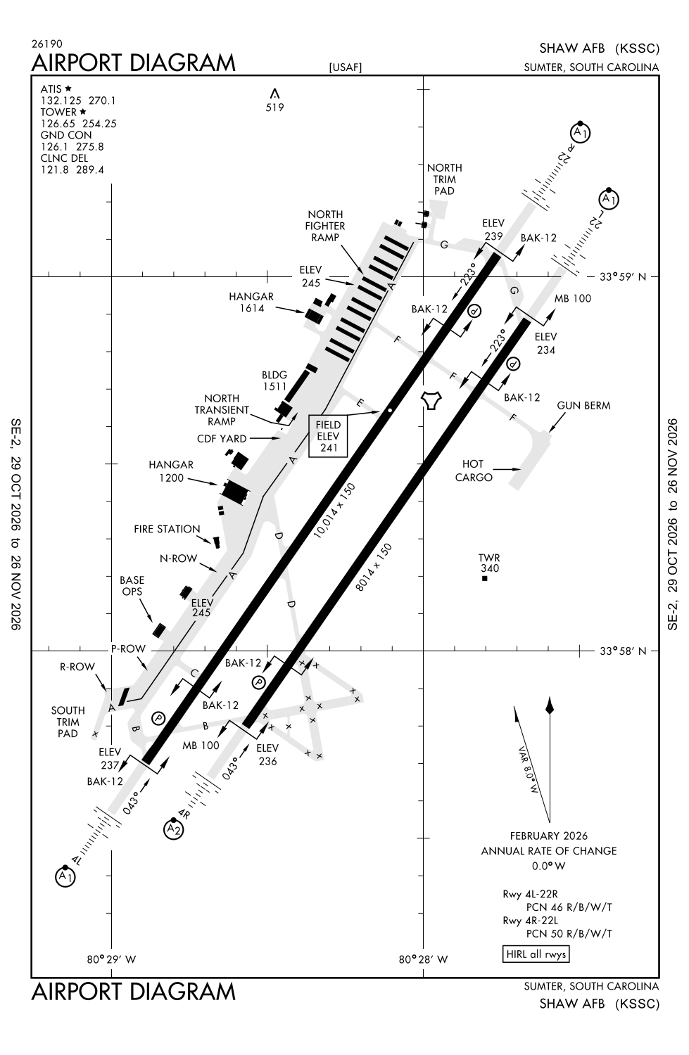
Runway 04L/22R:
10,014ft
Runway 04R/22L:
8,014ft
Access: Private to everyone
This is a military facility.
Current Weather — VFR
-
Weather data is strictly informational and not for flight planning purposes.
-
METAR2026-11-14 13:55:00 EST
Ceiling: Sky clear Wind: 330° @ 8kt Temperature: 58°F Dewpoint: 27°F Weather: N/A Visbility: 10SM Clouds: Scattered @ 6,500ft Raw:METAR KSSC 141855Z 33008KT 10SM SCT065 15/M03 A3003 RMK AO2A SLP171 T01481026 $ -
TAF2026-11-14 11:00:00 EST – 2026-11-14 14:00:00 EST
Ceiling: Sky clear Wind: 360° @ 9kt Weather: N/A Visbility: 6SM Clouds: @ ft Raw:TAF KSSC 141600Z 1416/1522 36009KT 9999 SKC QNH3005INS BECMG 1419/1420 36009KT 9999 SCT060 QNH3005INS BECMG 1500/1501 36006KT 9999 SKC QNH3014INS TX15/1420Z TN01/1512Z -
TAF2026-11-14 14:00:00 EST – 2026-11-14 19:00:00 EST
Ceiling: Sky clear Wind: 360° @ 9kt Weather: N/A Visbility: 6SM Clouds: Scattered @ 6,000ft Raw:TAF KSSC 141600Z 1416/1522 36009KT 9999 SKC QNH3005INS BECMG 1419/1420 36009KT 9999 SCT060 QNH3005INS BECMG 1500/1501 36006KT 9999 SKC QNH3014INS TX15/1420Z TN01/1512Z -
TAF2026-11-14 19:00:00 EST – 2026-11-15 17:00:00 EST
Ceiling: Sky clear Wind: 360° @ 6kt Weather: N/A Visbility: 6SM Clouds: @ ft Raw:TAF KSSC 141600Z 1416/1522 36009KT 9999 SKC QNH3005INS BECMG 1419/1420 36009KT 9999 SCT060 QNH3005INS BECMG 1500/1501 36006KT 9999 SKC QNH3014INS TX15/1420Z TN01/1512Z
Click/tap to add an annotation marker to the map
No webcams added yet.
Remarks
- Bearing strength rwy 04l-22r: st175; sbtt576, ddt745.
- Bearing strength rwy 04r-22l: st130; sbtt351; ddt490.
- Lgt: all rwy thr lgt gated.
- A-gear: nml bak-12 configuration: both rwy 04l/22r ovrn a-g bak-12s are in the raised posn. rwy 04l/22r approach end cable disconnected. rwy 04r/22l, all cables in raised posn. bak-12a are nstd 900 ft run out, 1/4 in cable and 50000 lb wt setting. call twr or base ops at least 20 min in advance to req other configurations.
- Jasu: 2(m32a-60) 2(a/m32a-86).
Comments