Pirep is a free, collaborative database of all public and private airports. All pilots are welcome to contribute their local knowledge to any airport, no registration required.
Undocumented
METAR / TAF
Edit Tags
No upcoming events. Is anything happening here soon?
Airport Statistics
- Crew car availability
- Airport photos
- WiFi availability
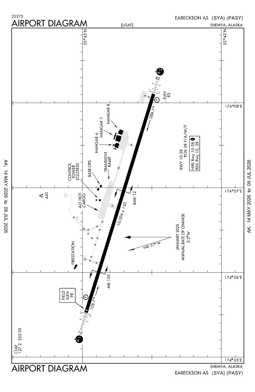
Location:
Shemya, AK
Elevation:
97ft
Sectional:
W Aleutian Isls
Activation date:
May 1949
Fuel:
None
Runway 10/28:
10,004ft
Access: Private to everyone
This is a military facility.
Click/tap to add an annotation marker to the map
No webcams added yet.
Remarks
- This airport has been surveyed by the national geodetic survey.
- 352.050 uhf.
- Customs unavbl.
- Arff index 7c
- Hills 8 nm w 662 ft msl.
Comments