Pirep is a free, collaborative database of all public and private airports. All pilots are welcome to contribute their local knowledge to any airport, no registration required.

Public
Undocumented
METAR / TAF
Edit Tags
No upcoming events. Is anything happening here soon?
Airport Statistics
- Crew car availability
- Airport photos
- Local flying clubs
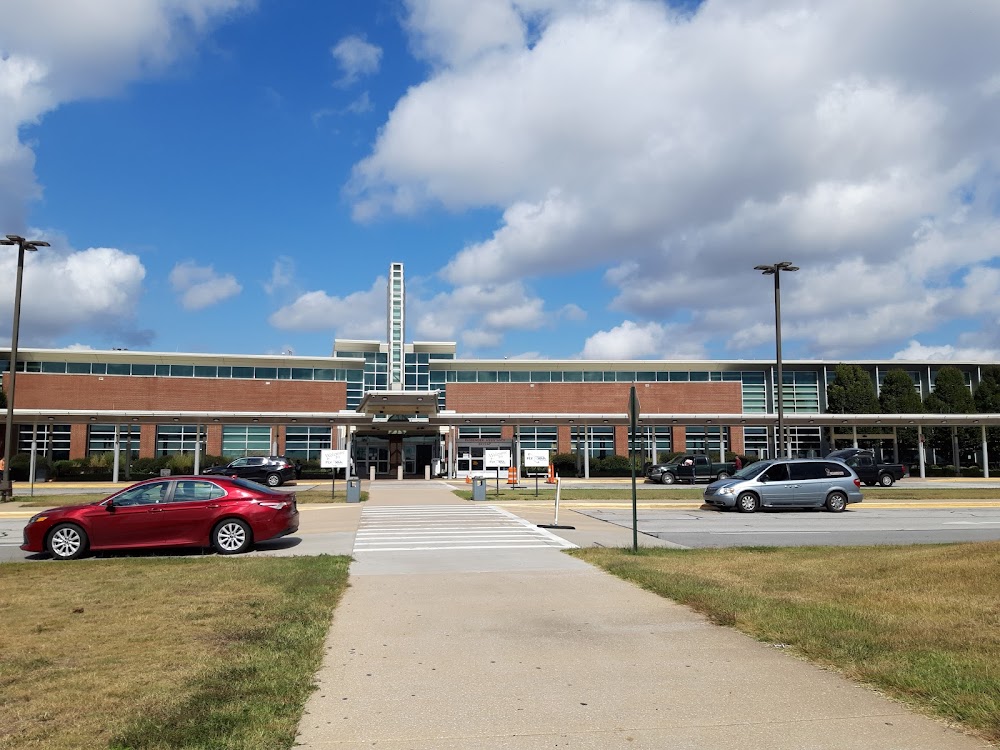
Location:
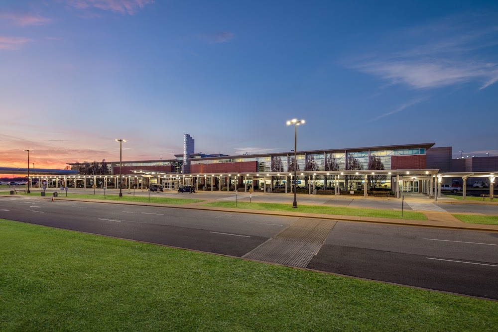
Fayetteville/Springdale/Rogers, AR
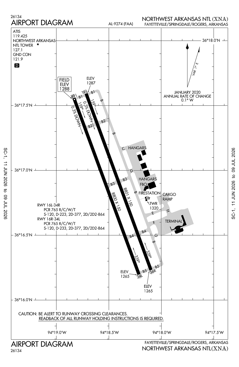
Elevation:
1,288ft
Sectional:
Kansas City
Activation date:
Apr 1997
Fuel:
100LL, A (prices)
Runway 16/34:
8,801ft
Runway 16L/34R:
8,801ft
Runway 17/35:
8,800ft
Runway 16R/34L:
8,800ft
Access: Open to the public
Current Weather — VFR
-
Weather data is strictly informational and not for flight planning purposes.
-
METAR2026-07-16 14:53:00 CDT
Ceiling: Sky clear Wind: 210° @ 7kt Temperature: 86°F Dewpoint: 69°F Weather: N/A Visbility: 10SM Clouds: Scattered @ 3,700ft Raw:METAR KXNA 161953Z 21007KT 10SM SCT037 30/21 A3014 RMK AO2 SLP191 T03000211 -
TAF2026-07-16 13:00:00 CDT – 2026-07-16 20:00:00 CDT
Ceiling: Sky clear Wind: 230° @ 7kt Weather: N/A Visbility: 6SM Clouds: Scattered @ 4,000ft, Scattered @ 12,000ft Raw:TAF KXNA 161728Z 1618/1718 23007KT P6SM SCT040 SCT120 PROB30 1619/1701 VRB15G25KT 5SM -TSRA BKN025CB FM170100 19004KT P6SM BKN150 FM171500 22008KT P6SM SCT040 BKN150 -
TAF2026-07-16 14:00:00 CDT – 2026-07-16 20:00:00 CDT
Ceiling: 2,500ft Wind: Variable, gusts 25kt Weather: Light thunderstorm rain Visbility: 5SM Clouds: Broken @ 2,500ft Raw:TAF KXNA 161728Z 1618/1718 23007KT P6SM SCT040 SCT120 PROB30 1619/1701 VRB15G25KT 5SM -TSRA BKN025CB FM170100 19004KT P6SM BKN150 FM171500 22008KT P6SM SCT040 BKN150 -
TAF2026-07-16 20:00:00 CDT – 2026-07-17 10:00:00 CDT
Ceiling: 15,000ft Wind: 190° @ 4kt Weather: N/A Visbility: 6SM Clouds: Broken @ 15,000ft Raw:TAF KXNA 161728Z 1618/1718 23007KT P6SM SCT040 SCT120 PROB30 1619/1701 VRB15G25KT 5SM -TSRA BKN025CB FM170100 19004KT P6SM BKN150 FM171500 22008KT P6SM SCT040 BKN150 -
TAF2026-07-17 10:00:00 CDT – 2026-07-17 13:00:00 CDT
Ceiling: 15,000ft Wind: 220° @ 8kt Weather: N/A Visbility: 6SM Clouds: Scattered @ 4,000ft, Broken @ 15,000ft Raw:TAF KXNA 161728Z 1618/1718 23007KT P6SM SCT040 SCT120 PROB30 1619/1701 VRB15G25KT 5SM -TSRA BKN025CB FM170100 19004KT P6SM BKN150 FM171500 22008KT P6SM SCT040 BKN150
Click/tap to add an annotation marker to the map
No webcams added yet.
Remarks
- See airspace ltr dated 2/26/97.
- Dstc & direction to arpt fm springdale is 10 nm nw & fm rogers msa is 9 nm sw.
- Bird activity on & invof arpt.
- Ctn elevated rwy thld lgts aer rwys 16l & 34r.
- For cd ctc memphis artcc at 901-368-8453/8449.
Comments