Pirep is a free, collaborative database of all public and private airports. All pilots are welcome to contribute their local knowledge to any airport, no registration required.


Undocumented
METAR / TAF
Edit Tags
No upcoming events. Is anything happening here soon?
Airport Statistics
- Local flying clubs
- Webcam links
- General description
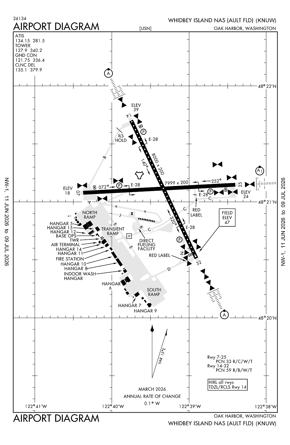
Location:
Oak Harbor, WA
Elevation:
47ft
Sectional:
Seattle
Activation date:
Jan 1950
Fuel:
100LL, J5, J8 (prices)
Runway 14/32:
8,001ft
Runway 07/25:
7,999ft
Access: Private to everyone
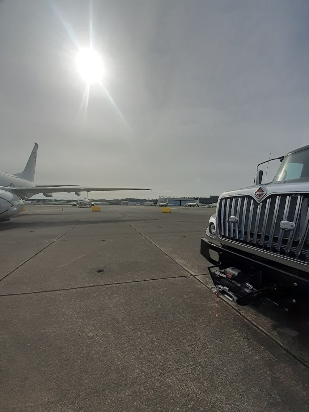
This is a military facility.
Current Weather — VFR
-
Weather data is strictly informational and not for flight planning purposes.
-
METAR2026-07-20 23:53:00 PDT
Ceiling: 23,000ft Wind: Calm Temperature: 57°F Dewpoint: 53°F Weather: N/A Visbility: 10SM Clouds: Scattered @ 18,000ft, Broken @ 23,000ft Raw:METAR KNUW 210653Z 00000KT 10SM SCT180 BKN230 14/12 A2996 RMK AO2 SLP149 T01390117 $ -
TAF2026-07-21 00:00:00 PDT – 2026-07-21 01:00:00 PDT
Ceiling: 23,000ft Wind: Variable Weather: N/A Visbility: 6SM Clouds: Scattered @ 18,000ft, Broken @ 23,000ft Raw:TAF COR KNUW 210700Z 2107/2207 VRB06KT 9999 SCT180 BKN230 QNH2992INS FM210800 VRB06KT 9000 FU HZ FEW150 SCT200 BKN250 QNH2994INS TEMPO 2111/2117 22007KT 3200 BR BCFG BKN004 FM220000 VRB06KT 9999 SCT160 BKN230 QNH2990INS TX19/2122Z TN11/2112Z COR 0713 FS30227 -
TAF2026-07-21 01:00:00 PDT – 2026-07-21 17:00:00 PDT
Ceiling: 25,000ft Wind: Variable Weather: Smoke, haze Visbility: 5SM Clouds: Few @ 15,000ft, Scattered @ 20,000ft, Broken @ 25,000ft Raw:TAF COR KNUW 210700Z 2107/2207 VRB06KT 9999 SCT180 BKN230 QNH2992INS FM210800 VRB06KT 9000 FU HZ FEW150 SCT200 BKN250 QNH2994INS TEMPO 2111/2117 22007KT 3200 BR BCFG BKN004 FM220000 VRB06KT 9999 SCT160 BKN230 QNH2990INS TX19/2122Z TN11/2112Z COR 0713 FS30227 -
TAF2026-07-21 04:00:00 PDT – 2026-07-21 10:00:00 PDT
Ceiling: 400ft Wind: 220° @ 7kt Weather: Mist, fog patches Visbility: 1SM Clouds: Broken @ 400ft Raw:TAF COR KNUW 210700Z 2107/2207 VRB06KT 9999 SCT180 BKN230 QNH2992INS FM210800 VRB06KT 9000 FU HZ FEW150 SCT200 BKN250 QNH2994INS TEMPO 2111/2117 22007KT 3200 BR BCFG BKN004 FM220000 VRB06KT 9999 SCT160 BKN230 QNH2990INS TX19/2122Z TN11/2112Z COR 0713 FS30227 -
TAF2026-07-21 17:00:00 PDT – 2026-07-22 00:00:00 PDT
Ceiling: 23,000ft Wind: Variable Weather: N/A Visbility: 6SM Clouds: Scattered @ 16,000ft, Broken @ 23,000ft Raw:TAF COR KNUW 210700Z 2107/2207 VRB06KT 9999 SCT180 BKN230 QNH2992INS FM210800 VRB06KT 9000 FU HZ FEW150 SCT200 BKN250 QNH2994INS TEMPO 2111/2117 22007KT 3200 BR BCFG BKN004 FM220000 VRB06KT 9999 SCT160 BKN230 QNH2990INS TX19/2122Z TN11/2112Z COR 0713 FS30227
Click/tap to add an annotation marker to the map
No webcams added yet.
Remarks
- Rstd: ppr required for all acft exc sar/medevac. ctc air terminal supervisor, 1430-0100z++ at dsn 820-2604/6707, c360-257-2604/6707. prior coord/flt advsy rqr for amc/josac/nalo msn.
- Tfc pat - overhead initial for rwys 7, 14, 32 4nm 2500', rwy 25 6nm 3000'; overhead break 1500'; pattern alt 1000'.
- See flip ap/1.
- Cstms/ag/img: 48 hr pn req, ctc air terminal supervisor, 1430-0100z++ at dsn 820-2604/6707, c360-257-2604/6707.
- Service- jasu - 1 (nc-10c), 1 (gtc-85/gte-85), 1(msu-200nav/ a/u47a-5 fuel-j8 fluid-sp presair de-ice (2 hr pn req) lhox tran alert- tran crews must provide technical direct/assistance in svc/maint to include direct supervision of fueling. ltd svc/maint avbl 1500-2300z++ mon-fri. no maint sat, sunand hol. air terminal opr 1400-0200z++, as rqr ot.
Comments