Pirep is a free, collaborative database of all public and private airports. All pilots are welcome to contribute their local knowledge to any airport, no registration required.
Public
Undocumented
METAR / TAF
Edit Tags
No upcoming events. Is anything happening here soon?
Airport Statistics
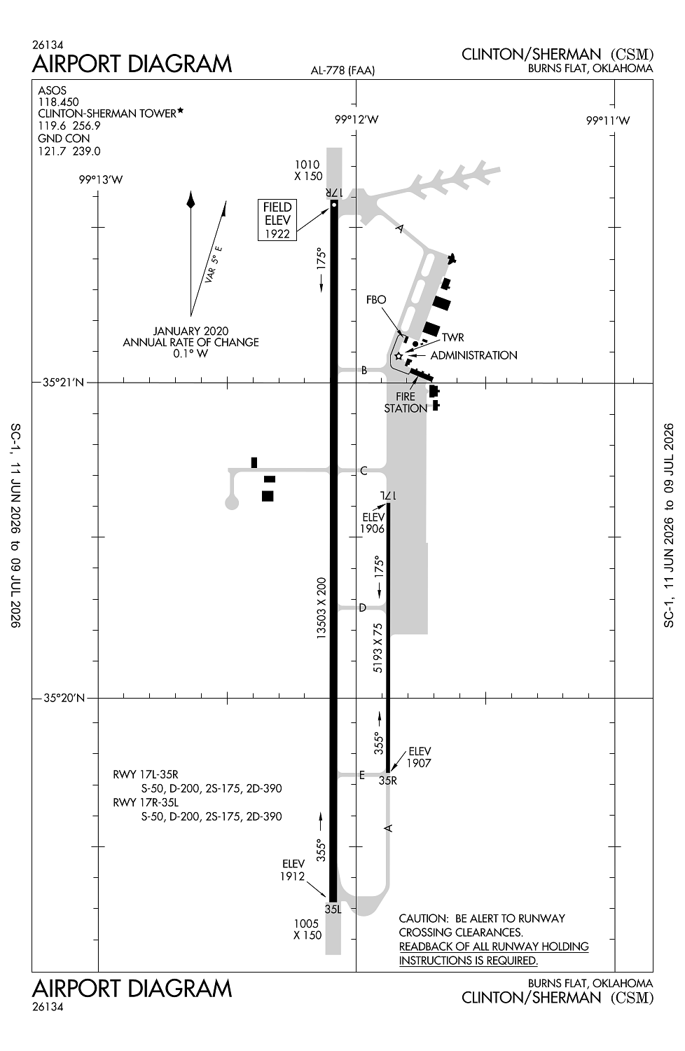
- Airport map annotations
- Airport photos
- Fuel pump location
Location:
Burns Flat, OK
Elevation:
1,922ft
Sectional:
Dallas Ft Worth
Activation date:
Oct 1971
Fuel:
A1+ (prices)
Runway 17R/35L:
13,503ft
Runway 17L/35R:
5,193ft
Access: Open to the public
Current Weather — VFR
-
Weather data is strictly informational and not for flight planning purposes.
-
METAR2026-06-26 12:53:00 CDT
Ceiling: Sky clear Wind: 180° @ 14kt, gusts 23kt Temperature: 87°F Dewpoint: 69°F Weather: N/A Visbility: 10SM Raw:METAR KCSM 261753Z 18014G23KT 10SM CLR 31/21 A2992 RMK AO2 SLP105 T03110211 10311 20211 58008 -
TAF2026-06-26 13:00:00 CDT – 2026-06-26 19:00:00 CDT
Ceiling: Sky clear Wind: 200° @ 14kt, gusts 23kt Weather: N/A Visbility: 6SM Clouds: Scattered @ 5,000ft Raw:TAF KCSM 261720Z 2618/2718 20014G23KT P6SM SCT050 FM270000 16010KT P6SM BKN250 FM271300 19020G28KT P6SM SCT250 -
TAF2026-06-26 19:00:00 CDT – 2026-06-27 08:00:00 CDT
Ceiling: 25,000ft Wind: 160° @ 10kt Weather: N/A Visbility: 6SM Clouds: Broken @ 25,000ft Raw:TAF KCSM 261720Z 2618/2718 20014G23KT P6SM SCT050 FM270000 16010KT P6SM BKN250 FM271300 19020G28KT P6SM SCT250 -
TAF2026-06-27 08:00:00 CDT – 2026-06-27 13:00:00 CDT
Ceiling: Sky clear Wind: 190° @ 20kt, gusts 28kt Weather: N/A Visbility: 6SM Clouds: Scattered @ 25,000ft Raw:TAF KCSM 261720Z 2618/2718 20014G23KT P6SM SCT050 FM270000 16010KT P6SM BKN250 FM271300 19020G28KT P6SM SCT250
Click/tap to add an annotation marker to the map
No webcams added yet.
Remarks
- This airport has been surveyed by the national geodetic survey.
- Established prior to 1958-subsequent military const.not airspaced.
- Mil jet trng: hvy jets sfc to 5000 ft wi 25 nmr. extsv student pilot trng fm sfc to 5000 ft wi 10 nmr btn 0900-1200.
- Rwy 17l/35r laid out & mrkd on rwy 17l/35r parl twy.
- Mil jet ngt vision trng: ctc atct 10 mins prior to ldg aft ss to adjust arpt lgts.
Comments